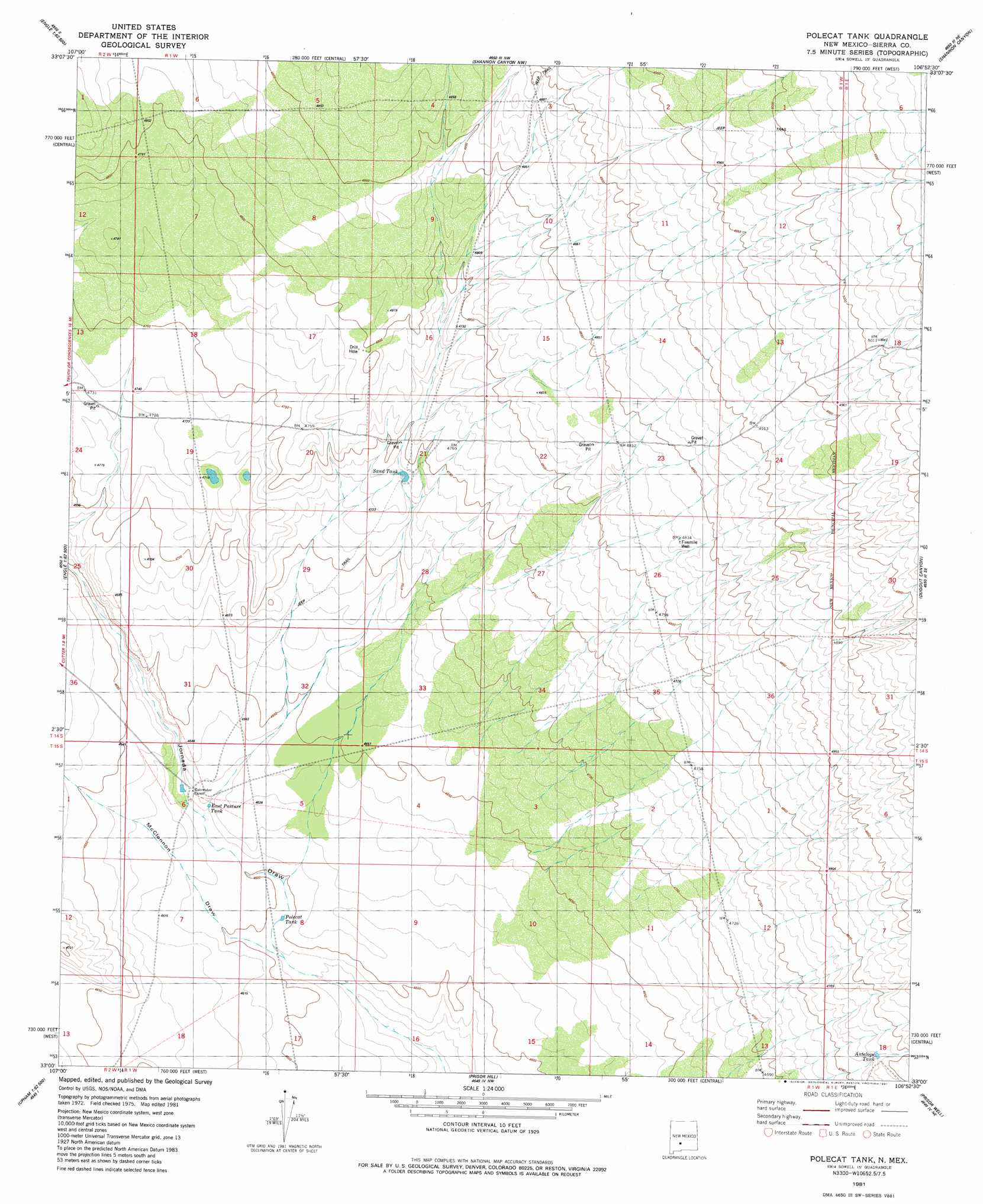
Polecat Tank Topo Map New Mexico
To zoom in, hover over the map of Polecat Tank
USGS Topo Quad 33106a8 - 1:24,000 scale
| Topo Map Name: | Polecat Tank |
| USGS Topo Quad ID: | 33106a8 |
| Print Size: | ca. 21 1/4" wide x 27" high |
| Southeast Coordinates: | 33° N latitude / 106.875° W longitude |
| Map Center Coordinates: | 33.0625° N latitude / 106.9375° W longitude |
| U.S. State: | NM |
| Filename: | o33106a8.jpg |
| Download Map JPG Image: | Polecat Tank topo map 1:24,000 scale |
| Map Type: | Topographic |
| Topo Series: | 7.5´ |
| Map Scale: | 1:24,000 |
| Source of Map Images: | United States Geological Survey (USGS) |
| Alternate Map Versions: |
Polecat Tank NM 1981, updated 1981 Download PDF Buy paper map Polecat Tank NM 1996, updated 2002 Download PDF Buy paper map Polecat Tank NM 2010 Download PDF Buy paper map Polecat Tank NM 2013 Download PDF Buy paper map Polecat Tank NM 2017 Download PDF Buy paper map |
1:24,000 Topo Quads surrounding Polecat Tank
Black Bluffs |
Crocker |
Fairview Well |
Fence Canyon |
Big Gyp Mountain |
Elephant Butte |
Engle |
Shannon Canyon Nw |
Shannon Canyon |
Hardscrabble Mountains |
Palomas Gap |
Cutter |
Polecat Tank |
Dugout Canyon |
Sulphur Pass |
Apache Gap |
Upham |
Prisor Hill |
Prisor Well |
Hembrillo Basin |
Mcleod Tank |
Alivio |
Upham Hills |
Gilmore Draw |
Fleck Draw |
> Back to 33106a1 at 1:100,000 scale
> Back to 33106a1 at 1:250,000 scale
> Back to U.S. Topo Maps home
Polecat Tank topo map: Gazetteer
Polecat Tank: Reservoirs
Antelope Tank elevation 1455m 4773′East Pasture Tank elevation 1406m 4612′
Polecat Tank elevation 1402m 4599′
Sand Tank elevation 1443m 4734′
Polecat Tank: Valleys
McLenden Draw elevation 1399m 4589′Polecat Tank: Wells
Fivemile Well elevation 1473m 4832′Polecat Tank digital topo map on disk
Buy this Polecat Tank topo map showing relief, roads, GPS coordinates and other geographical features, as a high-resolution digital map file on DVD: