Fence Canyon Topo Map New Mexico
To zoom in, hover over the map of Fence Canyon
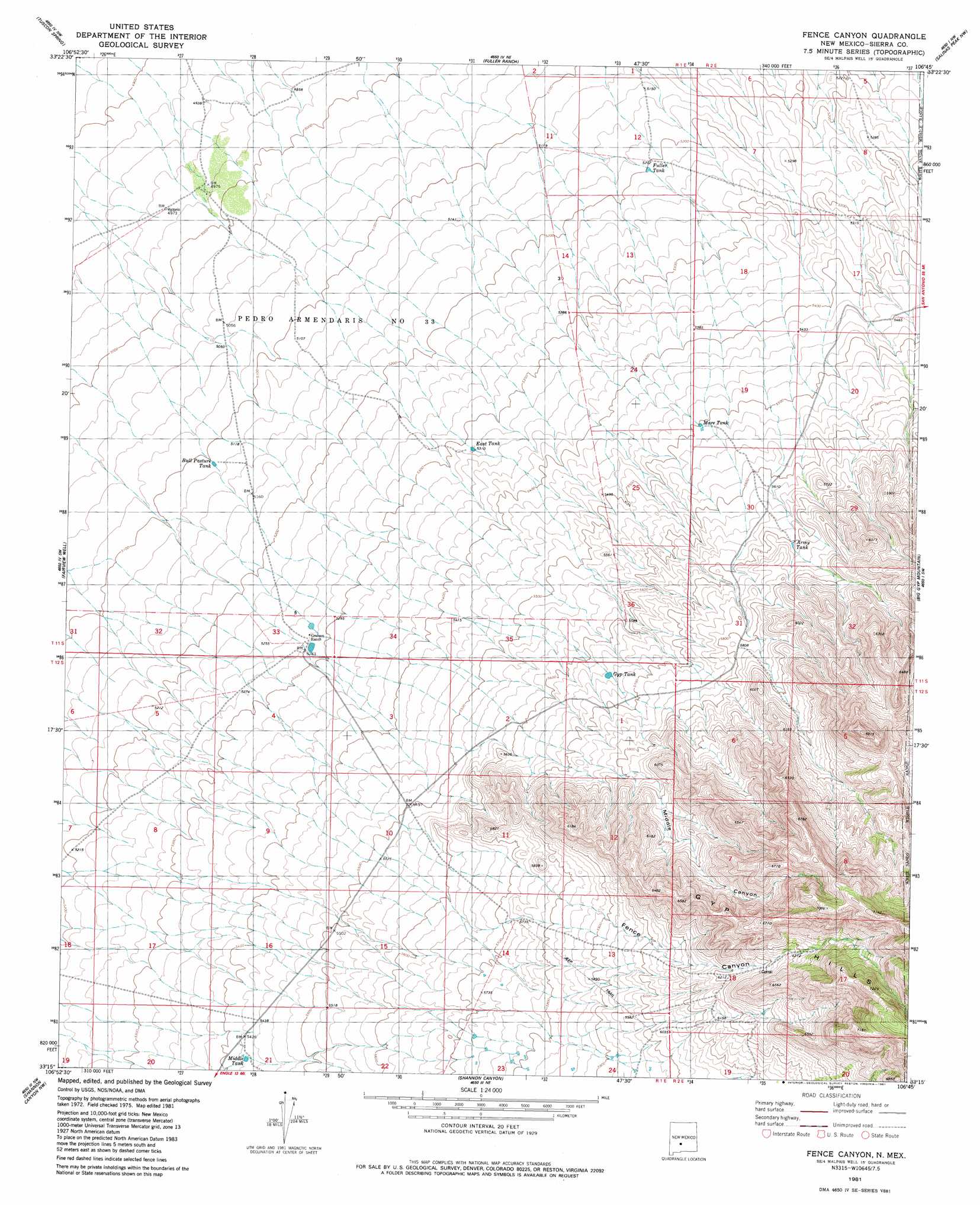
USGS Topo Quad 33106c7 - 1:24,000 scale
| Topo Map Name: | Fence Canyon |
| USGS Topo Quad ID: | 33106c7 |
| Print Size: | ca. 21 1/4" wide x 27" high |
| Southeast Coordinates: | 33.25° N latitude / 106.75° W longitude |
| Map Center Coordinates: | 33.3125° N latitude / 106.8125° W longitude |
| U.S. State: | NM |
| Filename: | o33106c7.jpg |
| Download Map JPG Image: | Fence Canyon topo map 1:24,000 scale |
| Map Type: | Topographic |
| Topo Series: | 7.5´ |
| Map Scale: | 1:24,000 |
| Source of Map Images: | United States Geological Survey (USGS) |
| Alternate Map Versions: |
Fence Canyon NM 1981, updated 1981 Download PDF Buy paper map Fence Canyon NM 2010 Download PDF Buy paper map Fence Canyon NM 2013 Download PDF Buy paper map Fence Canyon NM 2017 Download PDF Buy paper map |
1:24,000 Topo Quads surrounding Fence Canyon
Paraje Well |
Pope |
Harriet Ranch |
Blakemore Well |
Foster Well |
Lava |
Tucson Spring |
Fuller Ranch |
Salinas Peak Nw |
Fairview Mountain |
Crocker |
Fairview Well |
Fence Canyon |
Big Gyp Mountain |
Salinas Peak |
Engle |
Shannon Canyon Nw |
Shannon Canyon |
Hardscrabble Mountains |
Tip Top Canyon |
Cutter |
Polecat Tank |
Dugout Canyon |
Sulphur Pass |
Strawberry Peak |
> Back to 33106a1 at 1:100,000 scale
> Back to 33106a1 at 1:250,000 scale
> Back to U.S. Topo Maps home
Fence Canyon topo map: Gazetteer
Fence Canyon: Ranges
Gyp Hills elevation 2242m 7355′Fence Canyon: Reservoirs
Army Tank elevation 1742m 5715′Bull Pasture Tank elevation 1559m 5114′
East Tank elevation 1621m 5318′
Fuller Tank elevation 1586m 5203′
Gyp Tank elevation 1809m 5935′
Mare Tank elevation 1679m 5508′
Middle Tank elevation 1654m 5426′
Fence Canyon: Valleys
Fence Canyon elevation 1685m 5528′Middle Canyon elevation 1786m 5859′
Fence Canyon digital topo map on disk
Buy this Fence Canyon topo map showing relief, roads, GPS coordinates and other geographical features, as a high-resolution digital map file on DVD: