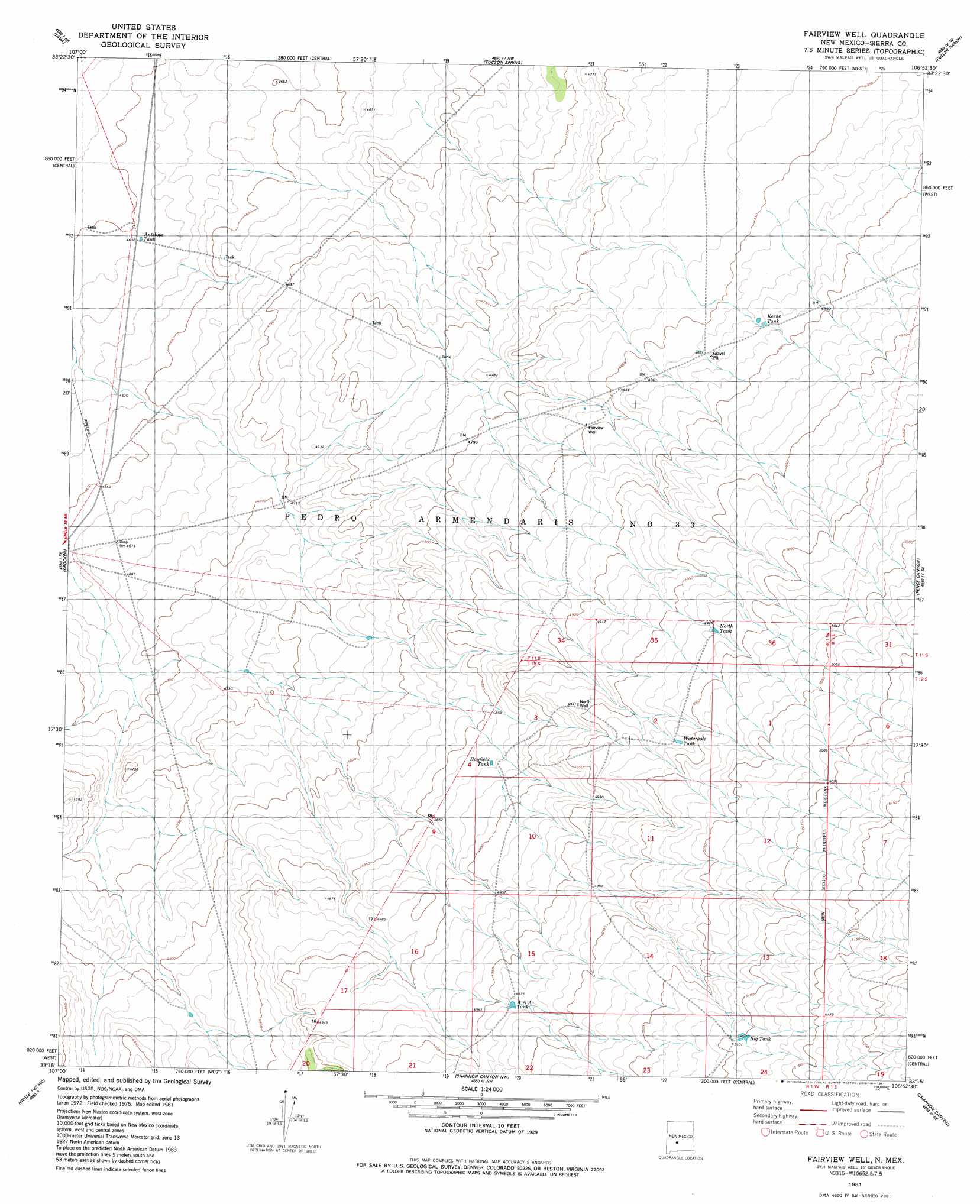
Fairview Well Topo Map New Mexico
To zoom in, hover over the map of Fairview Well
USGS Topo Quad 33106c8 - 1:24,000 scale
| Topo Map Name: | Fairview Well |
| USGS Topo Quad ID: | 33106c8 |
| Print Size: | ca. 21 1/4" wide x 27" high |
| Southeast Coordinates: | 33.25° N latitude / 106.875° W longitude |
| Map Center Coordinates: | 33.3125° N latitude / 106.9375° W longitude |
| U.S. State: | NM |
| Filename: | o33106c8.jpg |
| Download Map JPG Image: | Fairview Well topo map 1:24,000 scale |
| Map Type: | Topographic |
| Topo Series: | 7.5´ |
| Map Scale: | 1:24,000 |
| Source of Map Images: | United States Geological Survey (USGS) |
| Alternate Map Versions: |
Fairview Well NM 1981, updated 1981 Download PDF Buy paper map Fairview Well NM 2010 Download PDF Buy paper map Fairview Well NM 2013 Download PDF Buy paper map Fairview Well NM 2017 Download PDF Buy paper map |
1:24,000 Topo Quads surrounding Fairview Well
Black Hill |
Paraje Well |
Pope |
Harriet Ranch |
Blakemore Well |
Romero Canyon |
Lava |
Tucson Spring |
Fuller Ranch |
Salinas Peak Nw |
Black Bluffs |
Crocker |
Fairview Well |
Fence Canyon |
Big Gyp Mountain |
Elephant Butte |
Engle |
Shannon Canyon Nw |
Shannon Canyon |
Hardscrabble Mountains |
Palomas Gap |
Cutter |
Polecat Tank |
Dugout Canyon |
Sulphur Pass |
> Back to 33106a1 at 1:100,000 scale
> Back to 33106a1 at 1:250,000 scale
> Back to U.S. Topo Maps home
Fairview Well topo map: Gazetteer
Fairview Well: Reservoirs
AAA Tank elevation 1514m 4967′Antelope Tank elevation 1404m 4606′
Big Tank elevation 1556m 5104′
Hayfield Tank elevation 1485m 4872′
Keene Tank elevation 1489m 4885′
North Tank elevation 1519m 4983′
Waterhole Tank elevation 1521m 4990′
Fairview Well: Wells
North Well elevation 1507m 4944′Fairview Well digital topo map on disk
Buy this Fairview Well topo map showing relief, roads, GPS coordinates and other geographical features, as a high-resolution digital map file on DVD: