Three Rivers Nw Topo Map New Mexico
To zoom in, hover over the map of Three Rivers Nw
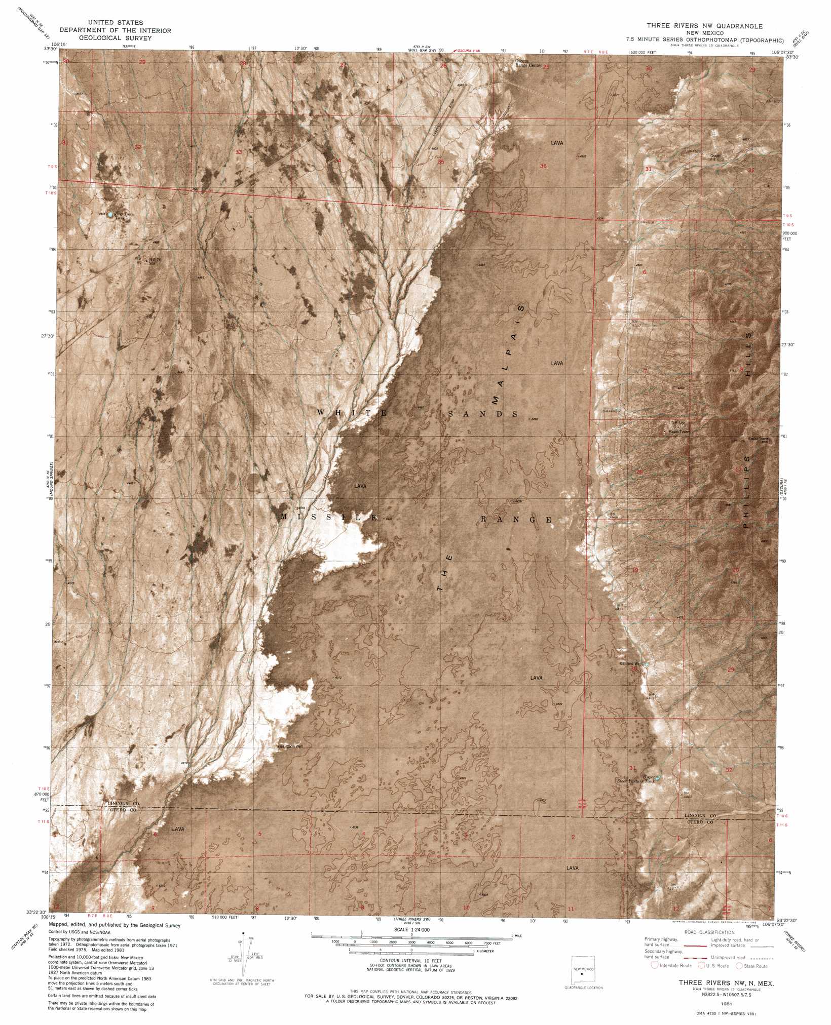
USGS Topo Quad 33106d2 - 1:24,000 scale
| Topo Map Name: | Three Rivers Nw |
| USGS Topo Quad ID: | 33106d2 |
| Print Size: | ca. 21 1/4" wide x 27" high |
| Southeast Coordinates: | 33.375° N latitude / 106.125° W longitude |
| Map Center Coordinates: | 33.4375° N latitude / 106.1875° W longitude |
| U.S. State: | NM |
| Filename: | p33106d2.jpg |
| Download Map JPG Image: | Three Rivers Nw topo map 1:24,000 scale |
| Map Type: | Orthophoto |
| Topo Series: | 7.5´ |
| Map Scale: | 1:24,000 |
| Source of Map Images: | United States Geological Survey (USGS) |
| Alternate Map Versions: |
Three Rivers NW NM 1981, updated 1982 Download PDF Buy paper map Three Rivers NW NM 2010 Download PDF Buy paper map Three Rivers NW NM 2013 Download PDF Buy paper map Three Rivers NW NM 2017 Download PDF Buy paper map |
1:24,000 Topo Quads surrounding Three Rivers Nw
Trinity Site |
Oscura Peak |
Red Canyon |
Wagon Canyon |
Carrizoza West |
Mockingbird Gap |
Mockingbird Gap Se |
Bull Gap Sw |
Bull Gap |
Cub Mountain |
Capitol Peak |
Mound Springs |
Three Rivers Nw |
Oscura |
Godfrey Peak |
Sheep Mountain |
Capitol Peak Se |
Three Rivers Sw |
Three Rivers |
Golondrina Draw |
Lumley Lake Nw |
Lumley Lake Ne |
Bitter Creek |
Tularosa Ne |
Cat Mountain |
> Back to 33106a1 at 1:100,000 scale
> Back to 33106a1 at 1:250,000 scale
> Back to U.S. Topo Maps home
Three Rivers Nw topo map: Gazetteer
Three Rivers Nw: Arroyos
Jackson Draw elevation 1342m 4402′North Mill Arroyo elevation 1404m 4606′
Three Rivers Nw: Populated Places
Roberson Place elevation 1376m 4514′Three Rivers Nw: Ranges
Phillips Hills elevation 1517m 4977′Three Rivers Nw: Reservoirs
Dog Town Tank elevation 1372m 4501′Upper Steer Pasture Tank elevation 1341m 4399′
Three Rivers Nw: Wells
Coon Well elevation 1321m 4333′ORC Fire Water Well elevation 1378m 4520′
South Gililland Well elevation 1342m 4402′
Three Rivers Nw digital topo map on disk
Buy this Three Rivers Nw topo map showing relief, roads, GPS coordinates and other geographical features, as a high-resolution digital map file on DVD: