Fairview Mountain Topo Map New Mexico
To zoom in, hover over the map of Fairview Mountain
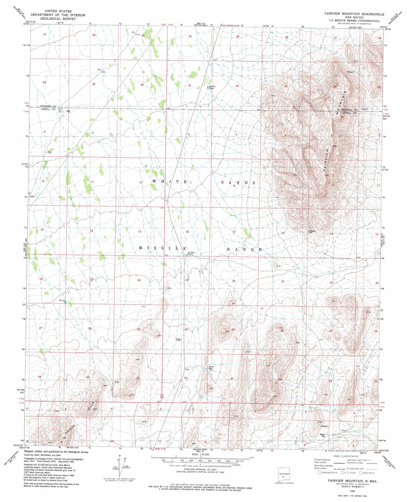
USGS Topo Quad 33106d5 - 1:24,000 scale
| Topo Map Name: | Fairview Mountain |
| USGS Topo Quad ID: | 33106d5 |
| Print Size: | ca. 21 1/4" wide x 27" high |
| Southeast Coordinates: | 33.375° N latitude / 106.5° W longitude |
| Map Center Coordinates: | 33.4375° N latitude / 106.5625° W longitude |
| U.S. State: | NM |
| Filename: | o33106d5.jpg |
| Download Map JPG Image: | Fairview Mountain topo map 1:24,000 scale |
| Map Type: | Topographic |
| Topo Series: | 7.5´ |
| Map Scale: | 1:24,000 |
| Source of Map Images: | United States Geological Survey (USGS) |
| Alternate Map Versions: |
Fairview Mountain NM 1981, updated 1981 Download PDF Buy paper map Fairview Mountain NM 2010 Download PDF Buy paper map Fairview Mountain NM 2013 Download PDF Buy paper map Fairview Mountain NM 2017 Download PDF Buy paper map |
1:24,000 Topo Quads surrounding Fairview Mountain
Little San Pasqual Mountain |
Granjean Well |
Greens Baber Well |
Trinity Site |
Oscura Peak |
Harriet Ranch |
Blakemore Well |
Foster Well |
Mockingbird Gap |
Mockingbird Gap Se |
Fuller Ranch |
Salinas Peak Nw |
Fairview Mountain |
Capitol Peak |
Mound Springs |
Fence Canyon |
Big Gyp Mountain |
Salinas Peak |
Sheep Mountain |
Capitol Peak Se |
Shannon Canyon |
Hardscrabble Mountains |
Tip Top Canyon |
Lumley Lake Nw |
Lumley Lake Ne |
> Back to 33106a1 at 1:100,000 scale
> Back to 33106a1 at 1:250,000 scale
> Back to U.S. Topo Maps home
Fairview Mountain topo map: Gazetteer
Fairview Mountain: Ranges
Poison Hills elevation 1781m 5843′Fairview Mountain: Reservoirs
Ladder Tank elevation 1518m 4980′Martin Tank elevation 1458m 4783′
McDonald Brother Tank elevation 1816m 5958′
Fairview Mountain: Summits
Fairview Mountain elevation 1879m 6164′Fairview Mountain: Valleys
Jonce Canyon elevation 1539m 5049′Fairview Mountain: Wells
Brown Well elevation 1567m 5141′Martin Headquaters Water Well elevation 1449m 4753′
Martin Well elevation 1574m 5164′
Fairview Mountain digital topo map on disk
Buy this Fairview Mountain topo map showing relief, roads, GPS coordinates and other geographical features, as a high-resolution digital map file on DVD: