Bull Gap Sw Topo Map New Mexico
To zoom in, hover over the map of Bull Gap Sw
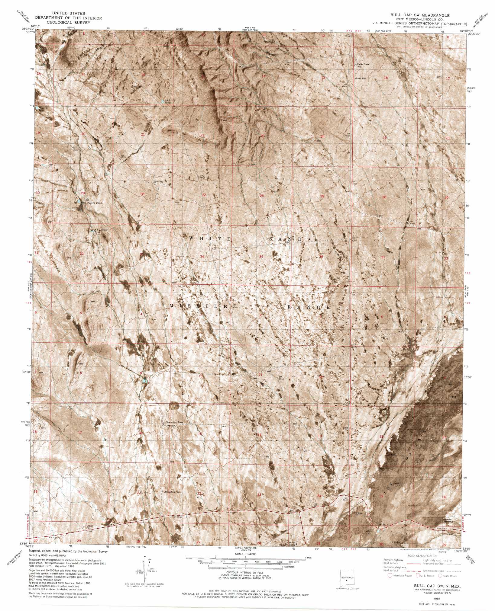
USGS Topo Quad 33106e2 - 1:24,000 scale
| Topo Map Name: | Bull Gap Sw |
| USGS Topo Quad ID: | 33106e2 |
| Print Size: | ca. 21 1/4" wide x 27" high |
| Southeast Coordinates: | 33.5° N latitude / 106.125° W longitude |
| Map Center Coordinates: | 33.5625° N latitude / 106.1875° W longitude |
| U.S. State: | NM |
| Filename: | p33106e2.jpg |
| Download Map JPG Image: | Bull Gap Sw topo map 1:24,000 scale |
| Map Type: | Orthophoto |
| Topo Series: | 7.5´ |
| Map Scale: | 1:24,000 |
| Source of Map Images: | United States Geological Survey (USGS) |
| Alternate Map Versions: |
Bull Gap SW NM 1981, updated 1981 Download PDF Buy paper map Bull Gap SW NM 2010 Download PDF Buy paper map Bull Gap SW NM 2013 Download PDF Buy paper map Bull Gap SW NM 2017 Download PDF Buy paper map |
1:24,000 Topo Quads surrounding Bull Gap Sw
Wrye Peak Sw |
Garden Spring Canyon |
Pink Peak |
Broken Back Crater |
Little Black Peak |
Trinity Site |
Oscura Peak |
Red Canyon |
Wagon Canyon |
Carrizoza West |
Mockingbird Gap |
Mockingbird Gap Se |
Bull Gap Sw |
Bull Gap |
Cub Mountain |
Capitol Peak |
Mound Springs |
Three Rivers Nw |
Oscura |
Godfrey Peak |
Sheep Mountain |
Capitol Peak Se |
Three Rivers Sw |
Three Rivers |
Golondrina Draw |
> Back to 33106e1 at 1:100,000 scale
> Back to 33106a1 at 1:250,000 scale
> Back to U.S. Topo Maps home
Bull Gap Sw topo map: Gazetteer
Bull Gap Sw: Arroyos
Harkey Draw elevation 1387m 4550′Bull Gap Sw: Reservoirs
A A A Tank elevation 1553m 5095′Dillard Tank elevation 1523m 4996′
J S Dillard Tank elevation 1481m 4858′
Sam Dillard Tank elevation 1492m 4895′
Bull Gap Sw: Wells
Newmill Well elevation 1433m 4701′Bull Gap Sw digital topo map on disk
Buy this Bull Gap Sw topo map showing relief, roads, GPS coordinates and other geographical features, as a high-resolution digital map file on DVD: