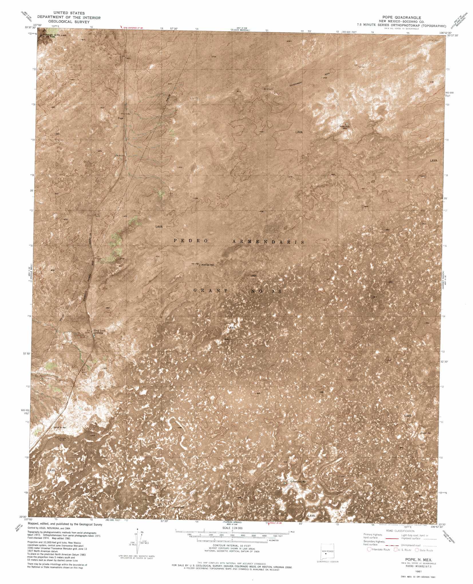
Pope Topo Map New Mexico
To zoom in, hover over the map of Pope
USGS Topo Quad 33106e8 - 1:24,000 scale
| Topo Map Name: | Pope |
| USGS Topo Quad ID: | 33106e8 |
| Print Size: | ca. 21 1/4" wide x 27" high |
| Southeast Coordinates: | 33.5° N latitude / 106.875° W longitude |
| Map Center Coordinates: | 33.5625° N latitude / 106.9375° W longitude |
| U.S. State: | NM |
| Filename: | p33106e8.jpg |
| Download Map JPG Image: | Pope topo map 1:24,000 scale |
| Map Type: | Orthophoto |
| Topo Series: | 7.5´ |
| Map Scale: | 1:24,000 |
| Source of Map Images: | United States Geological Survey (USGS) |
| Alternate Map Versions: |
Pope NM 1981, updated 1982 Download PDF Buy paper map Pope NM 2010 Download PDF Buy paper map Pope NM 2013 Download PDF Buy paper map Pope NM 2017 Download PDF Buy paper map |
1:24,000 Topo Quads surrounding Pope
Puertecito Gap |
Cienega Ranch |
Indian Well Wilderness |
San Antonio Se |
Cerro De La Campana |
Hickman Ranch |
Fort Craig |
San Marcial |
Little San Pasqual Mountain |
Granjean Well |
Black Hill |
Paraje Well |
Pope |
Harriet Ranch |
Blakemore Well |
Romero Canyon |
Lava |
Tucson Spring |
Fuller Ranch |
Salinas Peak Nw |
Black Bluffs |
Crocker |
Fairview Well |
Fence Canyon |
Big Gyp Mountain |
> Back to 33106e1 at 1:100,000 scale
> Back to 33106a1 at 1:250,000 scale
> Back to U.S. Topo Maps home
Pope topo map: Gazetteer
Pope: Populated Places
Hard Luck Crossing elevation 1426m 4678′Pope: Wells
10063 Water Well elevation 1479m 4852′Antelope Well elevation 1453m 4767′
Crater Well elevation 1478m 4849′
Hackberry Well elevation 1461m 4793′
North Water Well elevation 1445m 4740′
North Well elevation 1445m 4740′
Santa Fe Well elevation 1439m 4721′
Pope digital topo map on disk
Buy this Pope topo map showing relief, roads, GPS coordinates and other geographical features, as a high-resolution digital map file on DVD: