Bonner Canyon Topo Map New Mexico
To zoom in, hover over the map of Bonner Canyon
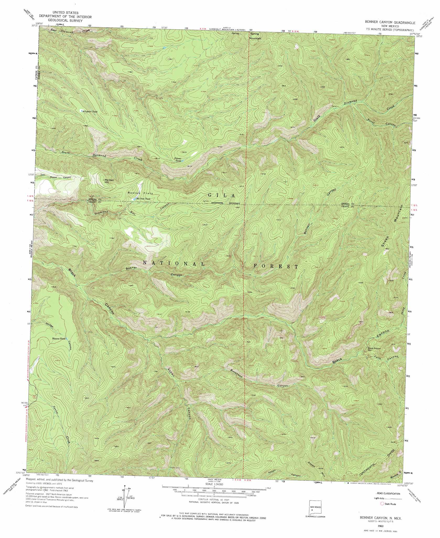
USGS Topo Quad 33107b8 - 1:24,000 scale
| Topo Map Name: | Bonner Canyon |
| USGS Topo Quad ID: | 33107b8 |
| Print Size: | ca. 21 1/4" wide x 27" high |
| Southeast Coordinates: | 33.125° N latitude / 107.875° W longitude |
| Map Center Coordinates: | 33.1875° N latitude / 107.9375° W longitude |
| U.S. State: | NM |
| Filename: | o33107b8.jpg |
| Download Map JPG Image: | Bonner Canyon topo map 1:24,000 scale |
| Map Type: | Topographic |
| Topo Series: | 7.5´ |
| Map Scale: | 1:24,000 |
| Source of Map Images: | United States Geological Survey (USGS) |
| Alternate Map Versions: |
Bonner Canyon NM 1963, updated 1965 Download PDF Buy paper map Bonner Canyon NM 1963, updated 1974 Download PDF Buy paper map Bonner Canyon NM 1999, updated 2002 Download PDF Buy paper map Bonner Canyon NM 2011 Download PDF Buy paper map Bonner Canyon NM 2013 Download PDF Buy paper map Bonner Canyon NM 2017 Download PDF Buy paper map |
| FStopo: | US Forest Service topo Bonner Canyon is available: Download FStopo PDF Download FStopo TIF |
1:24,000 Topo Quads surrounding Bonner Canyon
Black Mountain |
Spring Canyon |
Taylor Peak |
Sawmill Peak |
Iron Mountain |
Burnt Corral Canyon |
Wall Lake |
Baily Points |
Lookout Mountain |
Winston |
Gila Hot Springs |
Middle Mesa |
Bonner Canyon |
Reeds Peak |
Sugarloaf Peak |
Copperas Peak |
North Star Mesa |
Hay Mesa |
Victoria Park |
Apache Peak |
Twin Sisters |
Allie Canyon |
Hendricks Peak |
Hillsboro Peak |
Kingston |
> Back to 33107a1 at 1:100,000 scale
> Back to 33106a1 at 1:250,000 scale
> Back to U.S. Topo Maps home
Bonner Canyon topo map: Gazetteer
Bonner Canyon: Flats
Rastus Flats elevation 2406m 7893′Bonner Canyon: Reservoirs
Alligator Tank elevation 2388m 7834′Me Own Tank elevation 2389m 7837′
Meason Tank elevation 2379m 7805′
Polecat Tank elevation 2448m 8031′
Upper East Diamond Tank elevation 2393m 7851′
Bonner Canyon: Springs
Spring Mountain Spring elevation 2640m 8661′Bonner Canyon: Streams
Sheep Creek elevation 2481m 8139′Bonner Canyon: Summits
Me Own Hill elevation 2464m 8083′Sheep Mountain elevation 2977m 9767′
Spring Mountain elevation 2725m 8940′
Bonner Canyon: Valleys
Aspen Canyon elevation 2673m 8769′Black Canyon Box elevation 2412m 7913′
Bonner Canyon elevation 2135m 7004′
Buckhead Canyon elevation 2228m 7309′
Burnt Canyon elevation 2415m 7923′
Falls Canyon elevation 2406m 7893′
Bonner Canyon digital topo map on disk
Buy this Bonner Canyon topo map showing relief, roads, GPS coordinates and other geographical features, as a high-resolution digital map file on DVD: