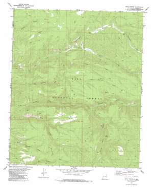
Baily Points Topo Map New Mexico
To zoom in, hover over the map of Baily Points
USGS Topo Quad 33107c8 - 1:24,000 scale
| Topo Map Name: | Baily Points |
| USGS Topo Quad ID: | 33107c8 |
| Print Size: | ca. 21 1/4" wide x 27" high |
| Southeast Coordinates: | 33.25° N latitude / 107.875° W longitude |
| Map Center Coordinates: | 33.3125° N latitude / 107.9375° W longitude |
| U.S. State: | NM |
| Filename: | o33107c8.jpg |
| Download Map JPG Image: | Baily Points topo map 1:24,000 scale |
| Map Type: | Topographic |
| Topo Series: | 7.5´ |
| Map Scale: | 1:24,000 |
| Source of Map Images: | United States Geological Survey (USGS) |
| Alternate Map Versions: |
Baily Points NM 1981, updated 1981 Download PDF Buy paper map Baily Points NM 1999, updated 2002 Download PDF Buy paper map Baily Points NM 2011 Download PDF Buy paper map Baily Points NM 2013 Download PDF Buy paper map Baily Points NM 2017 Download PDF Buy paper map |
| FStopo: | US Forest Service topo Baily Points is available: Download FStopo PDF Download FStopo TIF |
1:24,000 Topo Quads surrounding Baily Points
> Back to 33107a1 at 1:100,000 scale
> Back to 33106a1 at 1:250,000 scale
> Back to U.S. Topo Maps home
Baily Points topo map: Gazetteer
Baily Points: Forests
Black Range Ranger District elevation 2277m 7470′Baily Points: Mines
Seventy-Four Draw elevation 2403m 7883′Baily Points: Reservoirs
Big Bear Tank elevation 2253m 7391′Cox Tank elevation 2387m 7831′
Inman Cienega Tank elevation 2352m 7716′
Maverick Tank elevation 2476m 8123′
Road Tank elevation 2325m 7627′
Saucer Tank elevation 2406m 7893′
Sevety-four Draw Well elevation 2243m 7358′
Shallow Tank elevation 2305m 7562′
Slick Rock Tank elevation 2330m 7644′
South Mesa Tank elevation 2389m 7837′
Upper Dry Tank elevation 2307m 7568′
Baily Points: Springs
Miller Spring elevation 2186m 7171′Running Water Spring elevation 2359m 7739′
Baily Points: Streams
Baily Creek elevation 2056m 6745′Turkey Run elevation 2163m 7096′
Baily Points: Summits
Baily Points elevation 2424m 7952′Round Mountain elevation 2578m 8458′
South Mesa elevation 2560m 8398′
Baily Points: Valleys
Running Water Canyon elevation 2201m 7221′Seventyfour Draw elevation 2172m 7125′
Turkey Draw elevation 2163m 7096′
Baily Points: Wells
Caves Well elevation 2083m 6833′Baily Points digital topo map on disk
Buy this Baily Points topo map showing relief, roads, GPS coordinates and other geographical features, as a high-resolution digital map file on DVD:


