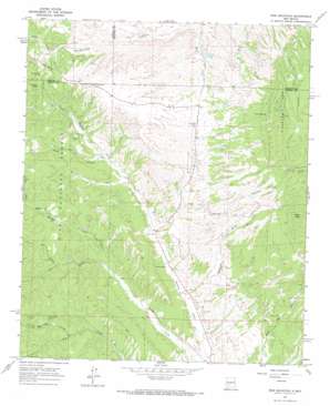
Iron Mountain Topo Map New Mexico
To zoom in, hover over the map of Iron Mountain
USGS Topo Quad 33107d6 - 1:24,000 scale
| Topo Map Name: | Iron Mountain |
| USGS Topo Quad ID: | 33107d6 |
| Print Size: | ca. 21 1/4" wide x 27" high |
| Southeast Coordinates: | 33.375° N latitude / 107.625° W longitude |
| Map Center Coordinates: | 33.4375° N latitude / 107.6875° W longitude |
| U.S. State: | NM |
| Filename: | o33107d6.jpg |
| Download Map JPG Image: | Iron Mountain topo map 1:24,000 scale |
| Map Type: | Topographic |
| Topo Series: | 7.5´ |
| Map Scale: | 1:24,000 |
| Source of Map Images: | United States Geological Survey (USGS) |
| Alternate Map Versions: |
Iron Mountain NM 1965, updated 1967 Download PDF Buy paper map Iron Mountain NM 1965, updated 1980 Download PDF Buy paper map Iron Mountain NM 1999, updated 2002 Download PDF Buy paper map Iron Mountain NM 2011 Download PDF Buy paper map Iron Mountain NM 2013 Download PDF Buy paper map Iron Mountain NM 2017 Download PDF Buy paper map |
| FStopo: | US Forest Service topo Iron Mountain is available: Download FStopo PDF Download FStopo TIF |
1:24,000 Topo Quads surrounding Iron Mountain
> Back to 33107a1 at 1:100,000 scale
> Back to 33106a1 at 1:250,000 scale
> Back to U.S. Topo Maps home
Iron Mountain topo map: Gazetteer
Iron Mountain: Dams
Iron Mountain Detention Dam elevation 2135m 7004′Iron Mountain: Mines
Alaska Group elevation 2089m 6853′Backslope elevation 2414m 7919′
Bellboy Mine elevation 2287m 7503′
Black Mountain elevation 2201m 7221′
Blackhawk Mine elevation 2166m 7106′
Emporia Mine elevation 2101m 6893′
Gold Coin elevation 2084m 6837′
Great Republic elevation 2175m 7135′
Horses Head elevation 2475m 8120′
Invincible Mine elevation 2298m 7539′
Iron Mountain Deposit elevation 2321m 7614′
Iron Mountain Mine elevation 2443m 8015′
Ivanhoe Mine elevation 2101m 6893′
Keystone elevation 2203m 7227′
Lucky Strike elevation 2466m 8090′
Minnehaha Mine elevation 2197m 7208′
Minnehoha Mine elevation 2183m 7162′
Parker Strike elevation 2402m 7880′
Paymaster Mine elevation 2167m 7109′
Republic Mine elevation 2167m 7109′
Scheelemite elevation 2099m 6886′
Scheelemite Gem Mine elevation 2443m 8015′
Tungsten Reef elevation 2439m 8001′
Iron Mountain: Populated Places
Grafton elevation 2077m 6814′Iron Mountain: Post Offices
Grafton Post Office (historical) elevation 2077m 6814′Iron Mountain: Reservoirs
C C Tank elevation 2098m 6883′Iron Mountain: Springs
Piñon Spring elevation 2292m 7519′Iron Mountain: Streams
Bear Creek elevation 1973m 6473′Buster Creek elevation 2023m 6637′
Little Bear Creek elevation 2052m 6732′
North Dry Creek elevation 2083m 6833′
Iron Mountain: Summits
Iron Mountain elevation 2479m 8133′Little Red Hill elevation 2184m 7165′
Reilly Peak elevation 2488m 8162′
Iron Mountain: Valleys
Alaska Draw elevation 2096m 6876′Edwards Draw elevation 1946m 6384′
Pine Canyon elevation 2031m 6663′
Rouse Canyon elevation 1986m 6515′
Sheep Canyon elevation 2132m 6994′
Iron Mountain: Wells
2 South Water Well elevation 1972m 6469′Blue Water Well elevation 1986m 6515′
Buster Water Well elevation 2009m 6591′
Midway Water Well elevation 2082m 6830′
Peewee Water Well elevation 2001m 6564′
Iron Mountain digital topo map on disk
Buy this Iron Mountain topo map showing relief, roads, GPS coordinates and other geographical features, as a high-resolution digital map file on DVD:


