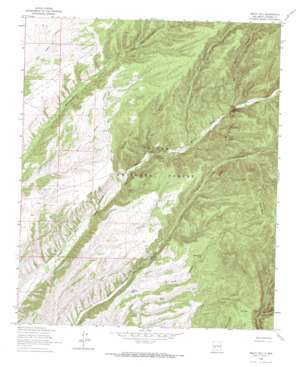
Welty Hill Topo Map New Mexico
To zoom in, hover over the map of Welty Hill
USGS Topo Quad 33107f5 - 1:24,000 scale
| Topo Map Name: | Welty Hill |
| USGS Topo Quad ID: | 33107f5 |
| Print Size: | ca. 21 1/4" wide x 27" high |
| Southeast Coordinates: | 33.625° N latitude / 107.5° W longitude |
| Map Center Coordinates: | 33.6875° N latitude / 107.5625° W longitude |
| U.S. State: | NM |
| Filename: | o33107f5.jpg |
| Download Map JPG Image: | Welty Hill topo map 1:24,000 scale |
| Map Type: | Topographic |
| Topo Series: | 7.5´ |
| Map Scale: | 1:24,000 |
| Source of Map Images: | United States Geological Survey (USGS) |
| Alternate Map Versions: |
Welty Hill NM 1964, updated 1966 Download PDF Buy paper map Welty Hill NM 1964, updated 1986 Download PDF Buy paper map Welty Hill NM 1995, updated 1998 Download PDF Buy paper map Welty Hill NM 2011 Download PDF Buy paper map Welty Hill NM 2013 Download PDF Buy paper map Welty Hill NM 2017 Download PDF Buy paper map |
| FStopo: | US Forest Service topo Welty Hill is available: Download FStopo PDF Download FStopo TIF |
1:24,000 Topo Quads surrounding Welty Hill
> Back to 33107e1 at 1:100,000 scale
> Back to 33106a1 at 1:250,000 scale
> Back to U.S. Topo Maps home
Welty Hill topo map: Gazetteer
Welty Hill: Gaps
Red John Box elevation 2174m 7132′Welty Hill: Reservoirs
Antelope Tank elevation 2138m 7014′Blazes Tank elevation 2288m 7506′
Coyote Tank elevation 2113m 6932′
Pine Tank elevation 2300m 7545′
Pinyon Tank elevation 2172m 7125′
Red Rock Tank elevation 2272m 7454′
Rock Spring Tank elevation 2236m 7335′
Sim Yaten Tank elevation 2113m 6932′
Upper Pigeon Tank elevation 2259m 7411′
Welty Tank elevation 2211m 7253′
West Red Tank elevation 2194m 7198′
Welty Hill: Summits
Burnt Peaks elevation 2462m 8077′Sim Yaten Hills elevation 2521m 8270′
Welty Hill elevation 2345m 7693′
Welty Hill: Valleys
Box Draw Canyon elevation 2166m 7106′East Whitewater Canyon elevation 2195m 7201′
Hudson Canyon elevation 2132m 6994′
Hutchison Branch elevation 2110m 6922′
Luke Canyon elevation 2226m 7303′
Maverick Canyon elevation 2198m 7211′
Owl Canyon elevation 2150m 7053′
Welty Hill: Wells
Red John Well elevation 2198m 7211′RG27571 Water Well elevation 2128m 6981′
Welty Hill digital topo map on disk
Buy this Welty Hill topo map showing relief, roads, GPS coordinates and other geographical features, as a high-resolution digital map file on DVD:


