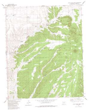
Indian Peaks West Topo Map New Mexico
To zoom in, hover over the map of Indian Peaks West
USGS Topo Quad 33108e1 - 1:24,000 scale
| Topo Map Name: | Indian Peaks West |
| USGS Topo Quad ID: | 33108e1 |
| Print Size: | ca. 21 1/4" wide x 27" high |
| Southeast Coordinates: | 33.5° N latitude / 108° W longitude |
| Map Center Coordinates: | 33.5625° N latitude / 108.0625° W longitude |
| U.S. State: | NM |
| Filename: | o33108e1.jpg |
| Download Map JPG Image: | Indian Peaks West topo map 1:24,000 scale |
| Map Type: | Topographic |
| Topo Series: | 7.5´ |
| Map Scale: | 1:24,000 |
| Source of Map Images: | United States Geological Survey (USGS) |
| Alternate Map Versions: |
Indian Peaks West NM 1981, updated 1981 Download PDF Buy paper map Indian Peaks West NM 1999, updated 2002 Download PDF Buy paper map Indian Peaks West NM 2011 Download PDF Buy paper map Indian Peaks West NM 2013 Download PDF Buy paper map Indian Peaks West NM 2017 Download PDF Buy paper map |
| FStopo: | US Forest Service topo Indian Peaks West is available: Download FStopo PDF Download FStopo TIF |
1:24,000 Topo Quads surrounding Indian Peaks West
> Back to 33108e1 at 1:100,000 scale
> Back to 33108a1 at 1:250,000 scale
> Back to U.S. Topo Maps home
Indian Peaks West topo map: Gazetteer
Indian Peaks West: Reservoirs
Bear Canyon Tank elevation 2245m 7365′Chaves Tank elevation 2177m 7142′
Garcia Tank elevation 2268m 7440′
Garcia Trick Tank elevation 2330m 7644′
Gravel Pit Tank elevation 2339m 7673′
Homestead Tank elevation 2267m 7437′
Indian Spring Tank elevation 2349m 7706′
Juan Tank elevation 2235m 7332′
Kennedy Tank elevation 2212m 7257′
Last Chance Tank elevation 2211m 7253′
Line Gap Tank elevation 2231m 7319′
Long Day Tank elevation 2330m 7644′
Lost Chance Tank elevation 2243m 7358′
Lower Mule Tank elevation 2233m 7326′
Lower North Star Tank elevation 2229m 7312′
Mesa Tank elevation 2335m 7660′
Middle North Star Tank elevation 2252m 7388′
Mule Tank elevation 2267m 7437′
North Star Tank elevation 2286m 7500′
Railroad Tank elevation 2224m 7296′
Upper Mule Tank elevation 2286m 7500′
Upper Spring Tank elevation 2320m 7611′
Valley Tank elevation 2231m 7319′
Wall Tank elevation 2236m 7335′
West Central Tank elevation 2334m 7657′
West Tank elevation 2315m 7595′
Whiskey Tank elevation 2224m 7296′
Indian Peaks West: Springs
Bear Springs elevation 2220m 7283′Cottonwood Spring elevation 2273m 7457′
Indian Peaks West: Summits
Indian Peaks elevation 2546m 8353′Indian Peaks West: Valleys
Last Chance Canyon elevation 2150m 7053′Lost Chance Canyon elevation 2212m 7257′
Whiskey Canyon elevation 2223m 7293′
Indian Peaks West: Wells
Mule Canyon Well elevation 2225m 7299′Indian Peaks West digital topo map on disk
Buy this Indian Peaks West topo map showing relief, roads, GPS coordinates and other geographical features, as a high-resolution digital map file on DVD:


