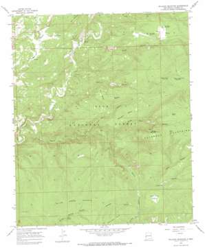
Milligan Mountain Topo Map New Mexico
To zoom in, hover over the map of Milligan Mountain
USGS Topo Quad 33108f6 - 1:24,000 scale
| Topo Map Name: | Milligan Mountain |
| USGS Topo Quad ID: | 33108f6 |
| Print Size: | ca. 21 1/4" wide x 27" high |
| Southeast Coordinates: | 33.625° N latitude / 108.625° W longitude |
| Map Center Coordinates: | 33.6875° N latitude / 108.6875° W longitude |
| U.S. State: | NM |
| Filename: | o33108f6.jpg |
| Download Map JPG Image: | Milligan Mountain topo map 1:24,000 scale |
| Map Type: | Topographic |
| Topo Series: | 7.5´ |
| Map Scale: | 1:24,000 |
| Source of Map Images: | United States Geological Survey (USGS) |
| Alternate Map Versions: |
Milligan Mountain NM 1965, updated 1968 Download PDF Buy paper map Milligan Mountain NM 1999, updated 2002 Download PDF Buy paper map Milligan Mountain NM 2011 Download PDF Buy paper map Milligan Mountain NM 2013 Download PDF Buy paper map Milligan Mountain NM 2017 Download PDF Buy paper map |
| FStopo: | US Forest Service topo Milligan Mountain is available: Download FStopo PDF Download FStopo TIF |
1:24,000 Topo Quads surrounding Milligan Mountain
> Back to 33108e1 at 1:100,000 scale
> Back to 33108a1 at 1:250,000 scale
> Back to U.S. Topo Maps home
Milligan Mountain topo map: Gazetteer
Milligan Mountain: Benches
Milligan Mesa elevation 2159m 7083′Polk Mesa elevation 2140m 7020′
Milligan Mountain: Flats
Piney Park elevation 2390m 7841′Milligan Mountain: Reservoirs
Dry Mesa Tank elevation 2108m 6916′Frisco Plaza Number 5 Tank elevation 2134m 7001′
Keko Canyon Tank Number 1 elevation 2280m 7480′
Keko Canyon Tank Number 2 elevation 2238m 7342′
Kiehnes Canyon Tank elevation 2222m 7290′
Largo Tank Number 2 elevation 1839m 6033′
Polk Mesa Tank Number 1 elevation 2131m 6991′
Polk Mesa Tank Number 2 elevation 2089m 6853′
Stump Tank elevation 2450m 8038′
Willow Spring Tank elevation 2195m 7201′
Milligan Mountain: Ridges
Willow Spring Mountain elevation 2414m 7919′Milligan Mountain: Springs
Kimball Spring elevation 1817m 5961′Willow Spring elevation 2121m 6958′
Milligan Mountain: Streams
Negrito Creek elevation 1802m 5912′Milligan Mountain: Summits
Dry Mesa elevation 2113m 6932′Flat Top Mesa elevation 2204m 7230′
Milligan Mountain elevation 2562m 8405′
Milligan Mountain: Valleys
Cerco Canyon elevation 1837m 6026′Chimney Canyon elevation 1948m 6391′
Gabe Canyon elevation 2006m 6581′
Keko Canyon elevation 1787m 5862′
Kiehnes Canyon elevation 1934m 6345′
Long Canyon elevation 1855m 6085′
Piney Park Canyon elevation 1861m 6105′
Sheep Basin Canyon elevation 1956m 6417′
Wilson Canyon elevation 1817m 5961′
Milligan Mountain digital topo map on disk
Buy this Milligan Mountain topo map showing relief, roads, GPS coordinates and other geographical features, as a high-resolution digital map file on DVD:


