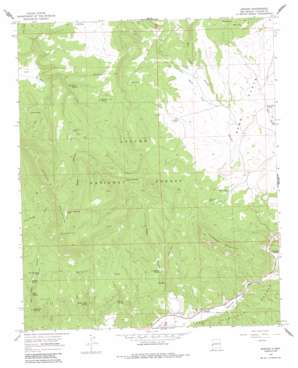
Aragon Topo Map New Mexico
To zoom in, hover over the map of Aragon
USGS Topo Quad 33108h5 - 1:24,000 scale
| Topo Map Name: | Aragon |
| USGS Topo Quad ID: | 33108h5 |
| Print Size: | ca. 21 1/4" wide x 27" high |
| Southeast Coordinates: | 33.875° N latitude / 108.5° W longitude |
| Map Center Coordinates: | 33.9375° N latitude / 108.5625° W longitude |
| U.S. State: | NM |
| Filename: | o33108h5.jpg |
| Download Map JPG Image: | Aragon topo map 1:24,000 scale |
| Map Type: | Topographic |
| Topo Series: | 7.5´ |
| Map Scale: | 1:24,000 |
| Source of Map Images: | United States Geological Survey (USGS) |
| Alternate Map Versions: |
Aragon NM 1965, updated 1968 Download PDF Buy paper map Aragon NM 1965, updated 1984 Download PDF Buy paper map Aragon NM 1999, updated 2002 Download PDF Buy paper map Aragon NM 2011 Download PDF Buy paper map Aragon NM 2013 Download PDF Buy paper map Aragon NM 2017 Download PDF Buy paper map |
| FStopo: | US Forest Service topo Aragon is available: Download FStopo PDF Download FStopo TIF |
1:24,000 Topo Quads surrounding Aragon
> Back to 33108e1 at 1:100,000 scale
> Back to 33108a1 at 1:250,000 scale
> Back to U.S. Topo Maps home
Aragon topo map: Gazetteer
Aragon: Airports
Sand Flat Airstrip elevation 2207m 7240′Aragon: Populated Places
Aragon elevation 2036m 6679′Aragon: Ranges
Tularosa Mountains elevation 2495m 8185′Aragon: Reservoirs
Apache Mountain Tank elevation 2593m 8507′Castillo Tank elevation 2238m 7342′
E Robertson Tank elevation 2308m 7572′
Horse Pasture Tank elevation 2199m 7214′
Indio Road Tank elevation 2220m 7283′
Jacob Draw Tank elevation 2417m 7929′
Kline Tank elevation 2250m 7381′
Means Tank elevation 2346m 7696′
Negrito Tank elevation 2273m 7457′
New Red Steer Tank elevation 2189m 7181′
NH Tank elevation 2395m 7857′
Pit Tank elevation 2214m 7263′
Rankin Tank elevation 2342m 7683′
Sand Tank elevation 2311m 7582′
Spring Tank elevation 2211m 7253′
Tularosa Tank elevation 2244m 7362′
Aragon: Springs
Apache Spring elevation 2179m 7148′Banta Spring elevation 2049m 6722′
Malpais Spring elevation 2445m 8021′
Mata Spring elevation 2324m 7624′
Miller Spring elevation 2122m 6961′
Negrito Springs elevation 2255m 7398′
Orono Spring elevation 2302m 7552′
Owl Water Spring elevation 2109m 6919′
Red Steer Spring elevation 2078m 6817′
Rock Spring elevation 2395m 7857′
Sand Spring elevation 2268m 7440′
Tularosa Spring elevation 2082m 6830′
Willow Bush Spring elevation 2093m 6866′
Aragon: Summits
Apache Mountain elevation 2702m 8864′Tularosa Mountain elevation 2495m 8185′
Aragon: Valleys
Bull Camp Canyon elevation 2217m 7273′Negro Canyon elevation 2052m 6732′
Aragon: Wells
Deep Well elevation 2235m 7332′Aragon digital topo map on disk
Buy this Aragon topo map showing relief, roads, GPS coordinates and other geographical features, as a high-resolution digital map file on DVD:


