Bonita Tank Topo Map Arizona
To zoom in, hover over the map of Bonita Tank
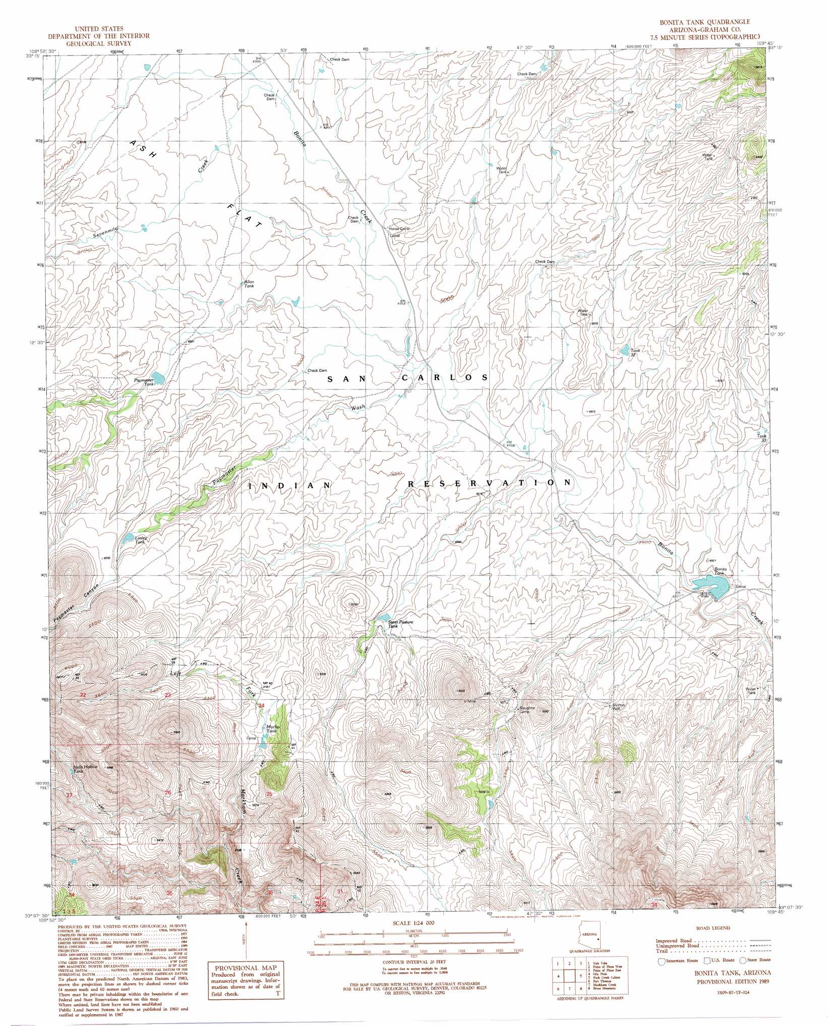
USGS Topo Quad 33109b7 - 1:24,000 scale
| Topo Map Name: | Bonita Tank |
| USGS Topo Quad ID: | 33109b7 |
| Print Size: | ca. 21 1/4" wide x 27" high |
| Southeast Coordinates: | 33.125° N latitude / 109.75° W longitude |
| Map Center Coordinates: | 33.1875° N latitude / 109.8125° W longitude |
| U.S. State: | AZ |
| Filename: | o33109b7.jpg |
| Download Map JPG Image: | Bonita Tank topo map 1:24,000 scale |
| Map Type: | Topographic |
| Topo Series: | 7.5´ |
| Map Scale: | 1:24,000 |
| Source of Map Images: | United States Geological Survey (USGS) |
| Alternate Map Versions: |
Bonita Tank AZ 1989, updated 1990 Download PDF Buy paper map Bonita Tank AZ 2011 Download PDF Buy paper map Bonita Tank AZ 2014 Download PDF Buy paper map |
1:24,000 Topo Quads surrounding Bonita Tank
Ash Creek Ne |
Natanes Mountains Nw |
Natanes Mountains Ne |
Sawbuck Mountain |
Willow Mountain |
Ash Creek Ranch |
Tule Tubs |
Point Of Pines West |
Point Of Pines East |
Willow Mountain Se |
Bylas |
Gila Peak |
Bonita Tank |
Park Creek Cabins |
Elevator Mountain |
Geronimo |
Fort Thomas |
Markham Creek |
Bryce Mountain |
Bonita Spring |
Telegraph Wash |
Eden |
Pima |
Weber Peak |
Lone Star Mountain |
> Back to 33109a1 at 1:100,000 scale
> Back to 33108a1 at 1:250,000 scale
> Back to U.S. Topo Maps home
Bonita Tank topo map: Gazetteer
Bonita Tank: Dams
Bonita Dam elevation 1488m 4881′Paymaster Dam elevation 1548m 5078′
Bonita Tank: Reservoirs
Allan Tank elevation 1531m 5022′Bonita Tank elevation 1486m 4875′
Hells Hollow Tank elevation 1633m 5357′
Lasley Tank elevation 1578m 5177′
Mocho Tank elevation 1567m 5141′
Paymaster Tank elevation 1540m 5052′
SCS Tank elevation 1571m 5154′
Steer Pasture Tank elevation 1546m 5072′
Tank Thirtythree elevation 1521m 4990′
Tank Thirtytwo elevation 1529m 5016′
Bonita Tank: Streams
Paymaster Wash elevation 1512m 4960′Sevenmile Creek elevation 0m 0′
Bonita Tank: Valleys
Paymaster Canyon elevation 1603m 5259′Bonita Tank: Wells
Shortys Well elevation 0m 0′Bonita Tank digital topo map on disk
Buy this Bonita Tank topo map showing relief, roads, GPS coordinates and other geographical features, as a high-resolution digital map file on DVD: