Point Of Pines East Topo Map Arizona
To zoom in, hover over the map of Point Of Pines East
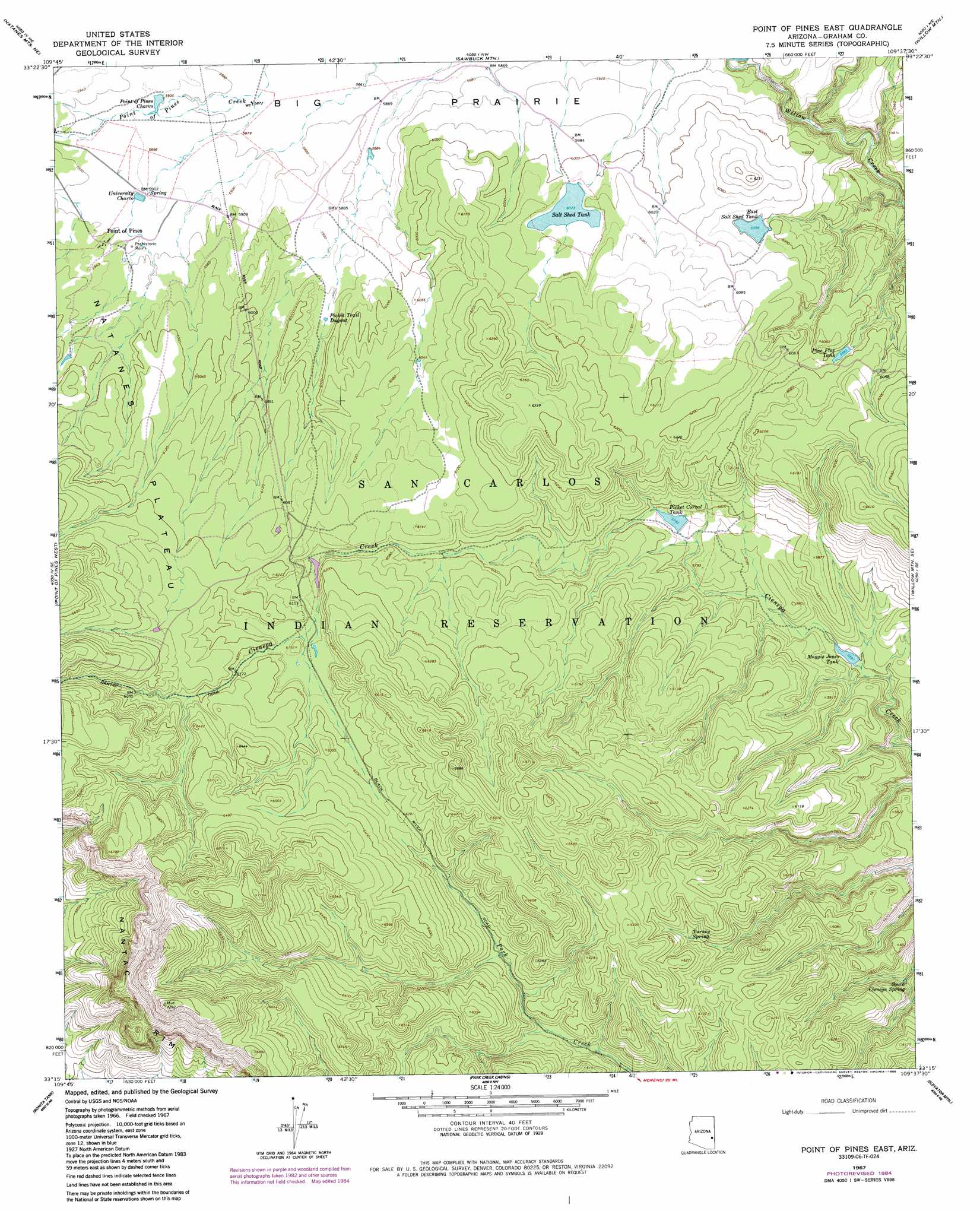
USGS Topo Quad 33109c6 - 1:24,000 scale
| Topo Map Name: | Point Of Pines East |
| USGS Topo Quad ID: | 33109c6 |
| Print Size: | ca. 21 1/4" wide x 27" high |
| Southeast Coordinates: | 33.25° N latitude / 109.625° W longitude |
| Map Center Coordinates: | 33.3125° N latitude / 109.6875° W longitude |
| U.S. State: | AZ |
| Filename: | o33109c6.jpg |
| Download Map JPG Image: | Point Of Pines East topo map 1:24,000 scale |
| Map Type: | Topographic |
| Topo Series: | 7.5´ |
| Map Scale: | 1:24,000 |
| Source of Map Images: | United States Geological Survey (USGS) |
| Alternate Map Versions: |
Point of Pines East AZ 1967, updated 1971 Download PDF Buy paper map Point of Pines East AZ 1967, updated 1985 Download PDF Buy paper map Point of Pines East AZ 2011 Download PDF Buy paper map Point of Pines East AZ 2014 Download PDF Buy paper map |
1:24,000 Topo Quads surrounding Point Of Pines East
Elwood Canyon |
West Poker Mountain |
Maverick Sw |
Freezeout Mountain |
Baldy Bill Point |
Natanes Mountains Nw |
Natanes Mountains Ne |
Sawbuck Mountain |
Willow Mountain |
Robinson Mesa |
Tule Tubs |
Point Of Pines West |
Point Of Pines East |
Willow Mountain Se |
Bee Canyon |
Gila Peak |
Bonita Tank |
Park Creek Cabins |
Elevator Mountain |
Coronado Mountain |
Fort Thomas |
Markham Creek |
Bryce Mountain |
Bonita Spring |
Copperplate Gulch |
> Back to 33109a1 at 1:100,000 scale
> Back to 33108a1 at 1:250,000 scale
> Back to U.S. Topo Maps home
Point Of Pines East topo map: Gazetteer
Point Of Pines East: Dams
East Salt Shed Dam elevation 1849m 6066′Salt Shed Dam elevation 1843m 6046′
Point Of Pines East: Reservoirs
Cienega Trap Tank elevation 1862m 6108′East Salt Shed Tank elevation 1828m 5997′
Maggie Jones Tank elevation 1706m 5597′
Picket Corral Tank elevation 1753m 5751′
Picket Trail Dugout elevation 1808m 5931′
Pine Flat Tank elevation 1819m 5967′
Point of Pines Charco elevation 1798m 5898′
Salt Shed Tank elevation 0m 0′
University Charco elevation 1800m 5905′
Point Of Pines East: Springs
South Cienega Spring elevation 1713m 5620′Turkey Spring elevation 1841m 6040′
Point Of Pines East: Trails
Nantac Trail elevation 1909m 6263′Point Of Pines East digital topo map on disk
Buy this Point Of Pines East topo map showing relief, roads, GPS coordinates and other geographical features, as a high-resolution digital map file on DVD: