Maverick Sw Topo Map Arizona
To zoom in, hover over the map of Maverick Sw
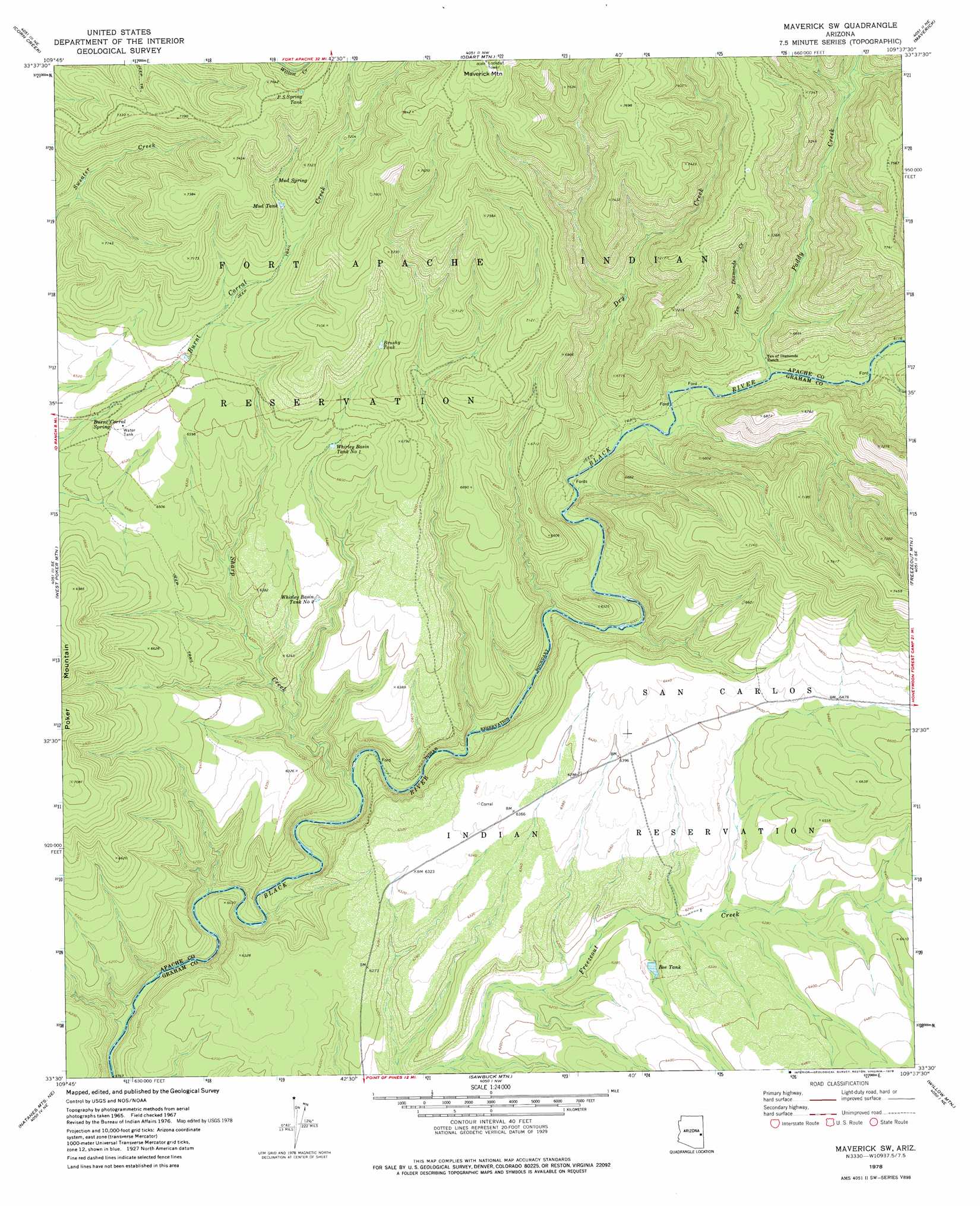
USGS Topo Quad 33109e6 - 1:24,000 scale
| Topo Map Name: | Maverick Sw |
| USGS Topo Quad ID: | 33109e6 |
| Print Size: | ca. 21 1/4" wide x 27" high |
| Southeast Coordinates: | 33.5° N latitude / 109.625° W longitude |
| Map Center Coordinates: | 33.5625° N latitude / 109.6875° W longitude |
| U.S. State: | AZ |
| Filename: | o33109e6.jpg |
| Download Map JPG Image: | Maverick Sw topo map 1:24,000 scale |
| Map Type: | Topographic |
| Topo Series: | 7.5´ |
| Map Scale: | 1:24,000 |
| Source of Map Images: | United States Geological Survey (USGS) |
| Alternate Map Versions: |
Maverick SW AZ 1967, updated 1970 Download PDF Buy paper map Maverick SW AZ 1978, updated 1978 Download PDF Buy paper map Maverick SW AZ 2011 Download PDF Buy paper map Maverick SW AZ 2014 Download PDF Buy paper map |
1:24,000 Topo Quads surrounding Maverick Sw
Whiteriver |
Corn Creek Plateau |
Marshall Butte |
Bonito Rock |
Big Lake South |
Bonito Prairie |
Corn Creek |
Odart Mountain |
Maverick |
Hoodoo Knob |
Elwood Canyon |
West Poker Mountain |
Maverick Sw |
Freezeout Mountain |
Baldy Bill Point |
Natanes Mountains Nw |
Natanes Mountains Ne |
Sawbuck Mountain |
Willow Mountain |
Robinson Mesa |
Tule Tubs |
Point Of Pines West |
Point Of Pines East |
Willow Mountain Se |
Bee Canyon |
> Back to 33109e1 at 1:100,000 scale
> Back to 33108a1 at 1:250,000 scale
> Back to U.S. Topo Maps home
Maverick Sw topo map: Gazetteer
Maverick Sw: Dams
Bee Dam elevation 1901m 6236′Maverick Sw: Reservoirs
Bee Tank elevation 1914m 6279′Brushy Tank elevation 2056m 6745′
Mud Tank elevation 2129m 6984′
P S Spring Tank elevation 2304m 7559′
Whirley Basin Tank Number One elevation 1993m 6538′
Whirley Basin Tank Number Two elevation 1949m 6394′
Maverick Sw: Springs
Burnt Corral Spring elevation 1974m 6476′Mud Spring elevation 2155m 7070′
Maverick Sw: Streams
Dry Creek elevation 1844m 6049′Paddy Creek elevation 1857m 6092′
Sharp Creek elevation 0m 0′
Ten of Diamonds Creek elevation 1883m 6177′
Maverick Sw digital topo map on disk
Buy this Maverick Sw topo map showing relief, roads, GPS coordinates and other geographical features, as a high-resolution digital map file on DVD: