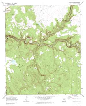
Elwood Canyon Topo Map Arizona
To zoom in, hover over the map of Elwood Canyon
USGS Topo Quad 33109e8 - 1:24,000 scale
| Topo Map Name: | Elwood Canyon |
| USGS Topo Quad ID: | 33109e8 |
| Print Size: | ca. 21 1/4" wide x 27" high |
| Southeast Coordinates: | 33.5° N latitude / 109.875° W longitude |
| Map Center Coordinates: | 33.5625° N latitude / 109.9375° W longitude |
| U.S. State: | AZ |
| Filename: | o33109e8.jpg |
| Download Map JPG Image: | Elwood Canyon topo map 1:24,000 scale |
| Map Type: | Topographic |
| Topo Series: | 7.5´ |
| Map Scale: | 1:24,000 |
| Source of Map Images: | United States Geological Survey (USGS) |
| Alternate Map Versions: |
Elwood Canyon AZ 1967, updated 1970 Download PDF Buy paper map Elwood Canyon AZ 1976, updated 1977 Download PDF Buy paper map Elwood Canyon AZ 2011 Download PDF Buy paper map Elwood Canyon AZ 2014 Download PDF Buy paper map |
1:24,000 Topo Quads surrounding Elwood Canyon
> Back to 33109e1 at 1:100,000 scale
> Back to 33108a1 at 1:250,000 scale
> Back to U.S. Topo Maps home
Elwood Canyon topo map: Gazetteer
Elwood Canyon: Dams
Bloody Basin Dam elevation 1749m 5738′Elwood Dam elevation 1769m 5803′
Hookers Gap Dam elevation 1743m 5718′
Elwood Canyon: Plains
Natanes Plateau elevation 1772m 5813′Elwood Canyon: Reservoirs
Bloody Basin Tank elevation 1750m 5741′Elwood Tank elevation 1772m 5813′
Grass Flat Tank elevation 1761m 5777′
Lower Grass Flat Tank elevation 1695m 5561′
Mud Spring Tank elevation 1692m 5551′
Mudhole Tank elevation 1754m 5754′
Prairie Pit Tank elevation 1789m 5869′
Rocky Basin Tank Number One elevation 1755m 5757′
Rocky Basin Tank Number Two elevation 1711m 5613′
Weaning Pen Tank elevation 1757m 5764′
Elwood Canyon: Streams
Big Bonito Creek elevation 1611m 5285′Elwood Creek elevation 1613m 5291′
Sawmill Creek elevation 0m 0′
Turkey Creek elevation 1570m 5150′
Willow Creek elevation 1639m 5377′
Elwood Canyon: Valleys
Bloody Basin Canyon elevation 1575m 5167′Elwood Canyon elevation 1615m 5298′
Mud Spring Canyon elevation 1582m 5190′
Sawmill Canyon elevation 0m 0′
Elwood Canyon digital topo map on disk
Buy this Elwood Canyon topo map showing relief, roads, GPS coordinates and other geographical features, as a high-resolution digital map file on DVD:


