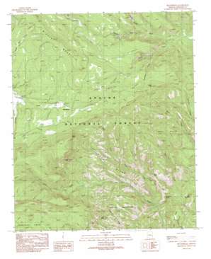
Beaverhead Topo Map Arizona
To zoom in, hover over the map of Beaverhead
USGS Topo Quad 33109f2 - 1:24,000 scale
| Topo Map Name: | Beaverhead |
| USGS Topo Quad ID: | 33109f2 |
| Print Size: | ca. 21 1/4" wide x 27" high |
| Southeast Coordinates: | 33.625° N latitude / 109.125° W longitude |
| Map Center Coordinates: | 33.6875° N latitude / 109.1875° W longitude |
| U.S. State: | AZ |
| Filename: | o33109f2.jpg |
| Download Map JPG Image: | Beaverhead topo map 1:24,000 scale |
| Map Type: | Topographic |
| Topo Series: | 7.5´ |
| Map Scale: | 1:24,000 |
| Source of Map Images: | United States Geological Survey (USGS) |
| Alternate Map Versions: |
Beaverhead AZ 1991, updated 1991 Download PDF Buy paper map Beaverhead AZ 1997, updated 2000 Download PDF Buy paper map Beaverhead AZ 2011 Download PDF Buy paper map Beaverhead AZ 2014 Download PDF Buy paper map |
| FStopo: | US Forest Service topo Beaverhead is available: Download FStopo PDF Download FStopo TIF |
1:24,000 Topo Quads surrounding Beaverhead
> Back to 33109e1 at 1:100,000 scale
> Back to 33108a1 at 1:250,000 scale
> Back to U.S. Topo Maps home
Beaverhead topo map: Gazetteer
Beaverhead: Areas
Tutt Cienega elevation 2494m 8182′Beaverhead: Basins
Hannagan Gravel Pit elevation 2498m 8195′Beaverhead: Cliffs
Burke Point elevation 2746m 9009′Devils Washboard elevation 2106m 6909′
Beaverhead: Flats
Jones Park elevation 2062m 6765′Beaverhead: Forests
Alpine Ranger District elevation 2565m 8415′Beaverhead: Lakes
Beaverhead Natural Lake elevation 2497m 8192′Beaverhead: Pillars
Bell Rock elevation 2213m 7260′Bell Rock elevation 2189m 7181′
Castle Rock elevation 2662m 8733′
Beaverhead: Populated Places
Carlton Vista elevation 2386m 7828′Beaverhead: Reservoirs
Accident Tank elevation 2353m 7719′Bear Tank elevation 2521m 8270′
Beaverhead Tank elevation 2477m 8126′
Buckalou Tank elevation 2370m 7775′
Campbell Blue Barrow Pit Tank Number Two elevation 2438m 7998′
Campbell Blue Borrow Pit Number One elevation 2389m 7837′
Duck Corral Tank elevation 2377m 7798′
Gravel Pit Tank elevation 2460m 8070′
Hannagan Tank elevation 2464m 8083′
Hawkwest Tank elevation 2486m 8156′
Log Canyon Tank elevation 2436m 7992′
Section Thirty-six Tank elevation 2420m 7939′
Snag Tank elevation 2443m 8015′
Spur Tank elevation 2424m 7952′
Tutt Tank elevation 2511m 8238′
Upper Tank elevation 2537m 8323′
Beaverhead: Ridges
Horse Ridge elevation 2258m 7408′Beaverhead: Springs
Cleveland Spring elevation 2034m 6673′Pearl Spring elevation 2583m 8474′
Soldier Spring elevation 2386m 7828′
Beaverhead: Streams
Buckelew Creek elevation 2179m 7148′Castle Creek elevation 2099m 6886′
Coleman Creek elevation 2160m 7086′
Hannagan Creek elevation 2379m 7805′
Right Fork Foote Creek elevation 1884m 6181′
Beaverhead: Summits
Burke Point elevation 2774m 9101′Deer Mountain elevation 2031m 6663′
Red Hills elevation 2247m 7372′
Sissy Point elevation 2250m 7381′
Beaverhead: Trails
Foote Creek Seventy-six Trail elevation 1971m 6466′Beaverhead digital topo map on disk
Buy this Beaverhead topo map showing relief, roads, GPS coordinates and other geographical features, as a high-resolution digital map file on DVD:


