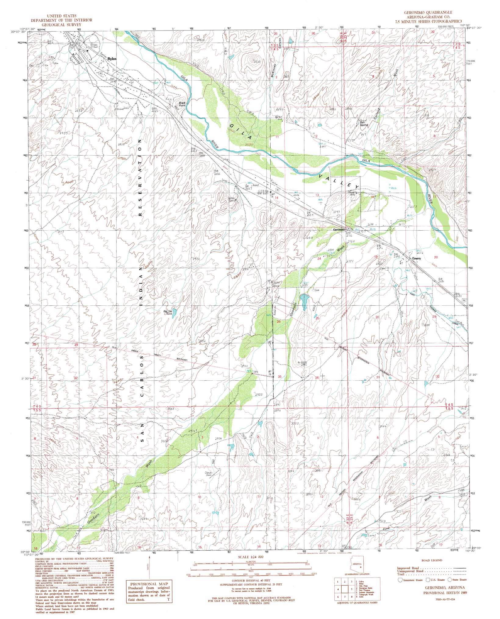
Geronimo Topo Map Arizona
To zoom in, hover over the map of Geronimo
USGS Topo Quad 33110a1 - 1:24,000 scale
| Topo Map Name: | Geronimo |
| USGS Topo Quad ID: | 33110a1 |
| Print Size: | ca. 21 1/4" wide x 27" high |
| Southeast Coordinates: | 33° N latitude / 110° W longitude |
| Map Center Coordinates: | 33.0625° N latitude / 110.0625° W longitude |
| U.S. State: | AZ |
| Filename: | o33110a1.jpg |
| Download Map JPG Image: | Geronimo topo map 1:24,000 scale |
| Map Type: | Topographic |
| Topo Series: | 7.5´ |
| Map Scale: | 1:24,000 |
| Source of Map Images: | United States Geological Survey (USGS) |
| Alternate Map Versions: |
Geronimo AZ 1989, updated 1990 Download PDF Buy paper map Geronimo AZ 2011 Download PDF Buy paper map Geronimo AZ 2014 Download PDF Buy paper map |
1:24,000 Topo Quads surrounding Geronimo
Mount Triplet |
Branaman Spring |
Ash Creek Ranch |
Tule Tubs |
Point Of Pines West |
Dewey Flat |
Calva |
Bylas |
Gila Peak |
Bonita Tank |
Mount Turnbull |
Beargrass Basin |
Geronimo |
Fort Thomas |
Markham Creek |
Cobre Grande Mountain |
Jackson Mountain |
Telegraph Wash |
Eden |
Pima |
Klondike |
Buford Hill |
Tripp Canyon |
Shingle Mill Mountain |
Thatcher |
> Back to 33110a1 at 1:100,000 scale
> Back to 33110a1 at 1:250,000 scale
> Back to U.S. Topo Maps home
Geronimo topo map: Gazetteer
Geronimo: Dams
Mallory Detention Dam elevation 841m 2759′Geronimo: Parks
Bylas Atheltic Field elevation 805m 2641′Geronimo: Populated Places
Emery elevation 817m 2680′Geronimo elevation 830m 2723′
Geronimo: Post Offices
Geronimo Post Office elevation 830m 2723′Geronimo: Springs
Salt Spring elevation 0m 0′Geronimo: Streams
Carland Wash elevation 804m 2637′Goodwin Wash elevation 805m 2641′
Geronimo: Summits
Black Point elevation 837m 2746′Geronimo: Valleys
Dutch Pasture Canyon elevation 854m 2801′McKinney Canyon elevation 827m 2713′
Geronimo digital topo map on disk
Buy this Geronimo topo map showing relief, roads, GPS coordinates and other geographical features, as a high-resolution digital map file on DVD: