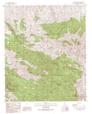
Mount Turnbull Topo Map Arizona
To zoom in, hover over the map of Mount Turnbull
USGS Topo Quad 33110a3 - 1:24,000 scale
| Topo Map Name: | Mount Turnbull |
| USGS Topo Quad ID: | 33110a3 |
| Print Size: | ca. 21 1/4" wide x 27" high |
| Southeast Coordinates: | 33° N latitude / 110.25° W longitude |
| Map Center Coordinates: | 33.0625° N latitude / 110.3125° W longitude |
| U.S. State: | AZ |
| Filename: | o33110a3.jpg |
| Download Map JPG Image: | Mount Turnbull topo map 1:24,000 scale |
| Map Type: | Topographic |
| Topo Series: | 7.5´ |
| Map Scale: | 1:24,000 |
| Source of Map Images: | United States Geological Survey (USGS) |
| Alternate Map Versions: |
Mount Turnbull AZ 1989, updated 1990 Download PDF Buy paper map Mount Turnbull AZ 2011 Download PDF Buy paper map Mount Turnbull AZ 2014 Download PDF Buy paper map |
| FStopo: | US Forest Service topo Mount Turnbull is available: Download FStopo PDF Download FStopo TIF |
1:24,000 Topo Quads surrounding Mount Turnbull
> Back to 33110a1 at 1:100,000 scale
> Back to 33110a1 at 1:250,000 scale
> Back to U.S. Topo Maps home
Mount Turnbull topo map: Gazetteer
Mount Turnbull: Basins
The Box elevation 1502m 4927′Mount Turnbull: Flats
Rustler Park elevation 0m 0′Mount Turnbull: Forests
Safford Ranger District elevation 1694m 5557′Mount Turnbull: Mines
Starlight Mine elevation 1268m 4160′Mount Turnbull: Populated Places
Ellison Place (historical) elevation 1701m 5580′Mount Turnbull: Reservoirs
House Tank elevation 1279m 4196′Mount Turnbull: Springs
Bee Spring elevation 1372m 4501′Bitter Spring elevation 1587m 5206′
Cold Spring elevation 1807m 5928′
Deer Spring elevation 1634m 5360′
Goat Ranch Spring elevation 1617m 5305′
Grapevine Spring elevation 1470m 4822′
Green House Spring elevation 1399m 4589′
Hillside Spring elevation 1629m 5344′
Hinton Spring elevation 1645m 5396′
Hinton Springs elevation 1405m 4609′
Horn Spring elevation 1406m 4612′
Jack Spring elevation 1660m 5446′
Lewis Spring elevation 1452m 4763′
Maple Spring elevation 1766m 5793′
Mescal Spring elevation 1620m 5314′
Mitchell Cabin Spring elevation 1449m 4753′
Musk Hog Canyon Spring elevation 1693m 5554′
Oak Spring elevation 1340m 4396′
Oak Spring elevation 1871m 6138′
Packwood Springs elevation 1569m 5147′
Post Office Spring elevation 1428m 4685′
Sycamore Spring elevation 1412m 4632′
Upper Goat Camp Spring elevation 1697m 5567′
Upper Kelly Spring elevation 1536m 5039′
Mount Turnbull: Summits
Crystal Peak elevation 2169m 7116′Duke Peak elevation 1593m 5226′
Granite Peak elevation 2160m 7086′
Limestone Mountain elevation 2022m 6633′
Mount Turnbull elevation 2527m 8290′
Packwood Mountain elevation 1932m 6338′
Quartzite Mountain elevation 1791m 5875′
Stanley Butte elevation 2133m 6998′
Mount Turnbull: Trails
Ellison Cabin Two hundred eighty three Trail elevation 1770m 5807′Mount Turnbull: Valleys
Hinton Canyon elevation 1592m 5223′Kelly Canyon elevation 1435m 4708′
Mitchell Canyon elevation 1171m 3841′
Musk Hog Canyon elevation 1524m 5000′
Packwood Canyon elevation 1326m 4350′
Rustler Park Canyon elevation 0m 0′
Mount Turnbull digital topo map on disk
Buy this Mount Turnbull topo map showing relief, roads, GPS coordinates and other geographical features, as a high-resolution digital map file on DVD:


