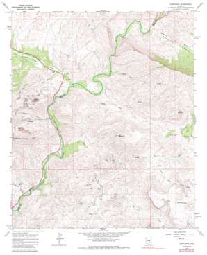
Christmas Topo Map Arizona
To zoom in, hover over the map of Christmas
USGS Topo Quad 33110a6 - 1:24,000 scale
| Topo Map Name: | Christmas |
| USGS Topo Quad ID: | 33110a6 |
| Print Size: | ca. 21 1/4" wide x 27" high |
| Southeast Coordinates: | 33° N latitude / 110.625° W longitude |
| Map Center Coordinates: | 33.0625° N latitude / 110.6875° W longitude |
| U.S. State: | AZ |
| Filename: | o33110a6.jpg |
| Download Map JPG Image: | Christmas topo map 1:24,000 scale |
| Map Type: | Topographic |
| Topo Series: | 7.5´ |
| Map Scale: | 1:24,000 |
| Source of Map Images: | United States Geological Survey (USGS) |
| Alternate Map Versions: |
Christmas AZ 1968, updated 1971 Download PDF Buy paper map Christmas AZ 1968, updated 1986 Download PDF Buy paper map Christmas AZ 1968, updated 1986 Download PDF Buy paper map Christmas AZ 2011 Download PDF Buy paper map Christmas AZ 2014 Download PDF Buy paper map |
1:24,000 Topo Quads surrounding Christmas
> Back to 33110a1 at 1:100,000 scale
> Back to 33110a1 at 1:250,000 scale
> Back to U.S. Topo Maps home
Christmas topo map: Gazetteer
Christmas: Basins
Granite Basin elevation 866m 2841′Christmas: Benches
The Tablelands elevation 943m 3093′Christmas: Dams
Christmas Tailings Dam Number Five elevation 902m 2959′Christmas Tailings Dam Number One elevation 902m 2959′
Christmas Tailings Dam Number Seven elevation 902m 2959′
Christmas Tailings Dam Number Six elevation 902m 2959′
Christmas Tailings Dam Number Three elevation 902m 2959′
Christmas Tailings Dam Number Two elevation 902m 2959′
Christmas: Mines
Christmas Mill and Mine elevation 916m 3005′Lees Mine elevation 681m 2234′
Pooles Mine elevation 810m 2657′
Two Queens Mine elevation 835m 2739′
Christmas: Populated Places
Christmas elevation 815m 2673′Christmas: Springs
Apache Spring elevation 635m 2083′Cottonwood Spring elevation 660m 2165′
Christmas: Streams
Ash Creek elevation 620m 2034′Deer Creek elevation 604m 1981′
Dripping Spring Wash elevation 617m 2024′
Little Ash Creek elevation 627m 2057′
Little Rock Creek elevation 733m 2404′
Rock Creek elevation 622m 2040′
Christmas: Summits
Corral Mountain elevation 1184m 3884′Lee Mountain elevation 1145m 3756′
Christmas: Valleys
Copper Canyon elevation 607m 1991′Dripping Springs Valley elevation 617m 2024′
Little Gold Gulch elevation 705m 2312′
O'Carroll Canyon elevation 605m 1984′
Porphyry Gulch elevation 656m 2152′
Christmas digital topo map on disk
Buy this Christmas topo map showing relief, roads, GPS coordinates and other geographical features, as a high-resolution digital map file on DVD:


