Bronco Gulch Topo Map Arizona
To zoom in, hover over the map of Bronco Gulch
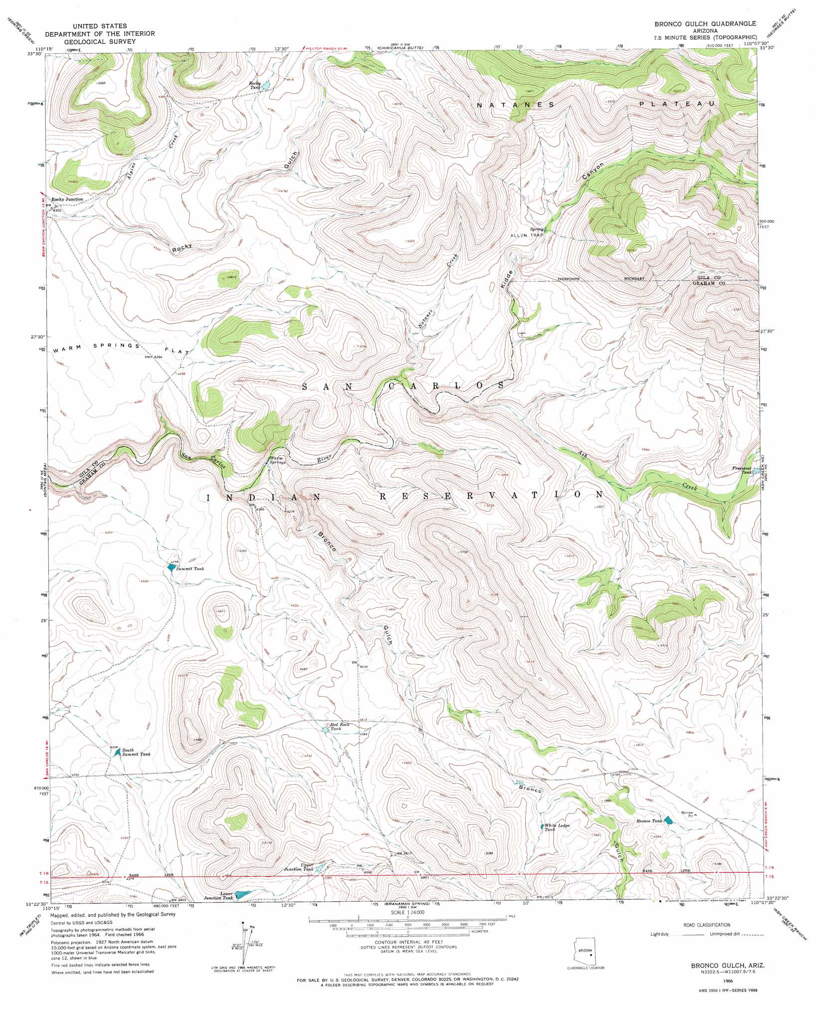
USGS Topo Quad 33110d2 - 1:24,000 scale
| Topo Map Name: | Bronco Gulch |
| USGS Topo Quad ID: | 33110d2 |
| Print Size: | ca. 21 1/4" wide x 27" high |
| Southeast Coordinates: | 33.375° N latitude / 110.125° W longitude |
| Map Center Coordinates: | 33.4375° N latitude / 110.1875° W longitude |
| U.S. State: | AZ |
| Filename: | o33110d2.jpg |
| Download Map JPG Image: | Bronco Gulch topo map 1:24,000 scale |
| Map Type: | Topographic |
| Topo Series: | 7.5´ |
| Map Scale: | 1:24,000 |
| Source of Map Images: | United States Geological Survey (USGS) |
| Alternate Map Versions: |
Bronco Gulch AZ 1966, updated 1967 Download PDF Buy paper map Bronco Gulch AZ 2011 Download PDF Buy paper map Bronco Gulch AZ 2014 Download PDF Buy paper map |
1:24,000 Topo Quads surrounding Bronco Gulch
Brushy Canyon |
Popcorn Canyon |
Forks Butte |
Velasquez Butte |
Bonito Prairie |
Cassadore Spring |
Sontag Creek |
Chiricahua Butte |
Georges Butte |
Elwood Canyon |
Natural Corral |
Sontag Mesa |
Bronco Gulch |
Ash Creek Ne |
Natanes Mountains Nw |
San Carlos |
Mount Triplet |
Branaman Spring |
Ash Creek Ranch |
Tule Tubs |
San Carlos Reservoir |
Dewey Flat |
Calva |
Bylas |
Gila Peak |
> Back to 33110a1 at 1:100,000 scale
> Back to 33110a1 at 1:250,000 scale
> Back to U.S. Topo Maps home
Bronco Gulch topo map: Gazetteer
Bronco Gulch: Cliffs
Allen Trap elevation 1418m 4652′Bronco Gulch: Dams
Lower Junction Dam elevation 1354m 4442′Bronco Gulch: Populated Places
Rocky Junction elevation 1313m 4307′Bronco Gulch: Reservoirs
Bronco Tank elevation 1477m 4845′Freezeout Tank elevation 1326m 4350′
Lower Junction Tank elevation 1354m 4442′
Red Rock Tank elevation 1388m 4553′
Rocky Tank elevation 1457m 4780′
South Summit Tank elevation 1297m 4255′
Summit Tank elevation 1305m 4281′
Upper Junction Tank elevation 1394m 4573′
White Ledge Tank elevation 1438m 4717′
Bronco Gulch: Springs
Warm Springs elevation 1245m 4084′Bronco Gulch: Streams
Alpine Creek elevation 1311m 4301′Ash Creek elevation 1352m 4435′
Natanes Creek elevation 1289m 4229′
Bronco Gulch: Valleys
Bronco Gulch elevation 1241m 4071′Kidde Canyon elevation 1298m 4258′
Bronco Gulch digital topo map on disk
Buy this Bronco Gulch topo map showing relief, roads, GPS coordinates and other geographical features, as a high-resolution digital map file on DVD: