Sontag Mesa Topo Map Arizona
To zoom in, hover over the map of Sontag Mesa
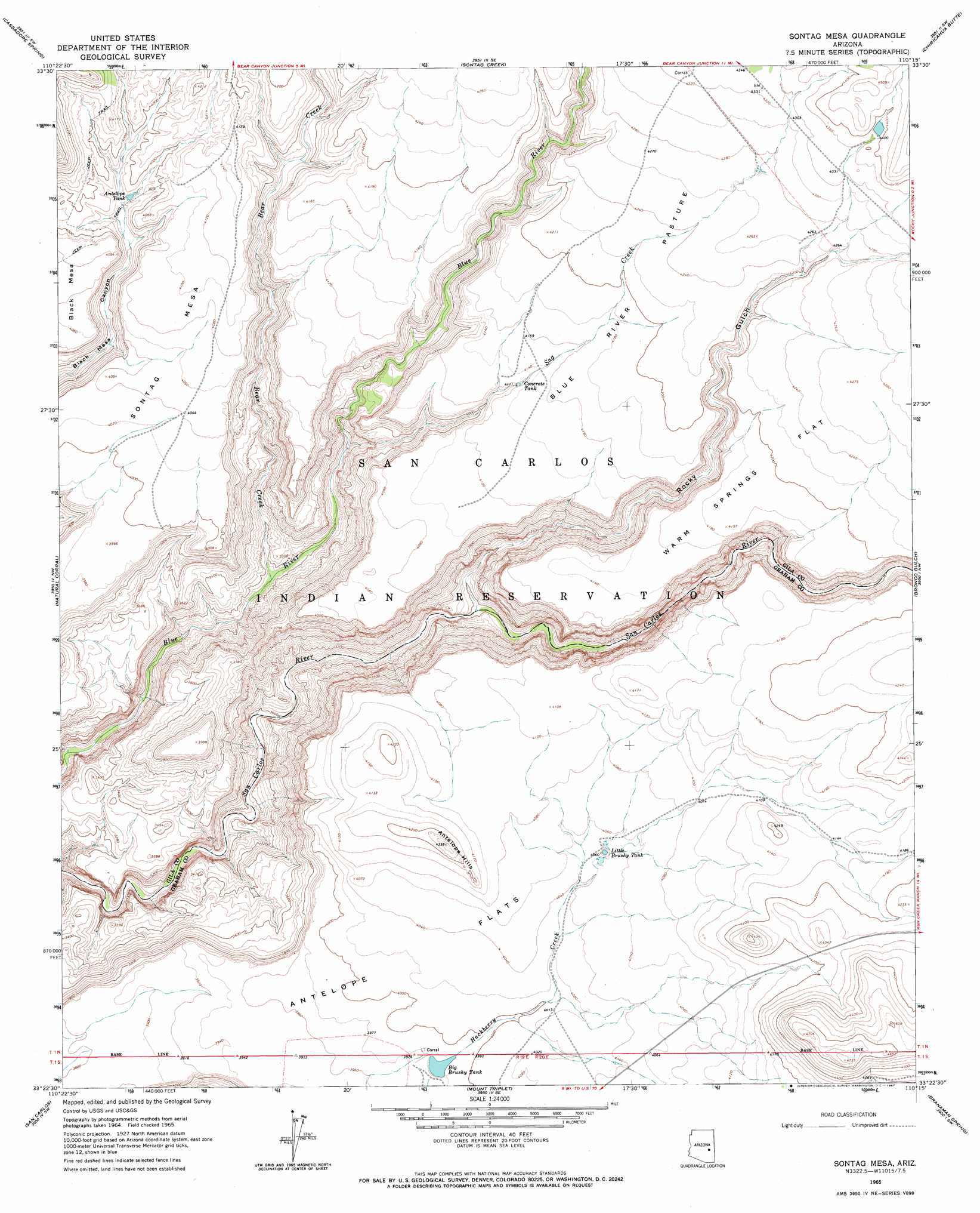
USGS Topo Quad 33110d3 - 1:24,000 scale
| Topo Map Name: | Sontag Mesa |
| USGS Topo Quad ID: | 33110d3 |
| Print Size: | ca. 21 1/4" wide x 27" high |
| Southeast Coordinates: | 33.375° N latitude / 110.25° W longitude |
| Map Center Coordinates: | 33.4375° N latitude / 110.3125° W longitude |
| U.S. State: | AZ |
| Filename: | o33110d3.jpg |
| Download Map JPG Image: | Sontag Mesa topo map 1:24,000 scale |
| Map Type: | Topographic |
| Topo Series: | 7.5´ |
| Map Scale: | 1:24,000 |
| Source of Map Images: | United States Geological Survey (USGS) |
| Alternate Map Versions: |
Sontag Mesa AZ 1965, updated 1967 Download PDF Buy paper map Sontag Mesa AZ 2011 Download PDF Buy paper map Sontag Mesa AZ 2014 Download PDF Buy paper map |
1:24,000 Topo Quads surrounding Sontag Mesa
Chrysotile |
Brushy Canyon |
Popcorn Canyon |
Forks Butte |
Velasquez Butte |
Sevenmile Mountains |
Cassadore Spring |
Sontag Creek |
Chiricahua Butte |
Georges Butte |
Dourine Canyon |
Natural Corral |
Sontag Mesa |
Bronco Gulch |
Ash Creek Ne |
Bucket Mountain |
San Carlos |
Mount Triplet |
Branaman Spring |
Ash Creek Ranch |
Coolidge Dam |
San Carlos Reservoir |
Dewey Flat |
Calva |
Bylas |
> Back to 33110a1 at 1:100,000 scale
> Back to 33110a1 at 1:250,000 scale
> Back to U.S. Topo Maps home
Sontag Mesa topo map: Gazetteer
Sontag Mesa: Dams
Big Brushy Dam elevation 1215m 3986′Sontag Mesa: Flats
Antelope Flats elevation 1227m 4025′Blue River Pasture elevation 1288m 4225′
Warm Springs Flat elevation 1301m 4268′
Sontag Mesa: Reservoirs
Antelope Tank elevation 1193m 3914′Big Brushy Tank elevation 1215m 3986′
Concrete Tank elevation 1250m 4101′
Little Brushy Tank elevation 1235m 4051′
Sontag Mesa: Streams
Bear Creek elevation 953m 3126′Sag Creek elevation 0m 0′
Sontag Mesa: Summits
Antelope Hills elevation 1317m 4320′Sontag Mesa elevation 1270m 4166′
Sontag Mesa: Valleys
Rocky Gulch elevation 971m 3185′Sontag Mesa digital topo map on disk
Buy this Sontag Mesa topo map showing relief, roads, GPS coordinates and other geographical features, as a high-resolution digital map file on DVD: