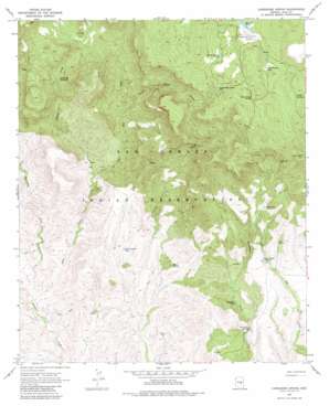
Cassadore Spring Topo Map Arizona
To zoom in, hover over the map of Cassadore Spring
USGS Topo Quad 33110e4 - 1:24,000 scale
| Topo Map Name: | Cassadore Spring |
| USGS Topo Quad ID: | 33110e4 |
| Print Size: | ca. 21 1/4" wide x 27" high |
| Southeast Coordinates: | 33.5° N latitude / 110.375° W longitude |
| Map Center Coordinates: | 33.5625° N latitude / 110.4375° W longitude |
| U.S. State: | AZ |
| Filename: | o33110e4.jpg |
| Download Map JPG Image: | Cassadore Spring topo map 1:24,000 scale |
| Map Type: | Topographic |
| Topo Series: | 7.5´ |
| Map Scale: | 1:24,000 |
| Source of Map Images: | United States Geological Survey (USGS) |
| Alternate Map Versions: |
Cassadore Spring AZ 1966, updated 1968 Download PDF Buy paper map Cassadore Spring AZ 1966, updated 1980 Download PDF Buy paper map Cassadore Spring AZ 2011 Download PDF Buy paper map Cassadore Spring AZ 2014 Download PDF Buy paper map |
1:24,000 Topo Quads surrounding Cassadore Spring
> Back to 33110e1 at 1:100,000 scale
> Back to 33110a1 at 1:250,000 scale
> Back to U.S. Topo Maps home
Cassadore Spring topo map: Gazetteer
Cassadore Spring: Cliffs
Big Cedar Trap elevation 1219m 3999′Geronimo Trap elevation 1059m 3474′
Wild Beef Trap elevation 1486m 4875′
Cassadore Spring: Dams
Sawmill Dam elevation 1719m 5639′Cassadore Spring: Flats
Bull Pasture elevation 1430m 4691′Cassadore Spring: Populated Places
Bear Canyon Junction elevation 1401m 4596′Sawmill elevation 1720m 5643′
Cassadore Spring: Reservoirs
Bull Pasture Tank elevation 1254m 4114′Cassadore Tank elevation 1267m 4156′
Horse Pasture Tank elevation 1740m 5708′
North Alder Creek Tank elevation 1736m 5695′
Oak Creek Tank elevation 1490m 4888′
Rose Garden Tank elevation 1737m 5698′
Sawmill Tank elevation 0m 0′
Cassadore Spring: Springs
Cassadore Spring elevation 1237m 4058′Cold Spring elevation 1084m 3556′
Horse Camp Spring elevation 1775m 5823′
Keam Spring elevation 1287m 4222′
Oak Spring elevation 1426m 4678′
Wild Bee Spring elevation 1400m 4593′
Cassadore Spring: Streams
Alder Creek elevation 1016m 3333′New Creek elevation 1205m 3953′
North Alder Creek elevation 1328m 4356′
Rocky Creek elevation 1181m 3874′
Cassadore Spring: Summits
Indian Lookout elevation 1819m 5967′Cassadore Spring: Wells
I K Bar Well elevation 1171m 3841′Cassadore Spring digital topo map on disk
Buy this Cassadore Spring topo map showing relief, roads, GPS coordinates and other geographical features, as a high-resolution digital map file on DVD:


