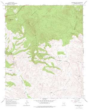
Sevenmile Mountains Topo Map Arizona
To zoom in, hover over the map of Sevenmile Mountains
USGS Topo Quad 33110e5 - 1:24,000 scale
| Topo Map Name: | Sevenmile Mountains |
| USGS Topo Quad ID: | 33110e5 |
| Print Size: | ca. 21 1/4" wide x 27" high |
| Southeast Coordinates: | 33.5° N latitude / 110.5° W longitude |
| Map Center Coordinates: | 33.5625° N latitude / 110.5625° W longitude |
| U.S. State: | AZ |
| Filename: | o33110e5.jpg |
| Download Map JPG Image: | Sevenmile Mountains topo map 1:24,000 scale |
| Map Type: | Topographic |
| Topo Series: | 7.5´ |
| Map Scale: | 1:24,000 |
| Source of Map Images: | United States Geological Survey (USGS) |
| Alternate Map Versions: |
Sevenmile Mts. AZ 1966, updated 1968 Download PDF Buy paper map Sevenmile Mts. AZ 1966, updated 1977 Download PDF Buy paper map Sevenmile Mountains AZ 2011 Download PDF Buy paper map Sevenmile Mountains AZ 2014 Download PDF Buy paper map |
| FStopo: | US Forest Service topo Sevenmile Mountains is available: Download FStopo PDF Download FStopo TIF |
1:24,000 Topo Quads surrounding Sevenmile Mountains
> Back to 33110e1 at 1:100,000 scale
> Back to 33110a1 at 1:250,000 scale
> Back to U.S. Topo Maps home
Sevenmile Mountains topo map: Gazetteer
Sevenmile Mountains: Basins
Brushy Basin elevation 1293m 4242′Sevenmile Mountains: Dams
Coffee Pot Dam elevation 1288m 4225′Sevenmile Mountains: Parks
Jackson Butte Recreation Area elevation 1510m 4954′Sevenmile Mountains: Reservoirs
Brushy Basin Tank elevation 1257m 4124′Pigeon Tank elevation 1556m 5104′
Red Rock Tank elevation 1088m 3569′
Sevenmile Tank elevation 1191m 3907′
Sevenmile Mountains: Springs
Gerald Spring elevation 1105m 3625′Poverty Spring elevation 1431m 4694′
Wood Spring elevation 1516m 4973′
Sevenmile Mountains: Streams
Corral Creek elevation 1100m 3608′Sevenmile Mountains: Summits
Rock Springs Butte elevation 1612m 5288′Sevenmile Mountains elevation 1627m 5337′
Sevenmile Mountains: Valleys
Bear Canyon elevation 1209m 3966′Sevenmile Mountains: Wells
Bean Belly Well elevation 1049m 3441′Coffee Pot Well elevation 1236m 4055′
Pigeon Spring Well elevation 1245m 4084′
Red Rock Well elevation 1115m 3658′
Sevenmile Mountains digital topo map on disk
Buy this Sevenmile Mountains topo map showing relief, roads, GPS coordinates and other geographical features, as a high-resolution digital map file on DVD:


