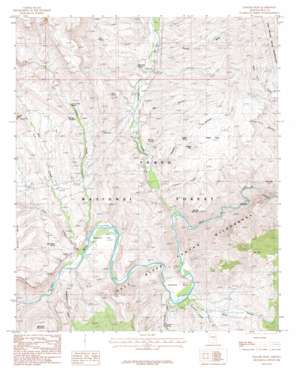
Dagger Peak Topo Map Arizona
To zoom in, hover over the map of Dagger Peak
USGS Topo Quad 33110f7 - 1:24,000 scale
| Topo Map Name: | Dagger Peak |
| USGS Topo Quad ID: | 33110f7 |
| Print Size: | ca. 21 1/4" wide x 27" high |
| Southeast Coordinates: | 33.625° N latitude / 110.75° W longitude |
| Map Center Coordinates: | 33.6875° N latitude / 110.8125° W longitude |
| U.S. State: | AZ |
| Filename: | o33110f7.jpg |
| Download Map JPG Image: | Dagger Peak topo map 1:24,000 scale |
| Map Type: | Topographic |
| Topo Series: | 7.5´ |
| Map Scale: | 1:24,000 |
| Source of Map Images: | United States Geological Survey (USGS) |
| Alternate Map Versions: |
Dagger Peak AZ 1986, updated 1986 Download PDF Buy paper map Dagger Peak AZ 2004, updated 2007 Download PDF Buy paper map Dagger Peak AZ 2011 Download PDF Buy paper map Dagger Peak AZ 2014 Download PDF Buy paper map |
| FStopo: | US Forest Service topo Dagger Peak is available: Download FStopo PDF Download FStopo TIF |
1:24,000 Topo Quads surrounding Dagger Peak
> Back to 33110e1 at 1:100,000 scale
> Back to 33110a1 at 1:250,000 scale
> Back to U.S. Topo Maps home
Dagger Peak topo map: Gazetteer
Dagger Peak: Basins
Dagger Basin elevation 956m 3136′Dagger Peak: Bends
Horseshoe Bend elevation 740m 2427′Dagger Peak: Flats
Redmond Flat elevation 741m 2431′Dagger Peak: Populated Places
Dagger elevation 805m 2641′Dagger Peak: Rapids
Cliff Hanger Rapid elevation 753m 2470′Corkscrew Rapid elevation 780m 2559′
Lower Corral Rapid elevation 780m 2559′
Quartzite Rapid elevation 780m 2559′
Quartzite Rapids elevation 796m 2611′
The Sleeper Rapid elevation 785m 2575′
Dagger Peak: Reservoirs
Black Mesa Tank Number One elevation 1022m 3353′Burnt Canyon Tank elevation 1077m 3533′
Winter Pasture Tank elevation 1409m 4622′
Dagger Peak: Springs
Bill Lee Spring elevation 919m 3015′Black Mesa Spring elevation 838m 2749′
Coon Creek Spring elevation 928m 3044′
Dagger Spring elevation 878m 2880′
DeVore Spring elevation 848m 2782′
Liquor Spring elevation 988m 3241′
Montague Spring elevation 866m 2841′
Rock Spring elevation 1053m 3454′
Turnout Spring elevation 839m 2752′
Dagger Peak: Streams
Chalk Creek elevation 708m 2322′Cherry Creek elevation 748m 2454′
Coon Creek elevation 709m 2326′
Dry Creek elevation 759m 2490′
Lawrence Creek elevation 763m 2503′
Mud Springs Wash elevation 733m 2404′
Pringle Wash elevation 829m 2719′
Redmond Wash elevation 711m 2332′
Dagger Peak: Summits
Buck Mountain elevation 1033m 3389′Dagger Peak elevation 991m 3251′
McGee Mountain elevation 1067m 3500′
Dagger Peak: Valleys
Bee Canyon elevation 817m 2680′Cougar Canyon elevation 941m 3087′
Dagger Canyon elevation 781m 2562′
Grapevine Canyon elevation 833m 2732′
Jump-Off Canyon elevation 896m 2939′
Storm Canyon elevation 831m 2726′
Sycamore Canyon elevation 756m 2480′
Dagger Peak: Wells
Dry Creek Well elevation 927m 3041′Montague Well elevation 985m 3231′
Natural Well elevation 971m 3185′
Pringle Well elevation 1009m 3310′
Storm Canyon Well elevation 971m 3185′
Dagger Peak digital topo map on disk
Buy this Dagger Peak topo map showing relief, roads, GPS coordinates and other geographical features, as a high-resolution digital map file on DVD:


