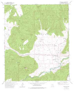
Canyon Day Topo Map Arizona
To zoom in, hover over the map of Canyon Day
USGS Topo Quad 33110g1 - 1:24,000 scale
| Topo Map Name: | Canyon Day |
| USGS Topo Quad ID: | 33110g1 |
| Print Size: | ca. 21 1/4" wide x 27" high |
| Southeast Coordinates: | 33.75° N latitude / 110° W longitude |
| Map Center Coordinates: | 33.8125° N latitude / 110.0625° W longitude |
| U.S. State: | AZ |
| Filename: | o33110g1.jpg |
| Download Map JPG Image: | Canyon Day topo map 1:24,000 scale |
| Map Type: | Topographic |
| Topo Series: | 7.5´ |
| Map Scale: | 1:24,000 |
| Source of Map Images: | United States Geological Survey (USGS) |
| Alternate Map Versions: |
Canyon Day AZ 1966, updated 1968 Download PDF Buy paper map Canyon Day AZ 2011 Download PDF Buy paper map Canyon Day AZ 2014 Download PDF Buy paper map |
1:24,000 Topo Quads surrounding Canyon Day
> Back to 33110e1 at 1:100,000 scale
> Back to 33110a1 at 1:250,000 scale
> Back to U.S. Topo Maps home
Canyon Day topo map: Gazetteer
Canyon Day: Populated Places
Canyon Day elevation 1524m 5000′Fort Apache Junction elevation 1537m 5042′
Canyon Day: Reservoirs
Amos Tank elevation 1611m 5285′Bear Canyon Number One elevation 1602m 5255′
Bear Canyon Tank elevation 1712m 5616′
Canyon Day Tank elevation 1571m 5154′
Cedar Gap Tank elevation 1610m 5282′
D-five Tank elevation 1708m 5603′
Ghost Tank elevation 1721m 5646′
Kinishba Tank elevation 1725m 5659′
Ruins Tank elevation 0m 0′
Ruins Tank Number Two elevation 0m 0′
Sawtooth Tank elevation 0m 0′
Sawtooth Tank Number Two elevation 0m 0′
Standing Rock Tank elevation 1616m 5301′
Canyon Day: Springs
Amos Spring elevation 1549m 5082′Coyote Spring elevation 1769m 5803′
D-five Spring elevation 1684m 5524′
Sore Spring elevation 1535m 5036′
Yellow Jacket Spring elevation 1826m 5990′
Canyon Day: Summits
Kelly Butte elevation 1877m 6158′Sawtooth Mountain elevation 0m 0′
Tsay-se-zhin Butte elevation 1812m 5944′
Canyon Day: Valleys
Bear Canyon elevation 1480m 4855′Canyon Day: Wells
G-one Well elevation 1555m 5101′Kinishba Well elevation 1612m 5288′
Macklin Well elevation 1575m 5167′
Canyon Day digital topo map on disk
Buy this Canyon Day topo map showing relief, roads, GPS coordinates and other geographical features, as a high-resolution digital map file on DVD:


