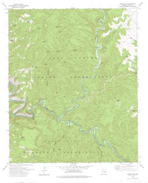
Carrizo Se Topo Map Arizona
To zoom in, hover over the map of Carrizo Se
USGS Topo Quad 33110g3 - 1:24,000 scale
| Topo Map Name: | Carrizo Se |
| USGS Topo Quad ID: | 33110g3 |
| Print Size: | ca. 21 1/4" wide x 27" high |
| Southeast Coordinates: | 33.75° N latitude / 110.25° W longitude |
| Map Center Coordinates: | 33.8125° N latitude / 110.3125° W longitude |
| U.S. State: | AZ |
| Filename: | o33110g3.jpg |
| Download Map JPG Image: | Carrizo Se topo map 1:24,000 scale |
| Map Type: | Topographic |
| Topo Series: | 7.5´ |
| Map Scale: | 1:24,000 |
| Source of Map Images: | United States Geological Survey (USGS) |
| Alternate Map Versions: |
Carrizo SE AZ 1966, updated 1968 Download PDF Buy paper map Carrizo SE AZ 2011 Download PDF Buy paper map Carrizo SE AZ 2014 Download PDF Buy paper map |
1:24,000 Topo Quads surrounding Carrizo Se
> Back to 33110e1 at 1:100,000 scale
> Back to 33110a1 at 1:250,000 scale
> Back to U.S. Topo Maps home
Carrizo Se topo map: Gazetteer
Carrizo Se: Mines
KM Mine elevation 1277m 4189′Carrizo Se: Reservoirs
Bill Schroeder Tank elevation 1606m 5269′Bonehead Catchment elevation 1529m 5016′
Bonehead Tank elevation 1633m 5357′
Clover Tank elevation 1562m 5124′
Cowboy Tank elevation 1516m 4973′
Drift Fence Tank elevation 1618m 5308′
John Moore Tank elevation 1575m 5167′
Louse Tank Number One elevation 1534m 5032′
Mescal Tank elevation 1610m 5282′
Mesquite Tank elevation 1716m 5629′
Mine Tank elevation 1437m 4714′
Mine Tank Number Two elevation 1583m 5193′
Quail Tank elevation 1591m 5219′
Ridge Tank Number One elevation 1517m 4977′
Rim Pit Tank elevation 1467m 4812′
Side Oat Tank elevation 0m 0′
Skeleton Tank elevation 0m 0′
Spoon Tank elevation 1360m 4461′
Swede Tank elevation 1597m 5239′
Trail Tank elevation 1567m 5141′
Carrizo Se: Springs
Bog Spring elevation 1444m 4737′Bonehead Spring elevation 1698m 5570′
Golden Roll Spring elevation 1611m 5285′
John Moore Spring elevation 1477m 4845′
Old R Spring elevation 1351m 4432′
Soda Spring elevation 1299m 4261′
Swede Spring elevation 1416m 4645′
Warm Spring elevation 1254m 4114′
Carrizo Se: Streams
Carrizo Creek elevation 1236m 4055′Cedar Creek elevation 1259m 4130′
Little Trough Creek elevation 1243m 4078′
Carrizo Se: Summits
Bull Butte elevation 1673m 5488′Cowboy Butte elevation 1639m 5377′
Carrizo Se: Valleys
Abdoul Canyon elevation 1242m 4074′Alkali Canyon elevation 1213m 3979′
Popcorn Canyon elevation 1270m 4166′
Carrizo Se digital topo map on disk
Buy this Carrizo Se topo map showing relief, roads, GPS coordinates and other geographical features, as a high-resolution digital map file on DVD:


