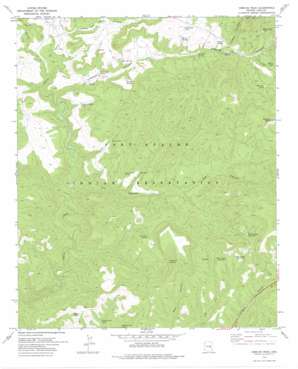
Cibecue Peak Topo Map Arizona
To zoom in, hover over the map of Cibecue Peak
USGS Topo Quad 33110h4 - 1:24,000 scale
| Topo Map Name: | Cibecue Peak |
| USGS Topo Quad ID: | 33110h4 |
| Print Size: | ca. 21 1/4" wide x 27" high |
| Southeast Coordinates: | 33.875° N latitude / 110.375° W longitude |
| Map Center Coordinates: | 33.9375° N latitude / 110.4375° W longitude |
| U.S. State: | AZ |
| Filename: | o33110h4.jpg |
| Download Map JPG Image: | Cibecue Peak topo map 1:24,000 scale |
| Map Type: | Topographic |
| Topo Series: | 7.5´ |
| Map Scale: | 1:24,000 |
| Source of Map Images: | United States Geological Survey (USGS) |
| Alternate Map Versions: |
Cibecue Peak AZ 1966, updated 1968 Download PDF Buy paper map Cibecue Peak AZ 1978, updated 1978 Download PDF Buy paper map Cibecue Peak AZ 2011 Download PDF Buy paper map Cibecue Peak AZ 2014 Download PDF Buy paper map |
1:24,000 Topo Quads surrounding Cibecue Peak
> Back to 33110e1 at 1:100,000 scale
> Back to 33110a1 at 1:250,000 scale
> Back to U.S. Topo Maps home
Cibecue Peak topo map: Gazetteer
Cibecue Peak: Reservoirs
Blue Fox Tank elevation 1692m 5551′Bobcat Tank elevation 1674m 5492′
Cibecue Canyon Tank elevation 1475m 4839′
Cibecue Rim Tank elevation 1641m 5383′
Fox Canyon Tank elevation 1498m 4914′
Jackrabbit Tank elevation 1599m 5246′
Saddle Tank elevation 0m 0′
Turkey Roost Tank elevation 1645m 5396′
Well Canyon Tank Number One elevation 1729m 5672′
Well Canyon Tank Number Three elevation 1719m 5639′
Well Canyon Tank Number Two elevation 1716m 5629′
White Cliff Tank elevation 1693m 5554′
Cibecue Peak: Springs
Cat Claw Spring elevation 1705m 5593′Cowboy Spring elevation 1607m 5272′
Flying H Spring elevation 1719m 5639′
Fox Spring elevation 1505m 4937′
Horse Spring elevation 1587m 5206′
Pine Spring elevation 1514m 4967′
Trap Number One Spring elevation 1559m 5114′
Trap Number Two Spring elevation 1595m 5232′
Wool Cutter Spring elevation 1464m 4803′
Cibecue Peak: Streams
Spring Creek elevation 1413m 4635′Cibecue Peak: Summits
Cibecue Peak elevation 1962m 6437′Cibecue Peak: Valleys
Cibecue Canyon elevation 1444m 4737′Cowboy Canyon elevation 1595m 5232′
Fox Canyon elevation 1349m 4425′
Indian Canyon elevation 1447m 4747′
Cibecue Peak digital topo map on disk
Buy this Cibecue Peak topo map showing relief, roads, GPS coordinates and other geographical features, as a high-resolution digital map file on DVD:


