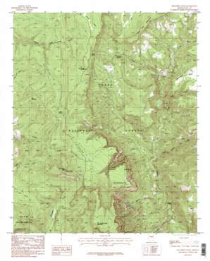
Mcfadden Peak Topo Map Arizona
To zoom in, hover over the map of Mcfadden Peak
USGS Topo Quad 33110h8 - 1:24,000 scale
| Topo Map Name: | Mcfadden Peak |
| USGS Topo Quad ID: | 33110h8 |
| Print Size: | ca. 21 1/4" wide x 27" high |
| Southeast Coordinates: | 33.875° N latitude / 110.875° W longitude |
| Map Center Coordinates: | 33.9375° N latitude / 110.9375° W longitude |
| U.S. State: | AZ |
| Filename: | o33110h8.jpg |
| Download Map JPG Image: | Mcfadden Peak topo map 1:24,000 scale |
| Map Type: | Topographic |
| Topo Series: | 7.5´ |
| Map Scale: | 1:24,000 |
| Source of Map Images: | United States Geological Survey (USGS) |
| Alternate Map Versions: |
McFadden Peak AZ 1986, updated 1986 Download PDF Buy paper map McFadden Peak AZ 1986, updated 1986 Download PDF Buy paper map McFadden Peak AZ 2004, updated 2007 Download PDF Buy paper map McFadden Peak AZ 2011 Download PDF Buy paper map McFadden Peak AZ 2014 Download PDF Buy paper map |
| FStopo: | US Forest Service topo McFadden Peak is available: Download FStopo PDF Download FStopo TIF |
1:24,000 Topo Quads surrounding Mcfadden Peak
> Back to 33110e1 at 1:100,000 scale
> Back to 33110a1 at 1:250,000 scale
> Back to U.S. Topo Maps home
Mcfadden Peak topo map: Gazetteer
Mcfadden Peak: Arches
Elephant Rock elevation 1937m 6354′Mcfadden Peak: Flats
Juniper Flat elevation 1855m 6085′Mcfadden Peak: Gaps
Board Tree Saddle elevation 1831m 6007′Mcfadden Peak: Reservoirs
Board Tree Saddle Tank elevation 1864m 6115′China Spring Tank elevation 1507m 4944′
Chinaman Tank elevation 1325m 4347′
Cow Flat Tank elevation 1572m 5157′
Dads Tank elevation 1450m 4757′
Gunsight Tank elevation 1538m 5045′
Horse Mountain Tank elevation 1567m 5141′
Juniper Flat Tank elevation 1854m 6082′
Olliger Mesa Tank elevation 1493m 4898′
Park Tank elevation 1794m 5885′
Paul Tank elevation 1808m 5931′
Pendleton Tank elevation 1590m 5216′
Reg Tank elevation 1816m 5958′
Rhinehart Tank elevation 1784m 5853′
Mcfadden Peak: Springs
Ash Creek Corral Spring elevation 1910m 6266′Ash Creek Spring elevation 1428m 4685′
Board Tree Spring elevation 1700m 5577′
P B Spring elevation 1381m 4530′
Turkey Spring elevation 1881m 6171′
Mcfadden Peak: Streams
Ash Creek elevation 1316m 4317′Billy Lawrence Creek elevation 1120m 3674′
China Spring Creek elevation 1253m 4110′
Deep Creek elevation 1163m 3815′
East Spear Creek elevation 1709m 5606′
Gold Creek elevation 1139m 3736′
Horse Tank Creek elevation 1300m 4265′
P B Creek elevation 1277m 4189′
Wilson Creek elevation 1349m 4425′
Mcfadden Peak: Summits
Cow Flat Mountain elevation 1753m 5751′McFadden Horse Mountain elevation 2286m 7500′
McFadden Peak elevation 2173m 7129′
Pendleton Mesa elevation 1616m 5301′
Pine Mountain elevation 2031m 6663′
Mcfadden Peak: Valleys
Billy Lawrence Canyon elevation 1120m 3674′Cold Water Canyon elevation 1209m 3966′
Mcfadden Peak digital topo map on disk
Buy this Mcfadden Peak topo map showing relief, roads, GPS coordinates and other geographical features, as a high-resolution digital map file on DVD:


