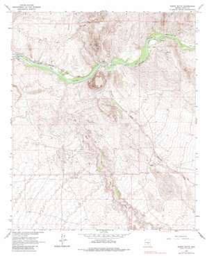
North Butte Topo Map Arizona
To zoom in, hover over the map of North Butte
USGS Topo Quad 33111a2 - 1:24,000 scale
| Topo Map Name: | North Butte |
| USGS Topo Quad ID: | 33111a2 |
| Print Size: | ca. 21 1/4" wide x 27" high |
| Southeast Coordinates: | 33° N latitude / 111.125° W longitude |
| Map Center Coordinates: | 33.0625° N latitude / 111.1875° W longitude |
| U.S. State: | AZ |
| Filename: | o33111a2.jpg |
| Download Map JPG Image: | North Butte topo map 1:24,000 scale |
| Map Type: | Topographic |
| Topo Series: | 7.5´ |
| Map Scale: | 1:24,000 |
| Source of Map Images: | United States Geological Survey (USGS) |
| Alternate Map Versions: |
North Butte AZ 1964, updated 1965 Download PDF Buy paper map North Butte AZ 1964, updated 1973 Download PDF Buy paper map North Butte AZ 1964, updated 1985 Download PDF Buy paper map North Butte AZ 2011 Download PDF Buy paper map North Butte AZ 2014 Download PDF Buy paper map |
1:24,000 Topo Quads surrounding North Butte
> Back to 33111a1 at 1:100,000 scale
> Back to 33110a1 at 1:250,000 scale
> Back to U.S. Topo Maps home
North Butte topo map: Gazetteer
North Butte: Dams
Ashurst Hayden Dam elevation 475m 1558′North Butte: Populated Places
Cochran elevation 500m 1640′Price elevation 482m 1581′
North Butte: Streams
Box O Wash elevation 483m 1584′Donnelly Wash elevation 489m 1604′
North Butte: Summits
Double Peaks elevation 906m 2972′North Butte elevation 881m 2890′
South Butte elevation 836m 2742′
North Butte: Valleys
Box Canyon elevation 488m 1601′Martinez Canyon elevation 518m 1699′
North Butte digital topo map on disk
Buy this North Butte topo map showing relief, roads, GPS coordinates and other geographical features, as a high-resolution digital map file on DVD:


