Florence Se Topo Map Arizona
To zoom in, hover over the map of Florence Se
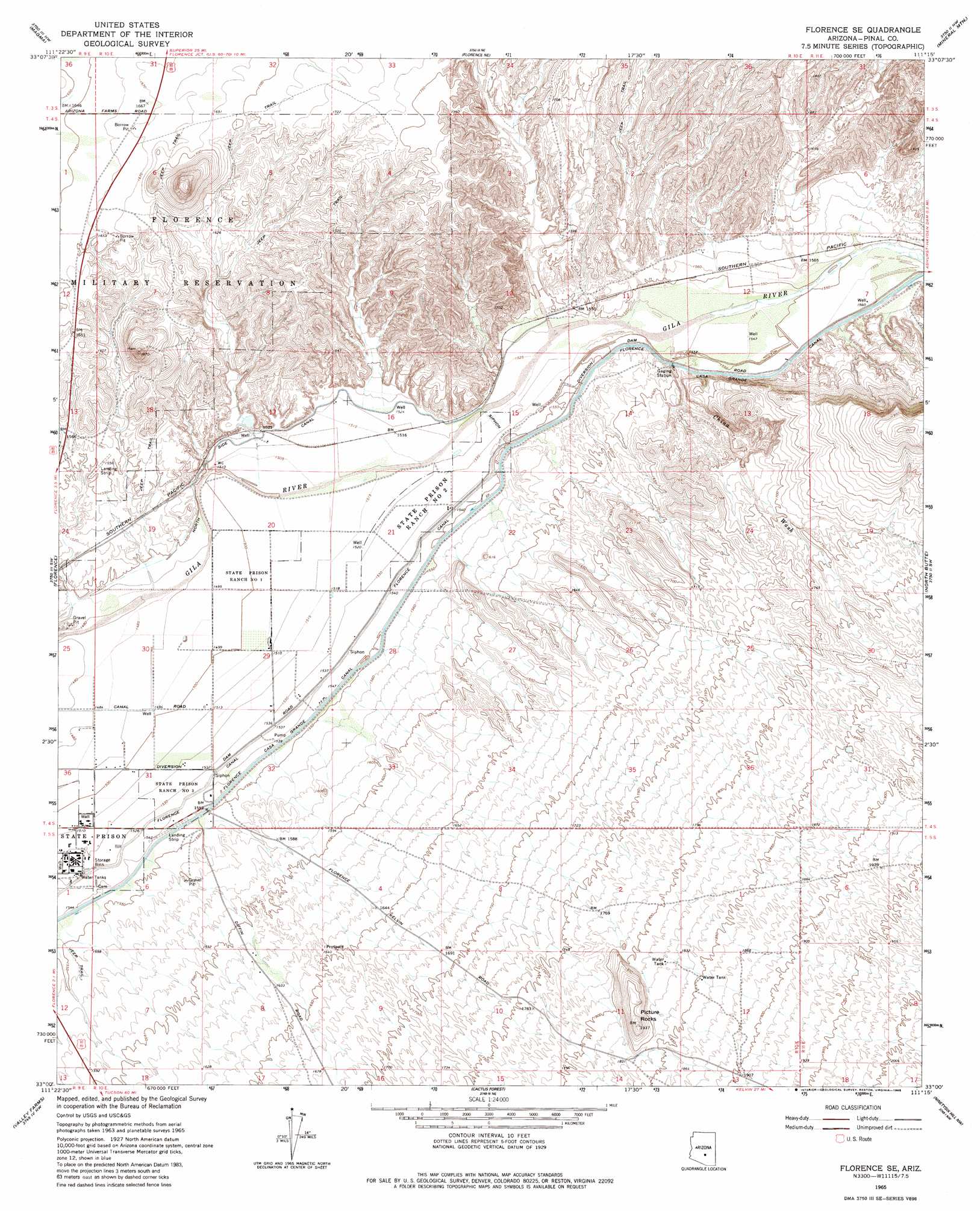
USGS Topo Quad 33111a3 - 1:24,000 scale
| Topo Map Name: | Florence Se |
| USGS Topo Quad ID: | 33111a3 |
| Print Size: | ca. 21 1/4" wide x 27" high |
| Southeast Coordinates: | 33° N latitude / 111.25° W longitude |
| Map Center Coordinates: | 33.0625° N latitude / 111.3125° W longitude |
| U.S. State: | AZ |
| Filename: | o33111a3.jpg |
| Download Map JPG Image: | Florence Se topo map 1:24,000 scale |
| Map Type: | Topographic |
| Topo Series: | 7.5´ |
| Map Scale: | 1:24,000 |
| Source of Map Images: | United States Geological Survey (USGS) |
| Alternate Map Versions: |
Florence SE AZ 1965, updated 1967 Download PDF Buy paper map Florence SE AZ 1965, updated 1985 Download PDF Buy paper map Florence SE AZ 1965, updated 1985 Download PDF Buy paper map Florence SE AZ 2011 Download PDF Buy paper map Florence SE AZ 2014 Download PDF Buy paper map |
1:24,000 Topo Quads surrounding Florence Se
Desert Well |
Superstition Mountains Sw |
Florence Junction |
Picketpost Mountain |
Superior |
Sacaton Ne |
Magma |
Florence Ne |
Mineral Mountain |
Teapot Mountain |
Blackwater |
Florence |
Florence Se |
North Butte |
Grayback |
Coolidge |
Valley Farms |
Cactus Forest |
Ninetysix Hills Nw |
Ninetysix Hills Ne |
Eloy North |
Picacho Reservoir |
Picacho Reservoir Se |
Ninetysix Hills Sw |
Ninetysix Hills Se |
> Back to 33111a1 at 1:100,000 scale
> Back to 33110a1 at 1:250,000 scale
> Back to U.S. Topo Maps home
Florence Se topo map: Gazetteer
Florence Se: Dams
Florence Diversion Dam elevation 475m 1558′Florence Se: Streams
China Wash elevation 474m 1555′Florence Se: Summits
Picture Rocks elevation 589m 1932′Florence Se digital topo map on disk
Buy this Florence Se topo map showing relief, roads, GPS coordinates and other geographical features, as a high-resolution digital map file on DVD: