Magma Topo Map Arizona
To zoom in, hover over the map of Magma
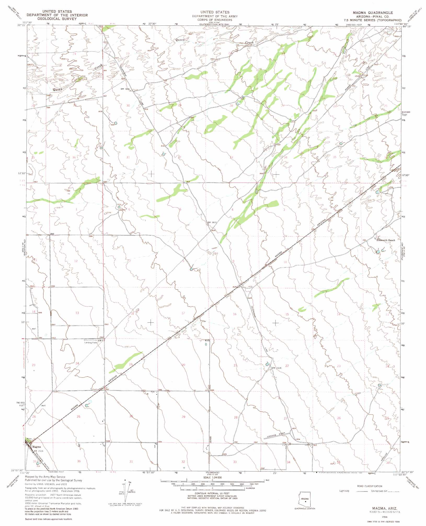
USGS Topo Quad 33111b4 - 1:24,000 scale
| Topo Map Name: | Magma |
| USGS Topo Quad ID: | 33111b4 |
| Print Size: | ca. 21 1/4" wide x 27" high |
| Southeast Coordinates: | 33.125° N latitude / 111.375° W longitude |
| Map Center Coordinates: | 33.1875° N latitude / 111.4375° W longitude |
| U.S. State: | AZ |
| Filename: | o33111b4.jpg |
| Download Map JPG Image: | Magma topo map 1:24,000 scale |
| Map Type: | Topographic |
| Topo Series: | 7.5´ |
| Map Scale: | 1:24,000 |
| Source of Map Images: | United States Geological Survey (USGS) |
| Alternate Map Versions: |
Magma AZ 1956, updated 1959 Download PDF Buy paper map Magma AZ 1956, updated 1973 Download PDF Buy paper map Magma AZ 1956, updated 1980 Download PDF Buy paper map Magma AZ 1956, updated 1980 Download PDF Buy paper map Magma AZ 2011 Download PDF Buy paper map Magma AZ 2014 Download PDF Buy paper map |
1:24,000 Topo Quads surrounding Magma
Buckhorn |
Apache Junction |
Goldfield |
Weavers Needle |
Iron Mountain |
Higley |
Desert Well |
Superstition Mountains Sw |
Florence Junction |
Picketpost Mountain |
Chandler Heights |
Sacaton Ne |
Magma |
Florence Ne |
Mineral Mountain |
Sacaton |
Blackwater |
Florence |
Florence Se |
North Butte |
Casa Crande East |
Coolidge |
Valley Farms |
Cactus Forest |
Ninetysix Hills Nw |
> Back to 33111a1 at 1:100,000 scale
> Back to 33110a1 at 1:250,000 scale
> Back to U.S. Topo Maps home
Magma topo map: Gazetteer
Magma: Arroyos
Magma Wash elevation 494m 1620′Magma: Dams
Magma Retarding Dam elevation 493m 1617′Magma: Populated Places
Magma elevation 463m 1519′Magma: Streams
Cottonwood Creek elevation 497m 1630′Magma digital topo map on disk
Buy this Magma topo map showing relief, roads, GPS coordinates and other geographical features, as a high-resolution digital map file on DVD: