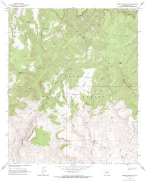
Armer Mountain Topo Map Arizona
To zoom in, hover over the map of Armer Mountain
USGS Topo Quad 33111g1 - 1:24,000 scale
| Topo Map Name: | Armer Mountain |
| USGS Topo Quad ID: | 33111g1 |
| Print Size: | ca. 21 1/4" wide x 27" high |
| Southeast Coordinates: | 33.75° N latitude / 111° W longitude |
| Map Center Coordinates: | 33.8125° N latitude / 111.0625° W longitude |
| U.S. State: | AZ |
| Filename: | o33111g1.jpg |
| Download Map JPG Image: | Armer Mountain topo map 1:24,000 scale |
| Map Type: | Topographic |
| Topo Series: | 7.5´ |
| Map Scale: | 1:24,000 |
| Source of Map Images: | United States Geological Survey (USGS) |
| Alternate Map Versions: |
Armer Mountain AZ 1964, updated 1965 Download PDF Buy paper map Armer Mountain AZ 1964, updated 1973 Download PDF Buy paper map Armer Mountain AZ 1964, updated 1973 Download PDF Buy paper map Armer Mountain AZ 2004, updated 2007 Download PDF Buy paper map Armer Mountain AZ 2011 Download PDF Buy paper map Armer Mountain AZ 2014 Download PDF Buy paper map |
| FStopo: | US Forest Service topo Armer Mountain is available: Download FStopo PDF Download FStopo TIF |
1:24,000 Topo Quads surrounding Armer Mountain
> Back to 33111e1 at 1:100,000 scale
> Back to 33110a1 at 1:250,000 scale
> Back to U.S. Topo Maps home
Armer Mountain topo map: Gazetteer
Armer Mountain: Basins
Tucker Box elevation 960m 3149′Armer Mountain: Cliffs
The Jug elevation 1026m 3366′Armer Mountain: Reservoirs
Butte Tank elevation 1260m 4133′Center Ridge Tank elevation 1146m 3759′
Dust Bowl Tank elevation 1205m 3953′
Dutchwoman Tank elevation 1218m 3996′
Lower Thompson Mesa Tank elevation 1388m 4553′
Upper Thompson Mesa Tank elevation 1427m 4681′
Whiskey Tank elevation 1097m 3599′
Armer Mountain: Ridges
Boyer Ridge elevation 1335m 4379′Armer Mountain: Springs
Cherry Creek Spring elevation 1244m 4081′Hale Spring elevation 1043m 3421′
Hopkins Spring elevation 1560m 5118′
Tin House Spring elevation 1279m 4196′
Armer Mountain: Streams
Big Cherry Creek elevation 1007m 3303′Cellar Creek elevation 929m 3047′
Little Cherry Creek elevation 1147m 3763′
Reynolds Creek elevation 1442m 4730′
Armer Mountain: Summits
Armer Mountain elevation 2223m 7293′Chubb Mountain elevation 1753m 5751′
Dutchwoman Butte elevation 1524m 5000′
Hopkins Mountain elevation 1989m 6525′
Round Mountain elevation 1098m 3602′
Tanner Peak elevation 2106m 6909′
Thompson Mesa elevation 1440m 4724′
Armer Mountain: Trails
Boyer Trail One Hundred Fortyeight elevation 1862m 6108′Armer Mountain: Valleys
Boyer Canyon elevation 937m 3074′Connor Canyon elevation 1028m 3372′
Armer Mountain digital topo map on disk
Buy this Armer Mountain topo map showing relief, roads, GPS coordinates and other geographical features, as a high-resolution digital map file on DVD:


