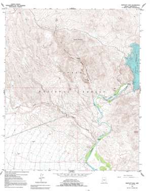
Bartlett Dam Topo Map Arizona
To zoom in, hover over the map of Bartlett Dam
USGS Topo Quad 33111g6 - 1:24,000 scale
| Topo Map Name: | Bartlett Dam |
| USGS Topo Quad ID: | 33111g6 |
| Print Size: | ca. 21 1/4" wide x 27" high |
| Southeast Coordinates: | 33.75° N latitude / 111.625° W longitude |
| Map Center Coordinates: | 33.8125° N latitude / 111.6875° W longitude |
| U.S. State: | AZ |
| Filename: | o33111g6.jpg |
| Download Map JPG Image: | Bartlett Dam topo map 1:24,000 scale |
| Map Type: | Topographic |
| Topo Series: | 7.5´ |
| Map Scale: | 1:24,000 |
| Source of Map Images: | United States Geological Survey (USGS) |
| Alternate Map Versions: |
Bartlett Dam AZ 1964, updated 1965 Download PDF Buy paper map Bartlett Dam AZ 1964, updated 1970 Download PDF Buy paper map Bartlett Dam AZ 1964, updated 1992 Download PDF Buy paper map Bartlett Dam AZ 2004, updated 2007 Download PDF Buy paper map Bartlett Dam AZ 2011 Download PDF Buy paper map Bartlett Dam AZ 2014 Download PDF Buy paper map |
| FStopo: | US Forest Service topo Bartlett Dam is available: Download FStopo PDF Download FStopo TIF |
1:24,000 Topo Quads surrounding Bartlett Dam
> Back to 33111e1 at 1:100,000 scale
> Back to 33110a1 at 1:250,000 scale
> Back to U.S. Topo Maps home
Bartlett Dam topo map: Gazetteer
Bartlett Dam: Airports
Bartlett Dam Heliport elevation 490m 1607′Bartlett Dam: Bays
Rattlesnake Cove elevation 533m 1748′South Cove elevation 536m 1758′
Bartlett Dam: Dams
Bartlett Dam elevation 533m 1748′Bartlett Dam: Reservoirs
Bartlett Reservoir elevation 533m 1748′Buckhorn Tank elevation 639m 2096′
Model A Tank elevation 659m 2162′
Bartlett Dam: Streams
Camp Creek elevation 465m 1525′Indian Spring Wash elevation 479m 1571′
Bartlett Dam: Summits
Bee Mountain elevation 880m 2887′Brushy Mountain elevation 1072m 3517′
Needle Rock elevation 484m 1587′
Bartlett Dam: Valleys
Bootleg Canyon elevation 485m 1591′Bartlett Dam digital topo map on disk
Buy this Bartlett Dam topo map showing relief, roads, GPS coordinates and other geographical features, as a high-resolution digital map file on DVD:


