Cotton Center Se Topo Map Arizona
To zoom in, hover over the map of Cotton Center Se
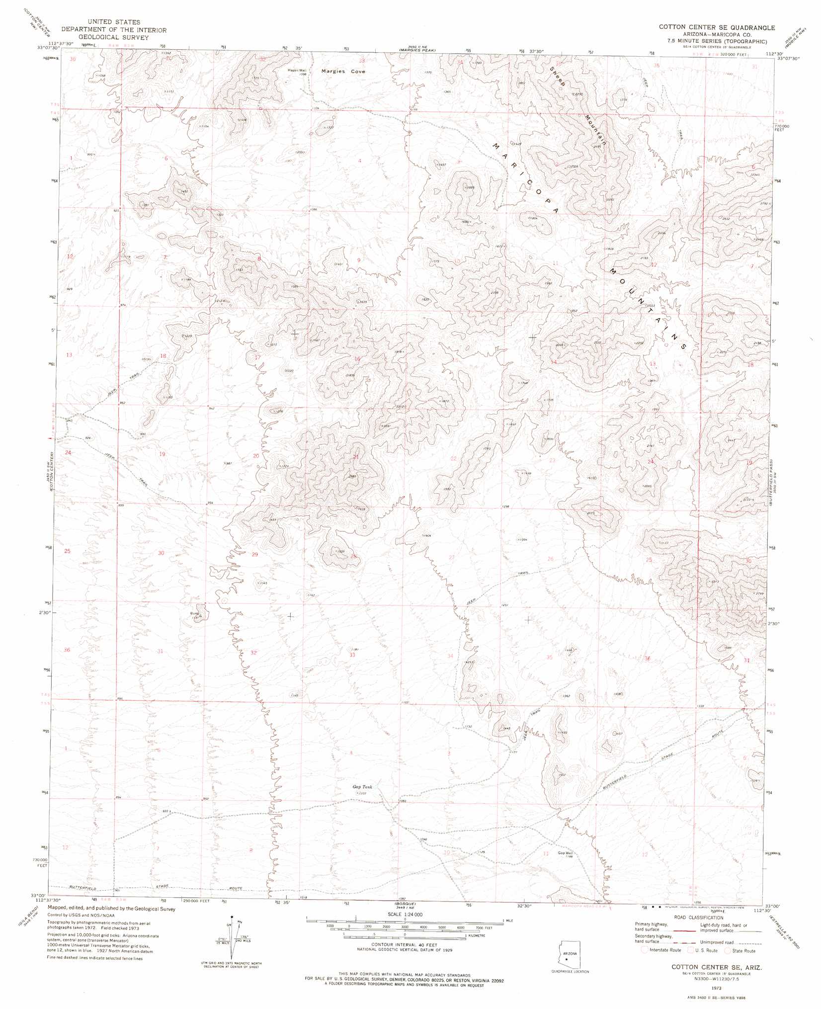
USGS Topo Quad 33112a5 - 1:24,000 scale
| Topo Map Name: | Cotton Center Se |
| USGS Topo Quad ID: | 33112a5 |
| Print Size: | ca. 21 1/4" wide x 27" high |
| Southeast Coordinates: | 33° N latitude / 112.5° W longitude |
| Map Center Coordinates: | 33.0625° N latitude / 112.5625° W longitude |
| U.S. State: | AZ |
| Filename: | o33112a5.jpg |
| Download Map JPG Image: | Cotton Center Se topo map 1:24,000 scale |
| Map Type: | Topographic |
| Topo Series: | 7.5´ |
| Map Scale: | 1:24,000 |
| Source of Map Images: | United States Geological Survey (USGS) |
| Alternate Map Versions: |
Cotton Center SE AZ 1973, updated 1976 Download PDF Buy paper map Cotton Center SE AZ 2011 Download PDF Buy paper map Cotton Center SE AZ 2014 Download PDF Buy paper map |
1:24,000 Topo Quads surrounding Cotton Center Se
Arlington |
Hassayampa |
Buckeye |
Avondale Sw |
Avondale Se |
Spring Mountain |
Cotton Center Nw |
Margies Peak |
Mobile Nw |
Mobile Ne |
Citrus Valley East |
Cotton Center |
Cotton Center Se |
Butterfield Pass |
Mobile |
Smurr |
Gila Bend |
Bosque |
Estrella |
Conley Well |
Black Gap |
South Of Gila Bend |
Blue Plateau |
Big Horn |
Lost Horse Peak |
> Back to 33112a1 at 1:100,000 scale
> Back to 33112a1 at 1:250,000 scale
> Back to U.S. Topo Maps home
Cotton Center Se topo map: Gazetteer
Cotton Center Se: Reservoirs
Fortymile Desert Tank elevation 438m 1437′Gap Tank elevation 326m 1069′
Cotton Center Se: Summits
Sheep Mountain elevation 0m 0′Cotton Center Se: Trails
Butterfield Stage Route (historical) elevation 290m 951′Cotton Center Se: Valleys
Margies Cove elevation 344m 1128′Cotton Center Se: Wells
Hazen Well elevation 338m 1108′Cotton Center Se digital topo map on disk
Buy this Cotton Center Se topo map showing relief, roads, GPS coordinates and other geographical features, as a high-resolution digital map file on DVD: