Avondale Se Topo Map Arizona
To zoom in, hover over the map of Avondale Se
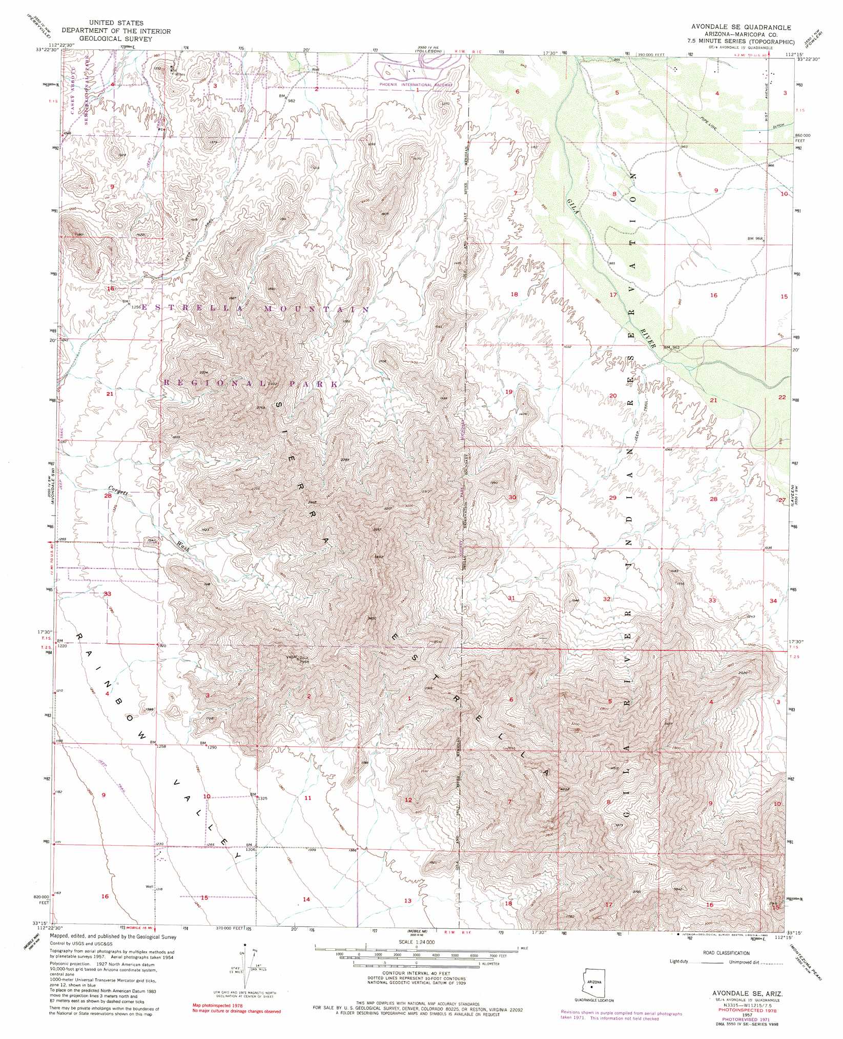
USGS Topo Quad 33112c3 - 1:24,000 scale
| Topo Map Name: | Avondale Se |
| USGS Topo Quad ID: | 33112c3 |
| Print Size: | ca. 21 1/4" wide x 27" high |
| Southeast Coordinates: | 33.25° N latitude / 112.25° W longitude |
| Map Center Coordinates: | 33.3125° N latitude / 112.3125° W longitude |
| U.S. State: | AZ |
| Filename: | o33112c3.jpg |
| Download Map JPG Image: | Avondale Se topo map 1:24,000 scale |
| Map Type: | Topographic |
| Topo Series: | 7.5´ |
| Map Scale: | 1:24,000 |
| Source of Map Images: | United States Geological Survey (USGS) |
| Alternate Map Versions: |
Avondale SE AZ 1957, updated 1958 Download PDF Buy paper map Avondale SE AZ 1957, updated 1962 Download PDF Buy paper map Avondale SE AZ 1957, updated 1972 Download PDF Buy paper map Avondale SE AZ 1957, updated 1983 Download PDF Buy paper map Avondale SE AZ 1971, updated 1972 Download PDF Buy paper map Avondale SE AZ 2011 Download PDF Buy paper map Avondale SE AZ 2014 Download PDF Buy paper map |
1:24,000 Topo Quads surrounding Avondale Se
White Tank Mountains |
Waddell |
El Mirage |
Glendale |
Sunnyslope |
Valencia |
Perryville |
Tolleson |
Fowler |
Phoenix |
Buckeye |
Avondale Sw |
Avondale Se |
Laveen |
Lone Butte |
Margies Peak |
Mobile Nw |
Mobile Ne |
Montezuma Peak |
Pima Butte |
Cotton Center Se |
Butterfield Pass |
Mobile |
Enid |
Maricopa |
> Back to 33112a1 at 1:100,000 scale
> Back to 33112a1 at 1:250,000 scale
> Back to U.S. Topo Maps home
Avondale Se topo map: Gazetteer
Avondale Se: Parks
Estrella Mountain Regional Park elevation 741m 2431′Avondale Se digital topo map on disk
Buy this Avondale Se topo map showing relief, roads, GPS coordinates and other geographical features, as a high-resolution digital map file on DVD: