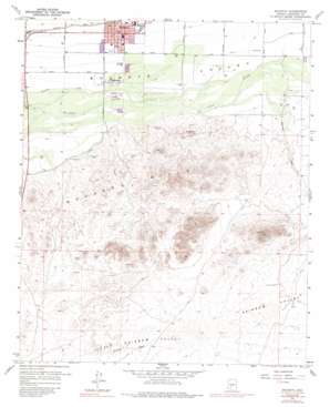
Buckeye Topo Map Arizona
To zoom in, hover over the map of Buckeye
USGS Topo Quad 33112c5 - 1:24,000 scale
| Topo Map Name: | Buckeye |
| USGS Topo Quad ID: | 33112c5 |
| Print Size: | ca. 21 1/4" wide x 27" high |
| Southeast Coordinates: | 33.25° N latitude / 112.5° W longitude |
| Map Center Coordinates: | 33.3125° N latitude / 112.5625° W longitude |
| U.S. State: | AZ |
| Filename: | o33112c5.jpg |
| Download Map JPG Image: | Buckeye topo map 1:24,000 scale |
| Map Type: | Topographic |
| Topo Series: | 7.5´ |
| Map Scale: | 1:24,000 |
| Source of Map Images: | United States Geological Survey (USGS) |
| Alternate Map Versions: |
Buckeye AZ 1958, updated 1959 Download PDF Buy paper map Buckeye AZ 1958, updated 1964 Download PDF Buy paper map Buckeye AZ 1958, updated 1972 Download PDF Buy paper map Buckeye AZ 1958, updated 1988 Download PDF Buy paper map Buckeye AZ 2011 Download PDF Buy paper map Buckeye AZ 2014 Download PDF Buy paper map |
1:24,000 Topo Quads surrounding Buckeye
> Back to 33112a1 at 1:100,000 scale
> Back to 33112a1 at 1:250,000 scale
> Back to U.S. Topo Maps home
Buckeye topo map: Gazetteer
Buckeye: Airports
Pierce Airport elevation 264m 866′Buckeye: Parks
Buckeye Sports Field elevation 261m 856′Buckeye Town Park elevation 266m 872′
Buckeye: Populated Places
Allenville elevation 255m 836′Buckeye elevation 265m 869′
Buckeye: Post Offices
Buckeye Post Office elevation 265m 869′Buckeye: Streams
Waterman Wash elevation 257m 843′Buckeye: Summits
Eagle Mountain elevation 322m 1056′Buckeye: Valleys
Rainbow Valley elevation 327m 1072′Buckeye digital topo map on disk
Buy this Buckeye topo map showing relief, roads, GPS coordinates and other geographical features, as a high-resolution digital map file on DVD:


