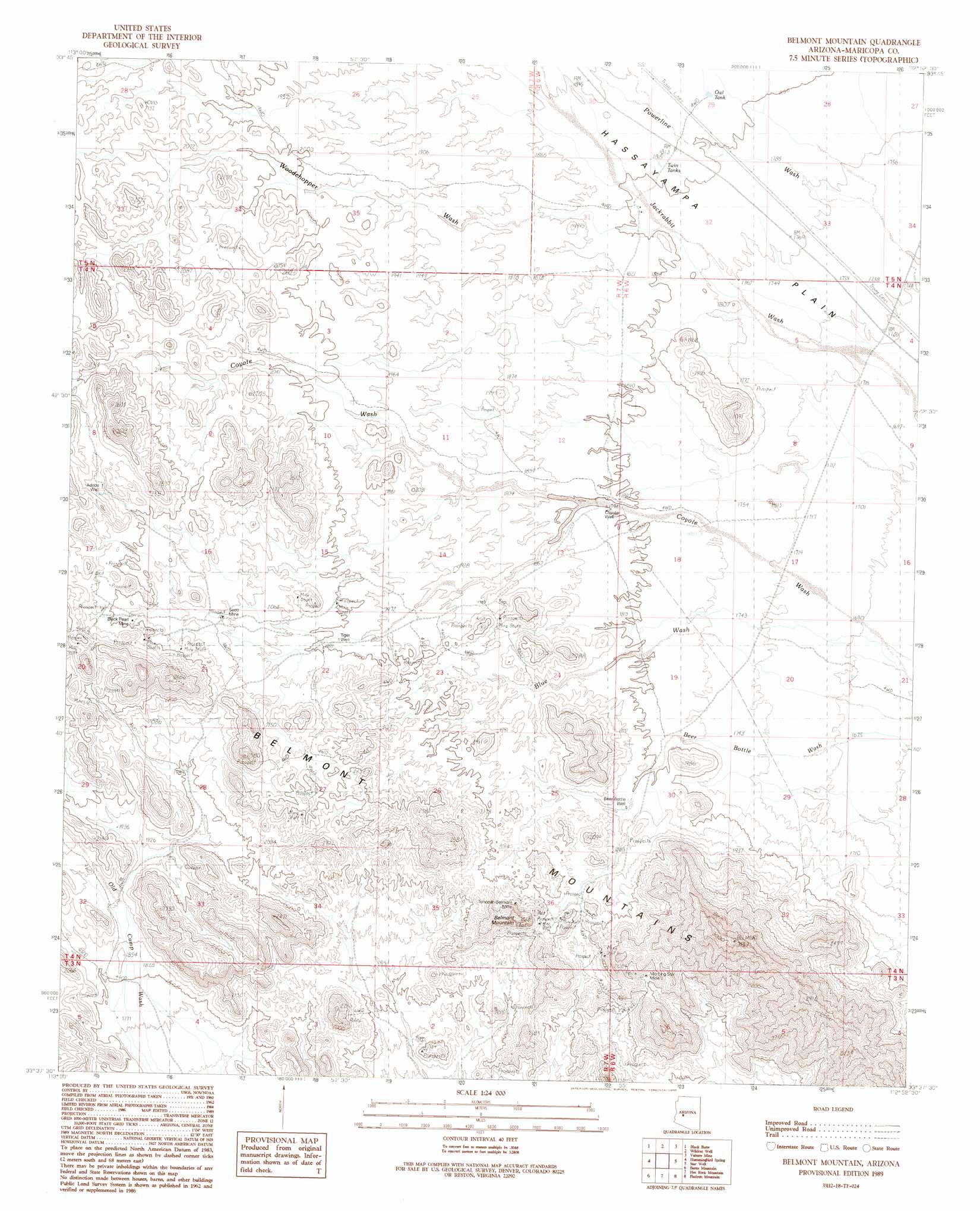
Belmont Mountain Topo Map Arizona
To zoom in, hover over the map of Belmont Mountain
USGS Topo Quad 33112f8 - 1:24,000 scale
| Topo Map Name: | Belmont Mountain |
| USGS Topo Quad ID: | 33112f8 |
| Print Size: | ca. 21 1/4" wide x 27" high |
| Southeast Coordinates: | 33.625° N latitude / 112.875° W longitude |
| Map Center Coordinates: | 33.6875° N latitude / 112.9375° W longitude |
| U.S. State: | AZ |
| Filename: | o33112f8.jpg |
| Download Map JPG Image: | Belmont Mountain topo map 1:24,000 scale |
| Map Type: | Topographic |
| Topo Series: | 7.5´ |
| Map Scale: | 1:24,000 |
| Source of Map Images: | United States Geological Survey (USGS) |
| Alternate Map Versions: |
Belmont Mountain AZ 1989, updated 1990 Download PDF Buy paper map Belmont Mountain AZ 2011 Download PDF Buy paper map Belmont Mountain AZ 2014 Download PDF Buy paper map |
1:24,000 Topo Quads surrounding Belmont Mountain
Aguila |
Forepaugh Peak |
Outlaw Hill |
Vulture Peak |
Wickenburg |
Tiger Well |
Black Butte |
Wildcat Well |
Vulture Mine |
Wickenburg Sw |
Little Horn Peak |
Hummingbird Spring |
Belmont Mountain |
Star Well |
Daggs Tank |
Big Horn Peak |
Burnt Mountain |
Hot Rock Mountain |
Flatiron Mountain |
Wagner Wash Well |
Cortez Peak Nw |
Saddle Mountain |
Tonopah |
Wintersburg |
Buckeye Nw |
> Back to 33112e1 at 1:100,000 scale
> Back to 33112a1 at 1:250,000 scale
> Back to U.S. Topo Maps home
Belmont Mountain topo map: Gazetteer
Belmont Mountain: Mines
Black Pearl Mine elevation 673m 2208′General Grant Mine elevation 632m 2073′
Morning Star Mine elevation 634m 2080′
Scott Mine elevation 0m 0′
Tonopah-Belmont Mine elevation 621m 2037′
Belmont Mountain: Ranges
Belmont Mountains elevation 931m 3054′Belmont Mountain: Reservoirs
Owl Tank elevation 554m 1817′Twin Tanks elevation 551m 1807′
Belmont Mountain: Streams
Woodchopper Wash elevation 547m 1794′Belmont Mountain: Summits
Belmont Mountain elevation 757m 2483′Belmont Mountain: Wells
Adobe Well elevation 682m 2237′Beer Bottle Well elevation 558m 1830′
Coyote Well elevation 550m 1804′
Tiger Well elevation 604m 1981′
Belmont Mountain digital topo map on disk
Buy this Belmont Mountain topo map showing relief, roads, GPS coordinates and other geographical features, as a high-resolution digital map file on DVD: