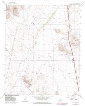
Biscuit Flat Topo Map Arizona
To zoom in, hover over the map of Biscuit Flat
USGS Topo Quad 33112g2 - 1:24,000 scale
| Topo Map Name: | Biscuit Flat |
| USGS Topo Quad ID: | 33112g2 |
| Print Size: | ca. 21 1/4" wide x 27" high |
| Southeast Coordinates: | 33.75° N latitude / 112.125° W longitude |
| Map Center Coordinates: | 33.8125° N latitude / 112.1875° W longitude |
| U.S. State: | AZ |
| Filename: | o33112g2.jpg |
| Download Map JPG Image: | Biscuit Flat topo map 1:24,000 scale |
| Map Type: | Topographic |
| Topo Series: | 7.5´ |
| Map Scale: | 1:24,000 |
| Source of Map Images: | United States Geological Survey (USGS) |
| Alternate Map Versions: |
Biscuit Flat AZ 1965, updated 1966 Download PDF Buy paper map Biscuit Flat AZ 1965, updated 1975 Download PDF Buy paper map Biscuit Flat AZ 1965, updated 1982 Download PDF Buy paper map Biscuit Flat AZ 2011 Download PDF Buy paper map Biscuit Flat AZ 2014 Download PDF Buy paper map |
1:24,000 Topo Quads surrounding Biscuit Flat
> Back to 33112e1 at 1:100,000 scale
> Back to 33112a1 at 1:250,000 scale
> Back to U.S. Topo Maps home
Biscuit Flat topo map: Gazetteer
Biscuit Flat: Crossings
Desert Hills Interchange elevation 578m 1896′Pioneer Interchange elevation 537m 1761′
Biscuit Flat: Flats
Biscuit Flat elevation 486m 1594′Biscuit Flat: Parks
Black Canyon Shooting Range elevation 501m 1643′Biscuit Flat: Populated Places
Anthem elevation 568m 1863′Biscuit Flat: Reservoirs
Aso Tank elevation 469m 1538′Biscuit Tank elevation 508m 1666′
Bobs Tank elevation 467m 1532′
CF Tank elevation 519m 1702′
Cline Tank elevation 545m 1788′
Escondido Tank elevation 492m 1614′
Flat Tank elevation 511m 1676′
Gibson Tank elevation 480m 1574′
Maricopa Tank elevation 462m 1515′
Middle Tanks elevation 467m 1532′
Milky Way Tank elevation 483m 1584′
New River Tank elevation 510m 1673′
Palo Verde Tank elevation 506m 1660′
Pepe Tank elevation 485m 1591′
Purcell Tank elevation 533m 1748′
Saguaro Tank elevation 0m 0′
Snodgrass Tank elevation 455m 1492′
Biscuit Flat: Streams
Deadman Wash elevation 449m 1473′Biscuit Flat: Summits
Black Mountain elevation 759m 2490′Mount Ochoa elevation 557m 1827′
Biscuit Flat digital topo map on disk
Buy this Biscuit Flat topo map showing relief, roads, GPS coordinates and other geographical features, as a high-resolution digital map file on DVD:


