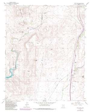
New River Topo Map Arizona
To zoom in, hover over the map of New River
USGS Topo Quad 33112h2 - 1:24,000 scale
| Topo Map Name: | New River |
| USGS Topo Quad ID: | 33112h2 |
| Print Size: | ca. 21 1/4" wide x 27" high |
| Southeast Coordinates: | 33.875° N latitude / 112.125° W longitude |
| Map Center Coordinates: | 33.9375° N latitude / 112.1875° W longitude |
| U.S. State: | AZ |
| Filename: | o33112h2.jpg |
| Download Map JPG Image: | New River topo map 1:24,000 scale |
| Map Type: | Topographic |
| Topo Series: | 7.5´ |
| Map Scale: | 1:24,000 |
| Source of Map Images: | United States Geological Survey (USGS) |
| Alternate Map Versions: |
New River AZ 1964, updated 1965 Download PDF Buy paper map New River AZ 1964, updated 1972 Download PDF Buy paper map New River AZ 1964, updated 1982 Download PDF Buy paper map New River AZ 1964, updated 1986 Download PDF Buy paper map New River AZ 1964, updated 1986 Download PDF Buy paper map New River AZ 2011 Download PDF Buy paper map New River AZ 2014 Download PDF Buy paper map |
1:24,000 Topo Quads surrounding New River
> Back to 33112e1 at 1:100,000 scale
> Back to 33112a1 at 1:250,000 scale
> Back to U.S. Topo Maps home
New River topo map: Gazetteer
New River: Cliffs
White Bluffs elevation 523m 1715′New River: Crossings
New River Interchange elevation 631m 2070′Table Mesa Interchange elevation 692m 2270′
New River: Mines
Bonnie Bell Mine elevation 642m 2106′New River: Populated Places
New River elevation 614m 2014′New River: Springs
Sweat Spring elevation 626m 2053′Whiskey Spring elevation 575m 1886′
New River: Streams
Boulder Creek elevation 518m 1699′Tule Creek elevation 500m 1640′
New River: Summits
Doe Peak elevation 802m 2631′Dutch Butte elevation 989m 3244′
Indian Mesa elevation 694m 2276′
Sweat Peak elevation 858m 2814′
Wild Burro Mesa elevation 851m 2791′
New River: Trails
Mazatzal Divide 23 elevation 576m 1889′New River: Valleys
Sweat Canyon elevation 586m 1922′New River digital topo map on disk
Buy this New River topo map showing relief, roads, GPS coordinates and other geographical features, as a high-resolution digital map file on DVD:


