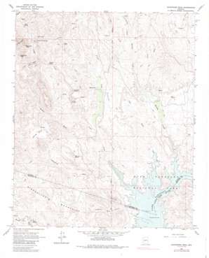
Governors Peak Topo Map Arizona
To zoom in, hover over the map of Governors Peak
USGS Topo Quad 33112h3 - 1:24,000 scale
| Topo Map Name: | Governors Peak |
| USGS Topo Quad ID: | 33112h3 |
| Print Size: | ca. 21 1/4" wide x 27" high |
| Southeast Coordinates: | 33.875° N latitude / 112.25° W longitude |
| Map Center Coordinates: | 33.9375° N latitude / 112.3125° W longitude |
| U.S. State: | AZ |
| Filename: | o33112h3.jpg |
| Download Map JPG Image: | Governors Peak topo map 1:24,000 scale |
| Map Type: | Topographic |
| Topo Series: | 7.5´ |
| Map Scale: | 1:24,000 |
| Source of Map Images: | United States Geological Survey (USGS) |
| Alternate Map Versions: |
Governors Peak AZ 1964, updated 1965 Download PDF Buy paper map Governors Peak AZ 1964, updated 1965 Download PDF Buy paper map Governors Peak AZ 1964, updated 1973 Download PDF Buy paper map Governors Peak AZ 1964, updated 1986 Download PDF Buy paper map Governors Peak AZ 1964, updated 1986 Download PDF Buy paper map Governors Peak AZ 2011 Download PDF Buy paper map Governors Peak AZ 2014 Download PDF Buy paper map |
1:24,000 Topo Quads surrounding Governors Peak
> Back to 33112e1 at 1:100,000 scale
> Back to 33112a1 at 1:250,000 scale
> Back to U.S. Topo Maps home
Governors Peak topo map: Gazetteer
Governors Peak: Flats
Squaw Mesa elevation 600m 1968′Governors Peak: Parks
Lake Pleasant Regional Park elevation 562m 1843′Governors Peak: Populated Places
Casa Rosa elevation 554m 1817′Castle Hot Springs elevation 616m 2020′
Governors Peak: Springs
Alkali Spring elevation 623m 2043′Dripping Spring elevation 554m 1817′
Hot Spring elevation 653m 2142′
Mitchell Spring elevation 551m 1807′
Mud Spring elevation 549m 1801′
Solo Spring elevation 538m 1765′
Tule Spring elevation 608m 1994′
Governors Peak: Streams
Bitter Creek elevation 606m 1988′Castle Creek elevation 478m 1568′
Coles Wash elevation 478m 1568′
Cottonwood Creek elevation 481m 1578′
Cottonwood Creek elevation 576m 1889′
Cow Creek elevation 564m 1850′
Dry Wash elevation 549m 1801′
French Creek elevation 507m 1663′
Garfias Wash elevation 516m 1692′
Humbug Creek elevation 478m 1568′
Governors Peak: Summits
Governors Peak elevation 982m 3221′Salvation Peak elevation 0m 0′
Governors Peak: Valleys
Crater Canyon elevation 607m 1991′Four Tanks Canyon elevation 600m 1968′
Pipeline Canyon elevation 489m 1604′
Rich Gulch elevation 552m 1811′
Spring Valley elevation 640m 2099′
Governors Peak digital topo map on disk
Buy this Governors Peak topo map showing relief, roads, GPS coordinates and other geographical features, as a high-resolution digital map file on DVD:


