Baragan Mountain Topo Map Arizona
To zoom in, hover over the map of Baragan Mountain
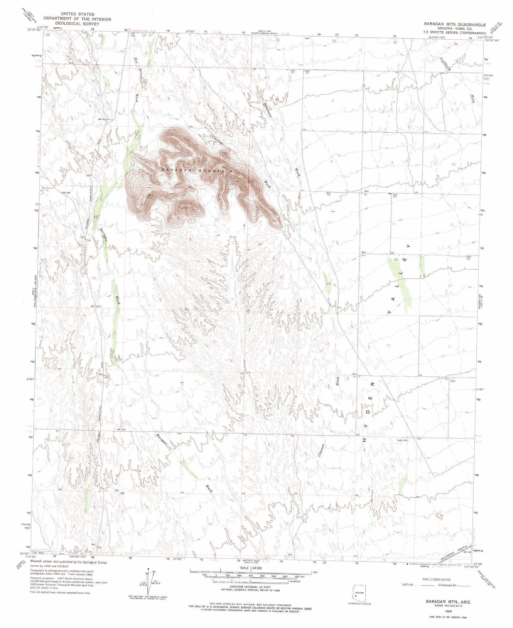
USGS Topo Quad 33113a4 - 1:24,000 scale
| Topo Map Name: | Baragan Mountain |
| USGS Topo Quad ID: | 33113a4 |
| Print Size: | ca. 21 1/4" wide x 27" high |
| Southeast Coordinates: | 33° N latitude / 113.375° W longitude |
| Map Center Coordinates: | 33.0625° N latitude / 113.4375° W longitude |
| U.S. State: | AZ |
| Filename: | o33113a4.jpg |
| Download Map JPG Image: | Baragan Mountain topo map 1:24,000 scale |
| Map Type: | Topographic |
| Topo Series: | 7.5´ |
| Map Scale: | 1:24,000 |
| Source of Map Images: | United States Geological Survey (USGS) |
| Alternate Map Versions: |
Baragan Mtn AZ 1965, updated 1966 Download PDF Buy paper map Baragan Mtn AZ 1965, updated 1978 Download PDF Buy paper map Baragan Mountain AZ 2011 Download PDF Buy paper map Baragan Mountain AZ 2014 Download PDF Buy paper map |
1:24,000 Topo Quads surrounding Baragan Mountain
Cementosa Wash |
Little Horn Mountains Se |
Nottbusch Butte |
Columbus Peak |
Cortez Peak |
Palomas Mountains Nw |
Palomas Mountains Ne |
Turtleback Mountain |
Hyder Ne |
Yellow Medicine Butte |
Palomas Mountains Sw |
Palomas Mountains Se |
Baragan Mountain |
Hyder |
Oatman Mountain |
Kofa |
Horn |
Aztec Nw |
Agua Caliente |
Sentinel Peak |
Texas Hill |
Dateland |
Aztec Hills |
Aztec Se |
Sentinel |
> Back to 33113a1 at 1:100,000 scale
> Back to 33112a1 at 1:250,000 scale
> Back to U.S. Topo Maps home
Baragan Mountain topo map: Gazetteer
Baragan Mountain: Streams
Deadman Wash elevation 211m 692′Red Raven Wash elevation 223m 731′
Baragan Mountain: Summits
Baragan Mountain elevation 384m 1259′Baragan Mountain: Valleys
Stone Cabin Gap Wash elevation 226m 741′Baragan Mountain: Wells
Hall Well elevation 175m 574′Hyder Well elevation 177m 580′
Baragan Mountain digital topo map on disk
Buy this Baragan Mountain topo map showing relief, roads, GPS coordinates and other geographical features, as a high-resolution digital map file on DVD: