Palomas Mountains Sw Topo Map Arizona
To zoom in, hover over the map of Palomas Mountains Sw
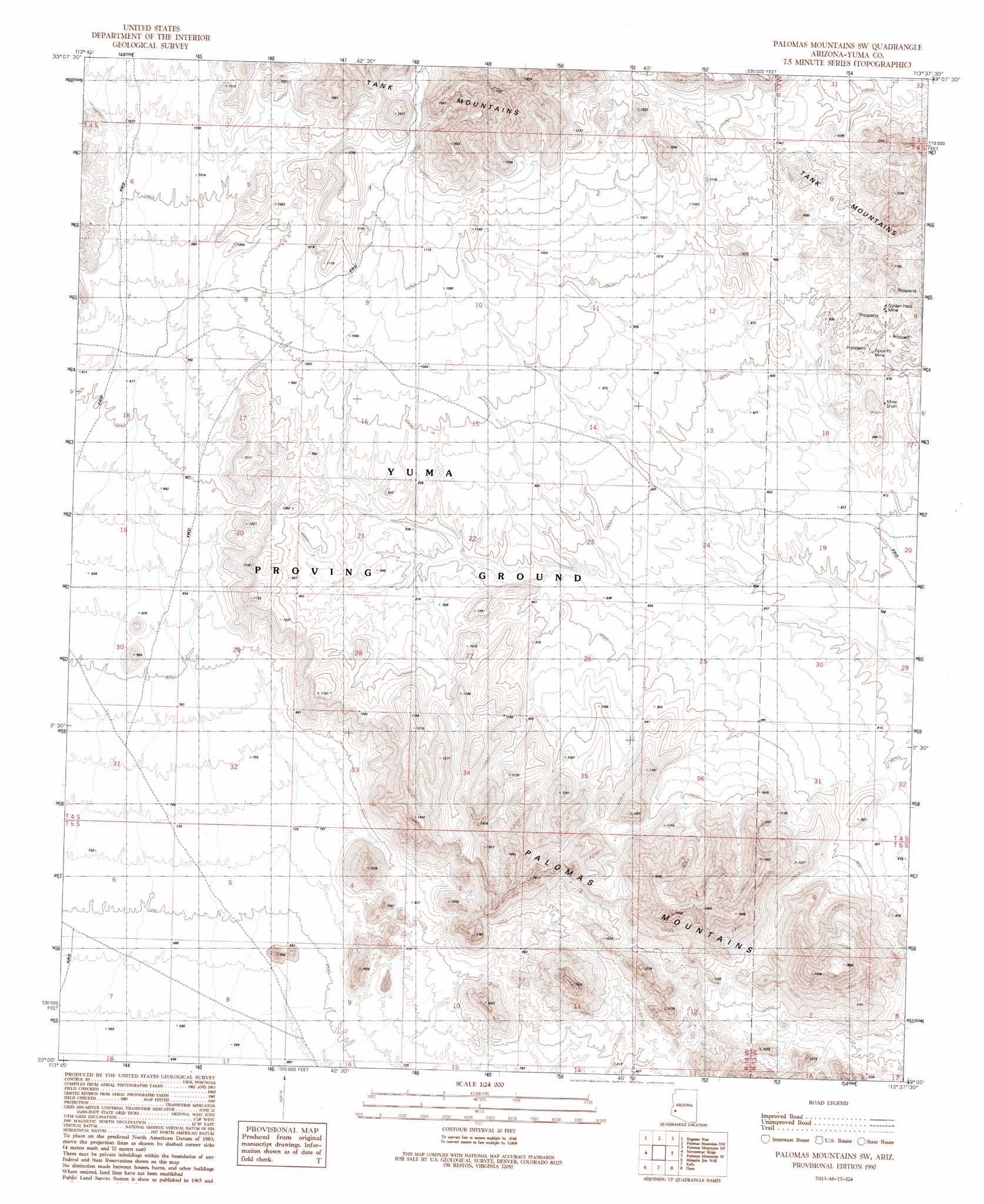
USGS Topo Quad 33113a6 - 1:24,000 scale
| Topo Map Name: | Palomas Mountains Sw |
| USGS Topo Quad ID: | 33113a6 |
| Print Size: | ca. 21 1/4" wide x 27" high |
| Southeast Coordinates: | 33° N latitude / 113.625° W longitude |
| Map Center Coordinates: | 33.0625° N latitude / 113.6875° W longitude |
| U.S. State: | AZ |
| Filename: | o33113a6.jpg |
| Download Map JPG Image: | Palomas Mountains Sw topo map 1:24,000 scale |
| Map Type: | Topographic |
| Topo Series: | 7.5´ |
| Map Scale: | 1:24,000 |
| Source of Map Images: | United States Geological Survey (USGS) |
| Alternate Map Versions: |
Palomas Mountains SW AZ 1990, updated 1990 Download PDF Buy paper map Palomas Mountains SW AZ 2011 Download PDF Buy paper map Palomas Mountains SW AZ 2014 Download PDF Buy paper map |
1:24,000 Topo Quads surrounding Palomas Mountains Sw
Kofa Butte |
Hoodoo Well |
Cementosa Wash |
Little Horn Mountains Se |
Nottbusch Butte |
Charlie Died Tank |
Engesser Pass |
Palomas Mountains Nw |
Palomas Mountains Ne |
Turtleback Mountain |
Engesser Pass Sw |
Neversweat Ridge |
Palomas Mountains Sw |
Palomas Mountains Se |
Baragan Mountain |
North Of Roll |
Mesquite Jim Well |
Kofa |
Horn |
Aztec Nw |
Roll |
Growler |
Texas Hill |
Dateland |
Aztec Hills |
> Back to 33113a1 at 1:100,000 scale
> Back to 33112a1 at 1:250,000 scale
> Back to U.S. Topo Maps home
Palomas Mountains Sw topo map: Gazetteer
Palomas Mountains Sw: Mines
Coyote Mine elevation 241m 790′Golden Harp Mine elevation 282m 925′
Palomas Mountains Sw: Ranges
Palomas Mountains elevation 575m 1886′Palomas Mountains Sw digital topo map on disk
Buy this Palomas Mountains Sw topo map showing relief, roads, GPS coordinates and other geographical features, as a high-resolution digital map file on DVD: