Cementosa Wash Topo Map Arizona
To zoom in, hover over the map of Cementosa Wash
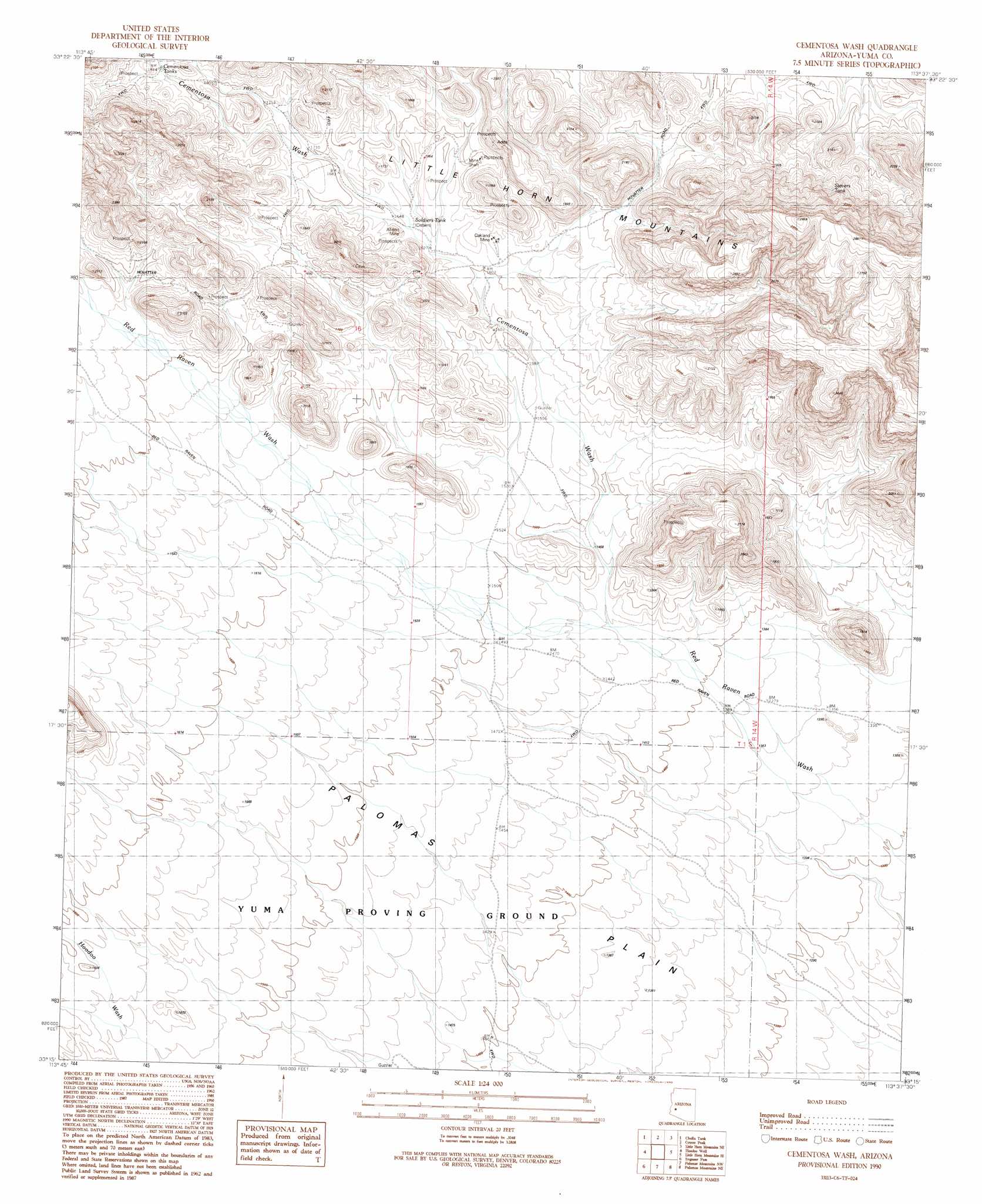
USGS Topo Quad 33113c6 - 1:24,000 scale
| Topo Map Name: | Cementosa Wash |
| USGS Topo Quad ID: | 33113c6 |
| Print Size: | ca. 21 1/4" wide x 27" high |
| Southeast Coordinates: | 33.25° N latitude / 113.625° W longitude |
| Map Center Coordinates: | 33.3125° N latitude / 113.6875° W longitude |
| U.S. State: | AZ |
| Filename: | o33113c6.jpg |
| Download Map JPG Image: | Cementosa Wash topo map 1:24,000 scale |
| Map Type: | Topographic |
| Topo Series: | 7.5´ |
| Map Scale: | 1:24,000 |
| Source of Map Images: | United States Geological Survey (USGS) |
| Alternate Map Versions: |
Cementosa Wash AZ 1990, updated 1990 Download PDF Buy paper map Cementosa Wash AZ 2011 Download PDF Buy paper map Cementosa Wash AZ 2014 Download PDF Buy paper map |
1:24,000 Topo Quads surrounding Cementosa Wash
New Water Mountains |
New Water Well |
Hope Sw |
Hope Se |
Lone Mountain |
Owl Head |
Cholla Tank |
Coyote Peak |
Little Horn Mountains Ne |
Eagletail Mountains West |
Kofa Butte |
Hoodoo Well |
Cementosa Wash |
Little Horn Mountains Se |
Nottbusch Butte |
Charlie Died Tank |
Engesser Pass |
Palomas Mountains Nw |
Palomas Mountains Ne |
Turtleback Mountain |
Engesser Pass Sw |
Neversweat Ridge |
Palomas Mountains Sw |
Palomas Mountains Se |
Baragan Mountain |
> Back to 33113a1 at 1:100,000 scale
> Back to 33112a1 at 1:250,000 scale
> Back to U.S. Topo Maps home
Cementosa Wash topo map: Gazetteer
Cementosa Wash: Arches
Conflagration Arch elevation 598m 1961′Cementosa Wash: Mines
Allison Mine elevation 553m 1814′Oakland Mine elevation 500m 1640′
Cementosa Wash: Parks
Virgin Peak elevation 800m 2624′Cementosa Wash: Plains
Palomas Plain elevation 421m 1381′Cementosa Wash: Reservoirs
Cementosa Tanks elevation 560m 1837′Sheep Tank elevation 552m 1811′
Soldiers Tank elevation 497m 1630′
Cementosa Wash: Streams
Cementosa Wash elevation 443m 1453′Cementosa Wash: Summits
Little Horn Mountains elevation 605m 1984′Cementosa Wash digital topo map on disk
Buy this Cementosa Wash topo map showing relief, roads, GPS coordinates and other geographical features, as a high-resolution digital map file on DVD: