Eagletail Mountains East Topo Map Arizona
To zoom in, hover over the map of Eagletail Mountains East
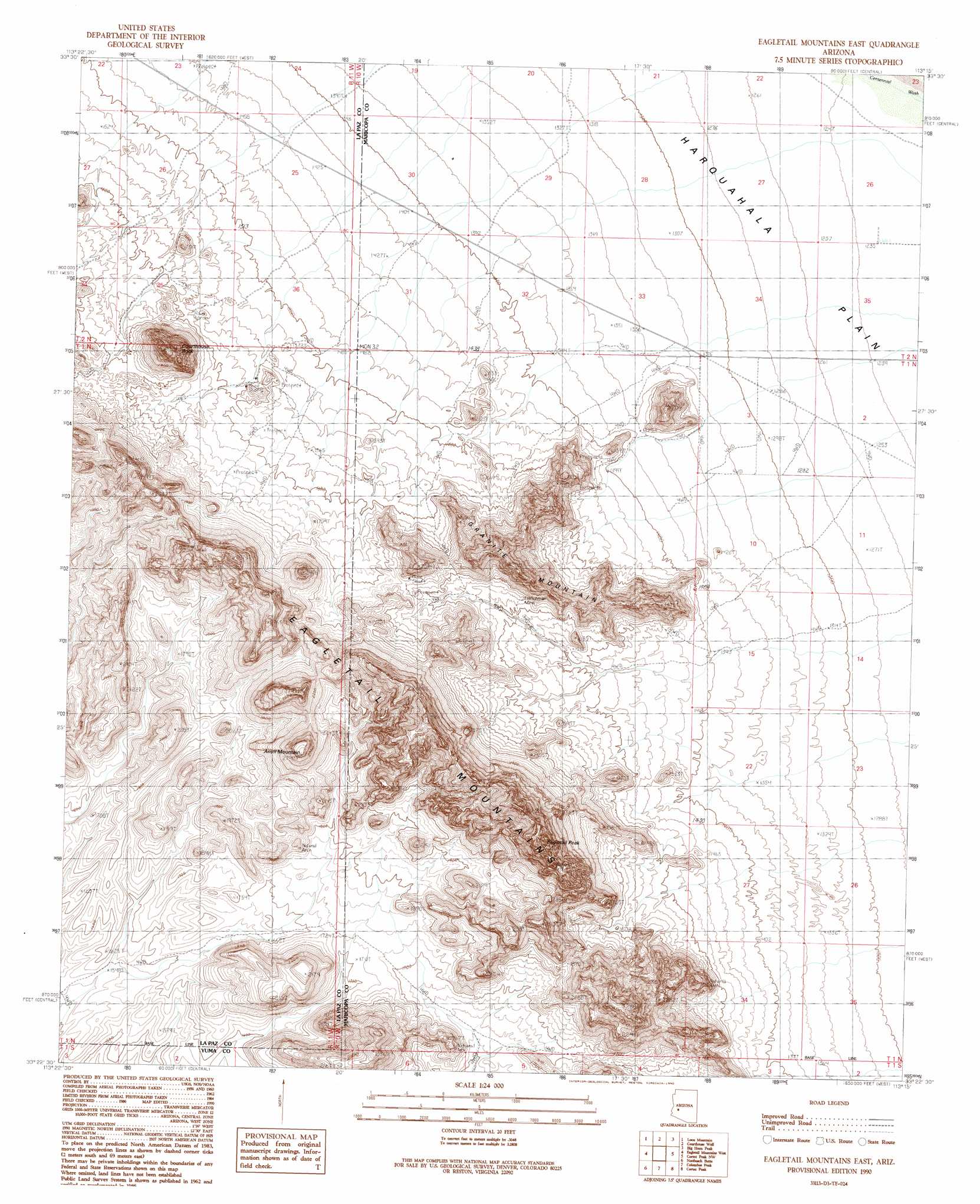
USGS Topo Quad 33113d3 - 1:24,000 scale
| Topo Map Name: | Eagletail Mountains East |
| USGS Topo Quad ID: | 33113d3 |
| Print Size: | ca. 21 1/4" wide x 27" high |
| Southeast Coordinates: | 33.375° N latitude / 113.25° W longitude |
| Map Center Coordinates: | 33.4375° N latitude / 113.3125° W longitude |
| U.S. State: | AZ |
| Filename: | o33113d3.jpg |
| Download Map JPG Image: | Eagletail Mountains East topo map 1:24,000 scale |
| Map Type: | Topographic |
| Topo Series: | 7.5´ |
| Map Scale: | 1:24,000 |
| Source of Map Images: | United States Geological Survey (USGS) |
| Alternate Map Versions: |
Eagletail Mountains East AZ 1990, updated 1990 Download PDF Buy paper map Eagletail Mountains East AZ 2011 Download PDF Buy paper map Eagletail Mountains East AZ 2014 Download PDF Buy paper map |
1:24,000 Topo Quads surrounding Eagletail Mountains East
Harrisburg Valley |
Socorro Mine |
Weldon Hill |
Little Horn Peak |
Hummingbird Spring |
Hope Se |
Lone Mountain |
Courthouse Well |
Big Horn Peak |
Burnt Mountain |
Little Horn Mountains Ne |
Eagletail Mountains West |
Eagletail Mountains East |
Cortez Peak Nw |
Saddle Mountain |
Little Horn Mountains Se |
Nottbusch Butte |
Columbus Peak |
Cortez Peak |
Fourth Of July Butte |
Palomas Mountains Ne |
Turtleback Mountain |
Hyder Ne |
Yellow Medicine Butte |
Quail Spring Wash |
> Back to 33113a1 at 1:100,000 scale
> Back to 33112a1 at 1:250,000 scale
> Back to U.S. Topo Maps home
Eagletail Mountains East topo map: Gazetteer
Eagletail Mountains East: Arches
Eagletail Arch elevation 555m 1820′Natural Arch elevation 822m 2696′
Natural Arch elevation 561m 1840′
Natural Arch elevation 584m 1916′
Natural Arch elevation 710m 2329′
Eagletail Mountains East: Mines
Frenchman Mine elevation 531m 1742′Eagletail Mountains East: Ranges
Eagletail Mountains elevation 640m 2099′Eagletail Mountains East: Springs
Willow Spring elevation 624m 2047′Eagletail Mountains East: Summits
Anvil Mountain elevation 842m 2762′Anvil Mountain elevation 663m 2175′
Courthouse Rock elevation 866m 2841′
Eagletail Peak elevation 921m 3021′
Granite Mountain elevation 637m 2089′
Eagletail Mountains East digital topo map on disk
Buy this Eagletail Mountains East topo map showing relief, roads, GPS coordinates and other geographical features, as a high-resolution digital map file on DVD: