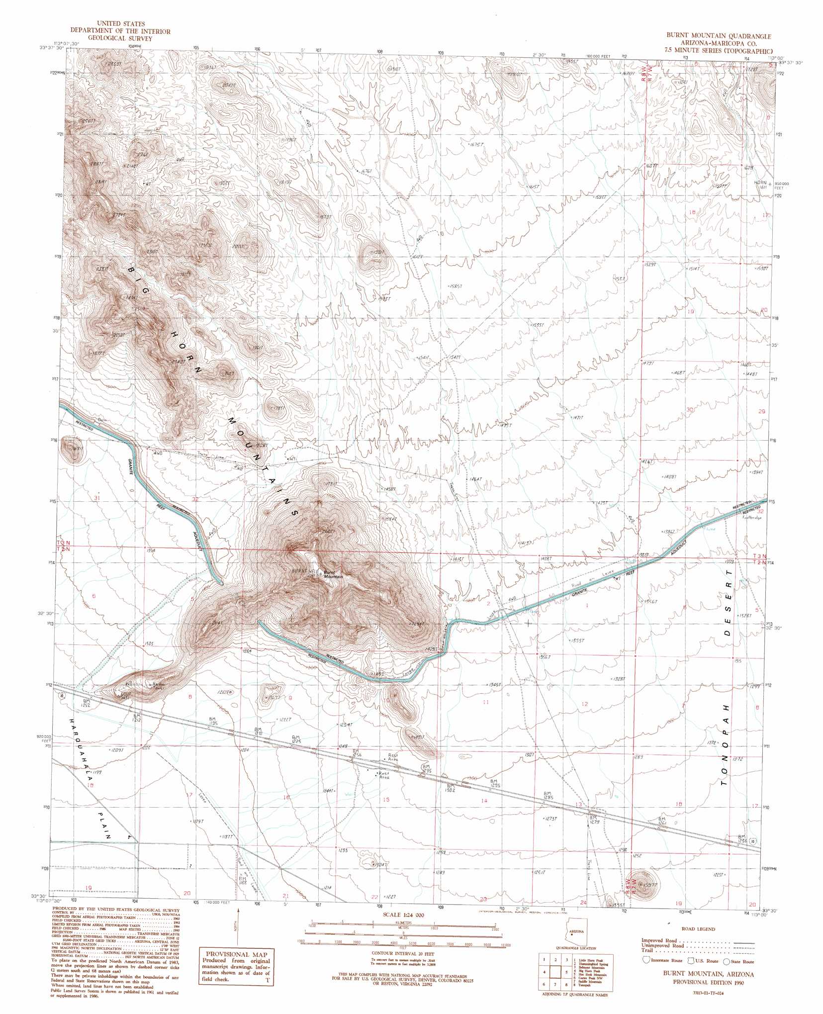
Burnt Mountain Topo Map Arizona
To zoom in, hover over the map of Burnt Mountain
USGS Topo Quad 33113e1 - 1:24,000 scale
| Topo Map Name: | Burnt Mountain |
| USGS Topo Quad ID: | 33113e1 |
| Print Size: | ca. 21 1/4" wide x 27" high |
| Southeast Coordinates: | 33.5° N latitude / 113° W longitude |
| Map Center Coordinates: | 33.5625° N latitude / 113.0625° W longitude |
| U.S. State: | AZ |
| Filename: | o33113e1.jpg |
| Download Map JPG Image: | Burnt Mountain topo map 1:24,000 scale |
| Map Type: | Topographic |
| Topo Series: | 7.5´ |
| Map Scale: | 1:24,000 |
| Source of Map Images: | United States Geological Survey (USGS) |
| Alternate Map Versions: |
Burnt Mountain AZ 1990, updated 1990 Download PDF Buy paper map Burnt Mountain AZ 2011 Download PDF Buy paper map Burnt Mountain AZ 2014 Download PDF Buy paper map |
1:24,000 Topo Quads surrounding Burnt Mountain
Harquahala Mountain |
Tiger Well |
Black Butte |
Wildcat Well |
Vulture Mine |
Weldon Hill |
Little Horn Peak |
Hummingbird Spring |
Belmont Mountain |
Star Well |
Courthouse Well |
Big Horn Peak |
Burnt Mountain |
Hot Rock Mountain |
Flatiron Mountain |
Eagletail Mountains East |
Cortez Peak Nw |
Saddle Mountain |
Tonopah |
Wintersburg |
Columbus Peak |
Cortez Peak |
Fourth Of July Butte |
Gillespie |
Arlington |
> Back to 33113e1 at 1:100,000 scale
> Back to 33112a1 at 1:250,000 scale
> Back to U.S. Topo Maps home
Burnt Mountain digital topo map on disk
Buy this Burnt Mountain topo map showing relief, roads, GPS coordinates and other geographical features, as a high-resolution digital map file on DVD: