Big Horn Peak Topo Map Arizona
To zoom in, hover over the map of Big Horn Peak
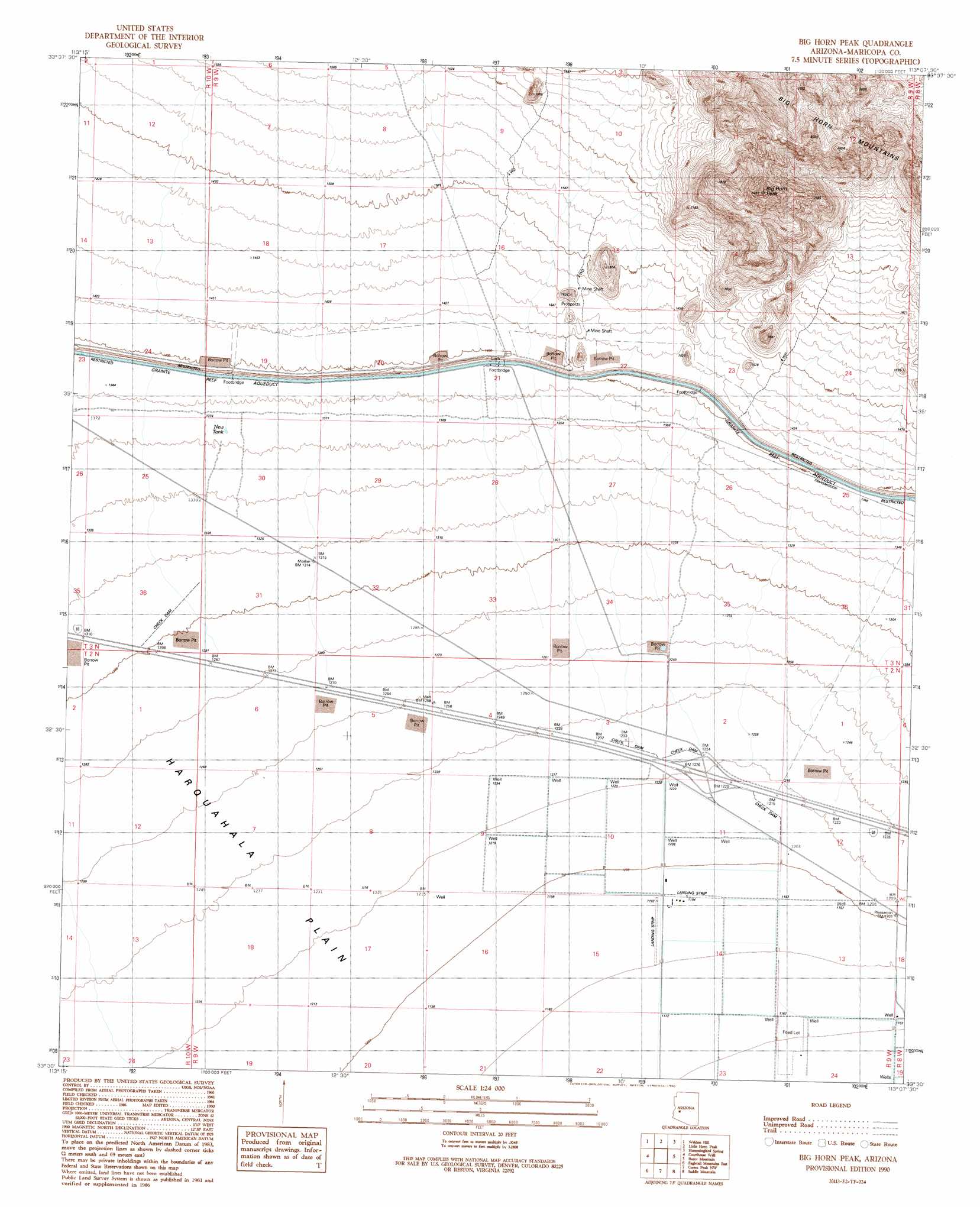
USGS Topo Quad 33113e2 - 1:24,000 scale
| Topo Map Name: | Big Horn Peak |
| USGS Topo Quad ID: | 33113e2 |
| Print Size: | ca. 21 1/4" wide x 27" high |
| Southeast Coordinates: | 33.5° N latitude / 113.125° W longitude |
| Map Center Coordinates: | 33.5625° N latitude / 113.1875° W longitude |
| U.S. State: | AZ |
| Filename: | o33113e2.jpg |
| Download Map JPG Image: | Big Horn Peak topo map 1:24,000 scale |
| Map Type: | Topographic |
| Topo Series: | 7.5´ |
| Map Scale: | 1:24,000 |
| Source of Map Images: | United States Geological Survey (USGS) |
| Alternate Map Versions: |
Big Horn Peak AZ 1990, updated 1990 Download PDF Buy paper map Big Horn Peak AZ 2011 Download PDF Buy paper map Big Horn Peak AZ 2014 Download PDF Buy paper map |
1:24,000 Topo Quads surrounding Big Horn Peak
Socorro Peak |
Harquahala Mountain |
Tiger Well |
Black Butte |
Wildcat Well |
Socorro Mine |
Weldon Hill |
Little Horn Peak |
Hummingbird Spring |
Belmont Mountain |
Lone Mountain |
Courthouse Well |
Big Horn Peak |
Burnt Mountain |
Hot Rock Mountain |
Eagletail Mountains West |
Eagletail Mountains East |
Cortez Peak Nw |
Saddle Mountain |
Tonopah |
Nottbusch Butte |
Columbus Peak |
Cortez Peak |
Fourth Of July Butte |
Gillespie |
> Back to 33113e1 at 1:100,000 scale
> Back to 33112a1 at 1:250,000 scale
> Back to U.S. Topo Maps home
Big Horn Peak topo map: Gazetteer
Big Horn Peak: Reservoirs
New Tank elevation 417m 1368′Big Horn Peak: Summits
Big Horn Peak elevation 833m 2732′Big Horn Peak: Wells
Burnt Well (historical) elevation 369m 1210′Big Horn Peak digital topo map on disk
Buy this Big Horn Peak topo map showing relief, roads, GPS coordinates and other geographical features, as a high-resolution digital map file on DVD: