Vicksburg Topo Map Arizona
To zoom in, hover over the map of Vicksburg
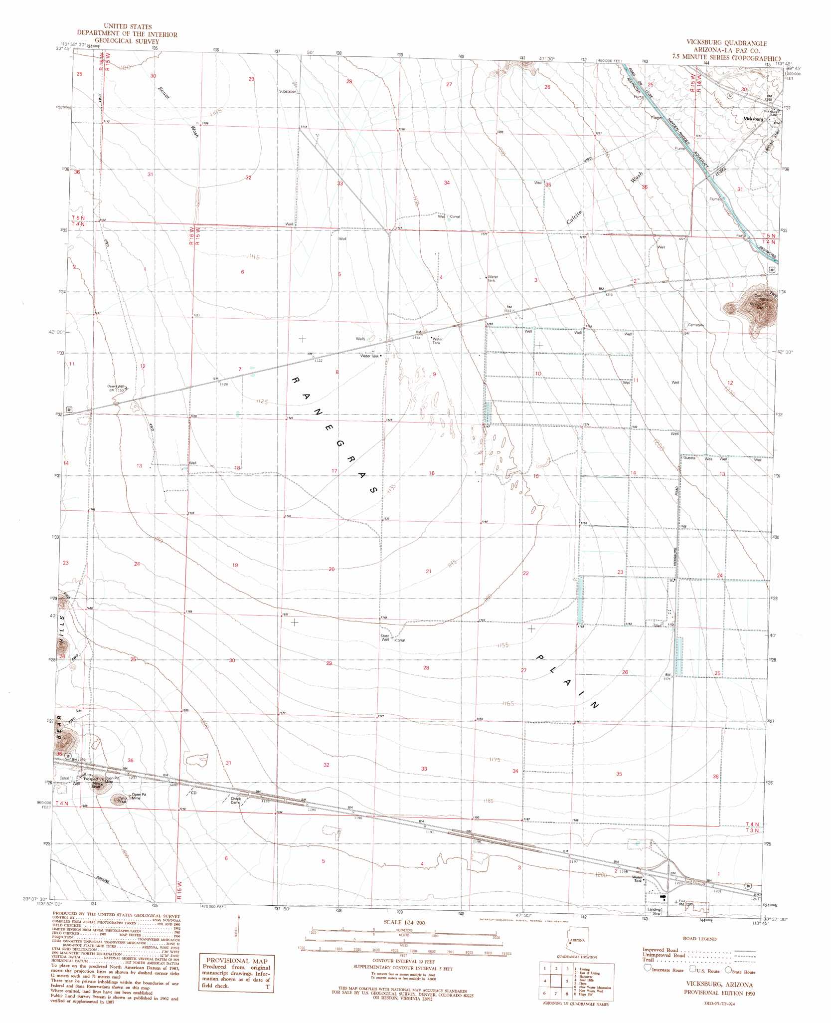
USGS Topo Quad 33113f7 - 1:24,000 scale
| Topo Map Name: | Vicksburg |
| USGS Topo Quad ID: | 33113f7 |
| Print Size: | ca. 21 1/4" wide x 27" high |
| Southeast Coordinates: | 33.625° N latitude / 113.75° W longitude |
| Map Center Coordinates: | 33.6875° N latitude / 113.8125° W longitude |
| U.S. State: | AZ |
| Filename: | o33113f7.jpg |
| Download Map JPG Image: | Vicksburg topo map 1:24,000 scale |
| Map Type: | Topographic |
| Topo Series: | 7.5´ |
| Map Scale: | 1:24,000 |
| Source of Map Images: | United States Geological Survey (USGS) |
| Alternate Map Versions: |
Vicksburg AZ 1990, updated 1990 Download PDF Buy paper map Vicksburg AZ 2011 Download PDF Buy paper map Vicksburg AZ 2014 Download PDF Buy paper map |
1:24,000 Topo Quads surrounding Vicksburg
Bouse |
Bouse Hills West |
Bouse Hills East |
Harcuvar Peak |
Cunningham Pass |
Ibex Peak |
Utting |
East Of Utting |
Harcuvar |
Salome |
Plomosa Pass |
Bear Hills |
Vicksburg |
Hope |
Harrisburg Valley |
Crystal Hill |
New Water Mountains |
New Water Well |
Hope Sw |
Hope Se |
Livingston Hills |
Owl Head |
Cholla Tank |
Coyote Peak |
Little Horn Mountains Ne |
> Back to 33113e1 at 1:100,000 scale
> Back to 33112a1 at 1:250,000 scale
> Back to U.S. Topo Maps home
Vicksburg topo map: Gazetteer
Vicksburg: Arroyos
Granite Wash elevation 361m 1184′Vicksburg: Plains
Ranegras Plain elevation 356m 1167′Vicksburg: Populated Places
Desert Wells elevation 345m 1131′New Hope elevation 369m 1210′
Vicksburg elevation 423m 1387′
Vicksburg Junction elevation 384m 1259′
Vicksburg: Streams
Calcite Wash elevation 348m 1141′Upper Bouse Wash elevation 360m 1181′
Vicksburg: Wells
Bradford Well elevation 362m 1187′Stutz Well elevation 352m 1154′
Vicksburg digital topo map on disk
Buy this Vicksburg topo map showing relief, roads, GPS coordinates and other geographical features, as a high-resolution digital map file on DVD: